Russian Shahed drone tracked over Odesa Oblast heading inland
What happened
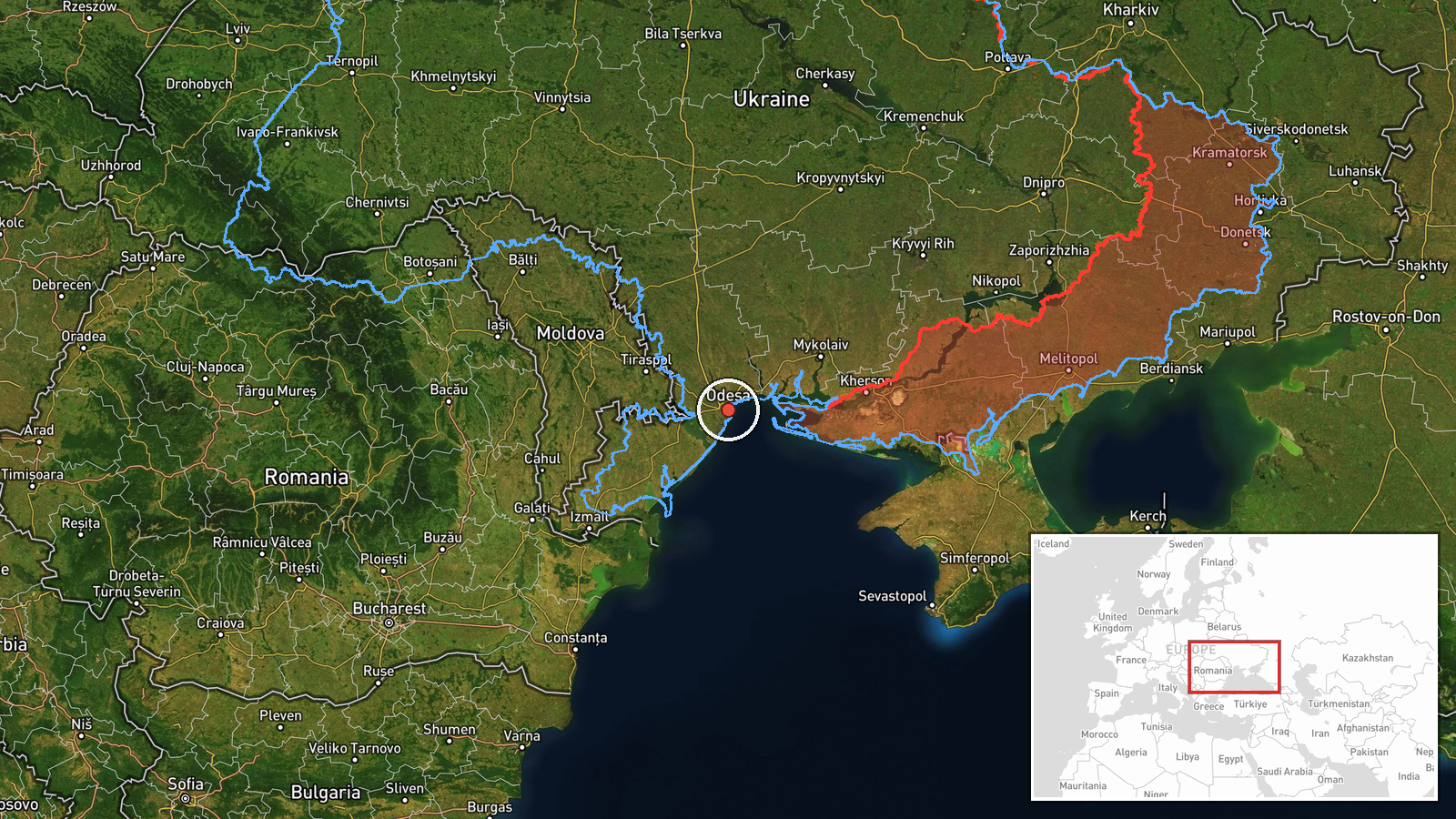
Ukrainian air monitoring channels reported detection of one Russian jet-powered Shahed (Geran-3) drone transiting over Odesa Oblast on 13 October at 13:28 UTC, reportedly heading toward Vinnytsia Oblast. The report was posted via the Telegram channel of Ukraine's air defense command (@kpszsu), which tracks incoming Russian unmanned aircraft. No strike or interception was immediately reported in the monitoring data.
Context and assessment
The Geran-3 (Shahed-136 variant) is a long-range kamikaze drone capable of striking targets deep within Ukrainian territory. Its detection over Odesa, a major Black Sea port region, and trajectory toward central Ukraine suggests possible targeting of infrastructure or military installations in Vinnytsia. This transit occurs amid concurrent Russian drone activity in neighboring Mykolaiv Oblast on the same day, indicating a coordinated or opportunistic multi-vector reconnaissance and strike pattern. Recent Ukrainian reports document sustained Russian UAS operations across southern and central regions, consistent with efforts to stress air defenses and target rear-area logistics.
Sources and confidence
Single source: Telegram channel @kpszsu (Ukrainian air defense command). No cross-confirmation from independent observers or multiple channels. Confidence score of 8.0 reflects official Ukrainian monitoring but limited corroboration and regional-level precision. Confirmation of impact or interception, or additional channel reporting, would raise confidence; absence of follow-up reporting on strike outcome slightly lowers it.
Location
Odesa Oblast, southern Ukraine, coordinates 46.48°N, 30.73°E. Precision is regional (oblast-level) due to air monitoring report format. The location sits near the Black Sea coast and represents typical transit corridor for Russian drones originating from Crimea or Russian airspace, heading north and east toward central Ukrainian targets.
Related events nearby
- Ukrainian air monitoring: 1 Russian jet-powered Shahed (Geran-3) drone heading toward Mykolaiv.2026-10-13 13:28 UTC · Drone Transit · Mykolaiv, Ukraine
- Ukrainian drone forces destroyed a large group of Russian Spetsnaz special forces attempting to cross the Dnip2026-10-13 09:15 UTC · UAS Strike · Kherson, Kherson Oblast, Ukraine
▶ View this event on the live map

Intel Mapper aggregates open-source reports from monitored Telegram and X channels, geolocates them, cross-checks duplicates across sources and assigns a confidence score. Entries are updated as new confirmations arrive. Read how we verify events.