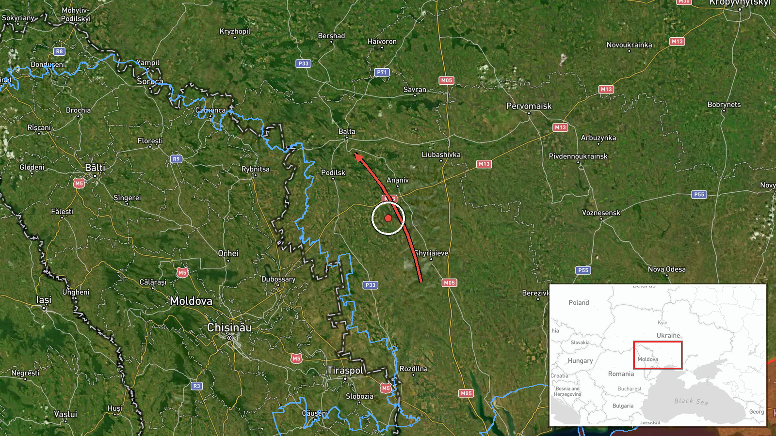
Russian Geran-3 drone transiting toward Balta in central Ukraine
What happened
Ukrainian air monitoring reported one Russian jet-powered Shahed (Geran-3) drone in flight from Odesa Oblast on a course toward Balta at 13:28 UTC on 13 October 2026. The report came from the Telegram channel of Ukraine's air force command. The Geran-3, a cruise-type unmanned aerial vehicle, represents Russia's long-range strike capability. No impact or interception was reported in the available data.
Context and assessment
Balta lies in Vinnytsia Oblast in central Ukraine, roughly 150 km north of the Russian-occupied Transnistrian region and within range of Russian cruise and drone strikes from the south. Related air monitoring reports on the same date tracked at least three additional Geran-3 drones heading toward nearby settlements—Kryzhopil, Sharhorod, and Mohyliv-Podilskyy—suggesting a coordinated multi-target strike effort across the region. Such distributed drone operations have become routine in the conflict, typically aimed at infrastructure, energy systems, or military positions. The concentration of reported tracks over a brief timeframe indicates possible saturation tactics to stress Ukrainian air defenses.
Sources and confidence
Single-source report from Telegram (@kpszsu), the official channel of Ukraine's air force command. Confidence of 8.0 reflects the authoritative source and real-time air monitoring capability, but lack of cross-confirmation and no reported outcome limits certainty. Confirmation through visual evidence or secondary Ukrainian military reports, or disclosure of interception/impact, would raise confidence; absence of follow-up reporting may indicate successful interception or tracking loss.
Location
Balta (47.94°N, 29.62°E), a settlement in Vinnytsia Oblast, central Ukraine. Located in the Podillia region, roughly 100 km north of the Dniester River and approximately 200 km from Russian-held territory. The town lies on open steppe with limited urban density, typical of the area's agricultural character.
Related events nearby
- Ukrainian air monitoring: 1 Russian jet-powered Shahed (Geran-3) drone heading toward Kryzhopil.2026-10-13 13:29 UTC · Drone Transit · Kryzhopil, Ukraine
- Ukrainian air monitoring: 1 Russian jet-powered Shahed (Geran-3) drone heading toward Sharhorod.2026-10-13 13:29 UTC · Drone Transit · Sharhorod, Ukraine
- Ukrainian air monitoring: 1 Russian jet-powered Shahed (Geran-3) drone heading toward Mohyliv-Podilskyy; 1 Rus2026-10-13 13:28 UTC · Drone Transit · Mohyliv-Podilskyy, Ukraine
▶ View this event on the live map

Intel Mapper aggregates open-source reports from monitored Telegram and X channels, geolocates them, cross-checks duplicates across sources and assigns a confidence score. Entries are updated as new confirmations arrive. Read how we verify events.