Russian Geran-3 drone tracked toward Dunayivtsi in Khmelnytskyi Oblast
What happened
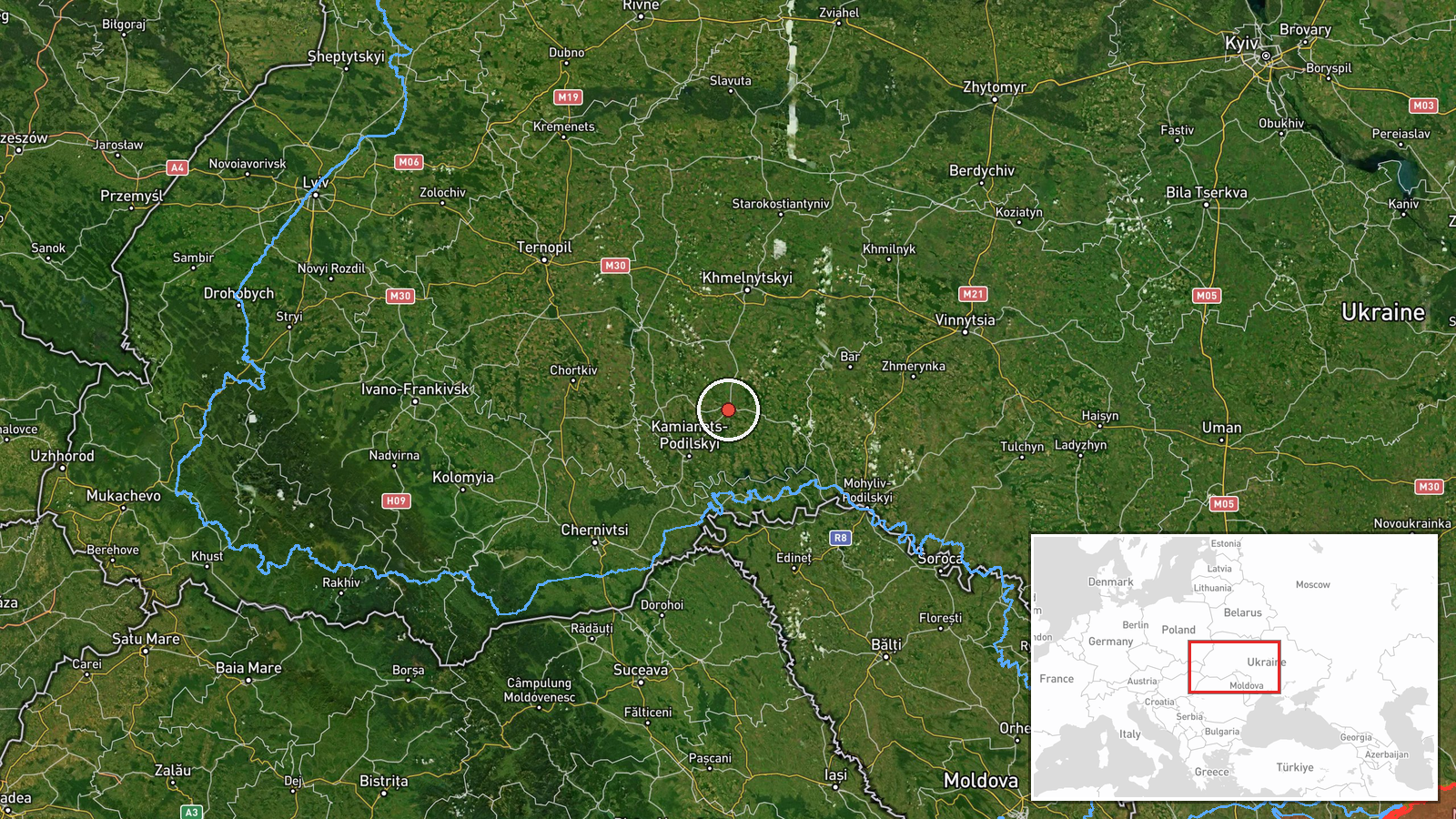
Ukrainian air monitoring reported a single Russian jet-powered Shahed drone (Geran-3 variant) in transit toward Dunayivtsi, a settlement in Khmelnytskyi Oblast in western Ukraine, on 13 October 2026 at 13:29 UTC. The report originated from the Telegram channel of the Ukrainian Territorial Defence Forces (@kpszsu), which maintains real-time tracking of air threats across Ukrainian airspace. No engagement or impact was reported in this initial detection.
Context and assessment
Dunayivtsi lies in Khmelnytskyi Oblast, approximately 300 kilometres west of the front lines and beyond typical range of conventional Russian cruise missiles, making it accessible primarily to extended-range or loitering munitions like the Geran-3. The detection occurred amid a coordinated wave of drone activity, with simultaneous reports of at least four additional Geran-3 units tracked toward nearby settlements—Yarmolyntsi, Husiatyn, Mohyliv-Podilskyy, and Sharhorod—all within the same region and timeframe. This pattern suggests a planned multi-target strike operation across western Ukraine, a tactic Russia has employed periodically to stress Ukrainian air defences and target civilian or military infrastructure in rear areas.
Sources and confidence
Reported by the Territorial Defence Forces (@kpszsu) on Telegram, a Ukrainian military channel with direct access to air defence tracking systems. Single-source reporting limits independent verification; confidence of 8.0 reflects systematic monitoring capability but absence of cross-confirmation from Ukrainian or allied sources. Confidence would rise with corroboration from other Ukrainian military channels or NATO reporting; would fall if follow-up impact data contradicts the detection.
Location
Dunayivtsi is a settlement in Khmelnytskyi Oblast, western Ukraine, located at coordinates 48.89°N, 26.85°E. It sits approximately 80 kilometres south-southwest of the regional capital Khmelnytskyi and roughly 40 kilometres north of the Dniester River, which forms part of Ukraine's southern border with Moldova. The settlement is positioned in relatively flat terrain typical of the Podolian Plateau region.
Related events nearby
- Ukrainian air monitoring: 1 Russian jet-powered Shahed (Geran-3) drone from Khmelnytskyi Oblast toward Yarmoly2026-10-13 13:30 UTC · Drone Transit · Yarmolyntsi, Ukraine
- Ukrainian air monitoring: 1 Russian jet-powered Shahed (Geran-3) drone heading toward Husiatyn.2026-10-13 13:29 UTC · Drone Transit · Husiatyn, Ukraine
- Ukrainian air monitoring: 1 Russian jet-powered Shahed (Geran-3) drone heading toward Mohyliv-Podilskyy; 1 Rus2026-10-13 13:28 UTC · Drone Transit · Mohyliv-Podilskyy, Ukraine
- Ukrainian air monitoring: 1 Russian jet-powered Shahed (Geran-3) drone heading toward Sharhorod.2026-10-13 13:29 UTC · Drone Transit · Sharhorod, Ukraine
▶ View this event on the live map

Intel Mapper aggregates open-source reports from monitored Telegram and X channels, geolocates them, cross-checks duplicates across sources and assigns a confidence score. Entries are updated as new confirmations arrive. Read how we verify events.