Russian Geran-3 drone tracked toward Kryzhopil in Vinnytsia Oblast
What happened
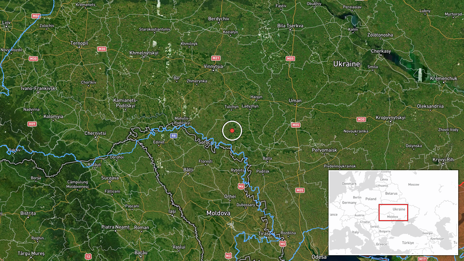
Ukrainian air monitoring reported tracking a single Russian jet-powered Shahed (Geran-3) drone heading toward Kryzhopil in Vinnytsia Oblast on 13 October 2026 at 17:01 UTC. The drone was observed in transit over the region. The report was issued by the Telegram channel of Ukraine's air defense coordination service (@kpszsu), which monitors Russian aerial activity across Ukrainian airspace.
Context and assessment
Kryzhopil lies in central Vinnytsia Oblast, a region that has seen repeated Russian drone sorties throughout 2026. The detection represents part of a sustained pattern: on the same day, multiple Geran-3 drones were tracked transiting toward settlements across the oblast, including Sharhorod, Balta, Mohyliv-Podilskyy, and Chechelnyk. The Geran-3 is a jet-powered variant with extended range, typically employed for strikes on infrastructure or urban areas at considerable distance from Russian territory. The apparent coordinated routing of several drones toward Vinnytsia may indicate a multi-target strike campaign, though individual drone movements do not necessarily result in confirmed impacts.
Sources and confidence
Source: Telegram channel @kpszsu (Ukrainian air defense coordination). Single-channel reporting limits independent verification; no cross-confirmation from other Ukrainian monitoring services is noted. Confidence score of 8.0 reflects official Ukrainian air defense source credibility balanced against absence of secondary confirmation. Score would rise with reports from additional air monitoring channels or impact assessments.
Location
Kryzhopil is a settlement in Vinnytsia Oblast, south-central Ukraine, positioned at approximately 48.38°N, 28.87°E. The town sits roughly 120 km southwest of Kyiv and within the broader Dnieper River basin region. Vinnytsia City lies to the northwest; the settlement is part of an agricultural and mixed-industrial zone characteristic of central Ukraine.
Related events nearby
- Ukrainian air monitoring: 2+ Russian jet-powered Shahed (Geran-3) drones heading toward Kryzhopil.2026-10-13 18:11 UTC · Drone Transit · Kryzhopil, Ukraine
- Ukrainian air monitoring: 1 Russian jet-powered Shahed (Geran-3) drone heading toward Kryzhopil.2026-10-13 13:29 UTC · Drone Transit · Kryzhopil, Ukraine
- Ukrainian air monitoring: 1 Russian jet-powered Shahed (Geran-3) drone from Odesa Oblast toward Chechelnyk.2026-10-13 16:59 UTC · Drone Transit · Chechelnyk, Ukraine
- Ukrainian air monitoring: 1 Russian jet-powered Shahed (Geran-3) drone heading toward Nemyriv.2026-10-13 17:50 UTC · Drone Transit · Nemyriv, Ukraine
- Ukrainian air monitoring: 1 Russian jet-powered Shahed (Geran-3) drone heading toward Sharhorod.2026-10-13 13:29 UTC · Drone Transit · Sharhorod, Ukraine
▶ View this event on the live map

Intel Mapper aggregates open-source reports from monitored Telegram and X channels, geolocates them, cross-checks duplicates across sources and assigns a confidence score. Entries are updated as new confirmations arrive. Read how we verify events.