Russian Geran-3 drone tracked toward Khmelnytskyi Oblast in western Ukraine
What happened
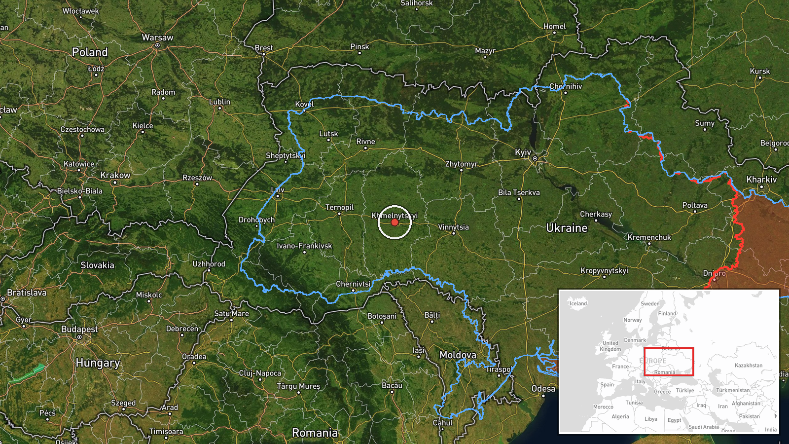
Ukrainian air monitoring systems detected one Russian jet-powered Shahed unmanned aerial vehicle, identified as a Geran-3 variant, in transit toward Khmelnytskyi Oblast in western Ukraine on 13 October at 17:18 UTC. The alert was issued by the Kyiv-controlled air defence command (@kpszsu) via Telegram. The drone's specific origin point within Russian-held territory was not specified in the monitoring report.
Context and assessment
Khmelnytskyi Oblast, located in northwestern Ukraine roughly 350 kilometres from the Russian border, has been a recurring target for long-range drone strikes throughout the conflict. Multiple related alerts on the same date document a sustained Russian drone campaign against the region, with at least four additional Geran-3 sightings reported between 13:29 and 17:27 UTC targeting Khmelnytskyi city, Yarmolyntsi, and Dunayivtsi. This pattern suggests either a coordinated multi-drone attack sequence or continuous reconnaissance-strike operations. Geran-3 drones, loitering munitions capable of striking infrastructure at range, are typically employed against civilian or military infrastructure targets beyond frontline reach.
Sources and confidence
Single source: Telegram channel @kpszsu (Kyiv air defence command). Related events from the same monitoring system on identical date provide corroborating detections of similar drone activity in the same region within hours, suggesting operational consistency rather than isolated report. Confidence score of 8.0 reflects live air defence data reliability but low geographic precision (regional-level reporting rather than settlement confirmation) and singular primary source channel.
Location
Khmelnytskyi Oblast, northwestern Ukraine, approximately 350 km west-northwest of Russian territory. Geographically positioned in the Dniester River basin region. The location confidence is low because Ukrainian air monitoring releases region-level alerts; the specific settlement or facility targeted was not disclosed in this particular report, though related same-day alerts reference Khmelnytskyi city and nearby towns.
Related events nearby
- Ukrainian air monitoring: 1 Russian jet-powered Shahed (Geran-3) drone over Khmelnytskyi.2026-10-13 18:59 UTC · Drone Transit · Khmelnytskyi, Ukraine
- Ukrainian air monitoring: 1 Russian jet-powered Shahed (Geran-3) drone heading toward Khmelnytskyi.2026-10-13 17:27 UTC · Drone Transit · Khmelnytskyi, Ukraine
- Ukrainian air monitoring: 1 Russian jet-powered Shahed (Geran-3) drone heading toward Khmelnytskyi; 1 Russian 2026-10-13 15:41 UTC · Drone Transit · Khmelnytskyi, Ukraine
- Ukrainian air monitoring: 1 Russian jet-powered Shahed (Geran-3) drone heading toward Khmelnytskyi Oblast.2026-10-13 15:20 UTC · Drone Transit · Khmelnytskyi Oblast, Ukraine
- Ukrainian air monitoring: 1 Russian jet-powered Shahed (Geran-3) drone from Khmelnytskyi Oblast toward Yarmoly2026-10-13 13:30 UTC · Drone Transit · Yarmolyntsi, Ukraine
▶ View this event on the live map

Intel Mapper aggregates open-source reports from monitored Telegram and X channels, geolocates them, cross-checks duplicates across sources and assigns a confidence score. Entries are updated as new confirmations arrive. Read how we verify events.