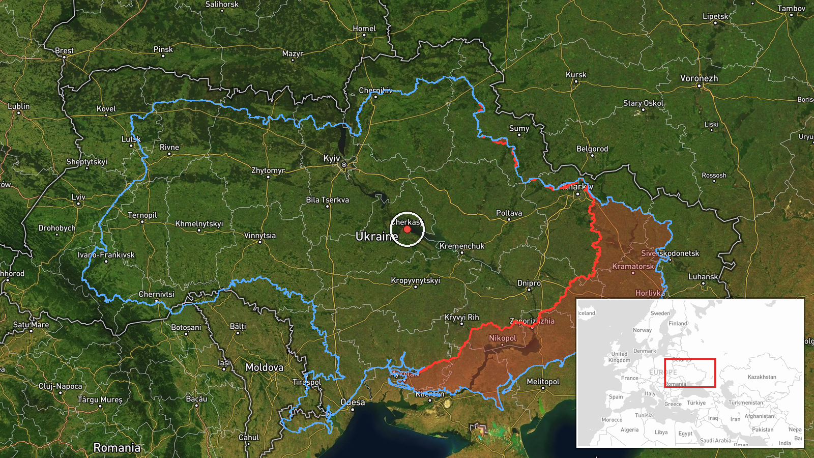
Russian Shahed drone detected transiting Cherkasy Oblast
What happened
Ukrainian air monitoring reported detection of a single Russian jet-powered Shahed (Geran-3) drone over Cherkasy Oblast on October 13 at 17:44 UTC. The report, issued by the Ukrainian General Staff's air command via Telegram, indicated the drone was in transit toward the Vinnytsia direction near the settlement of Dashiv. No immediate impact or interception was reported in the available data.
Context and assessment
The detection occurred during an exceptionally high operational tempo, with Ukrainian forces reporting 203 combat engagements and Russian deployment of over 9,500 kamikaze drones in the preceding 24 hours. Multiple Shahed transits across central Ukraine were tracked throughout October 13, including concurrent detections near Pereiaslav, Semenivka, and Zvenyhorodka. These jet-powered variants represent an escalation in endurance and precision compared to earlier models. The pattern suggests sustained Russian targeting of civilian and infrastructure targets in central oblasts beyond active frontlines, consistent with months of attrition-focused aerial campaigns.
Sources and confidence
Single source: Telegram channel @kpszsu (Ukrainian General Staff). No cross-confirmation from independent monitors or Ukrainian air defense reports provided. Confidence score of 8.0 reflects official Ukrainian reporting reliability but lack of corroboration. Confirmation by Ukrainian air defense intercept reports or damage assessments would raise confidence; absence of follow-up reporting on the drone's fate lowers overall assessment certainty.
Location
Cherkasy Oblast, central Ukraine, determined via Ukrainian air monitoring with regional-level precision. The reference to Dashiv settlement suggests transit track near the Cherkasy-Vinnytsia oblast boundary. Located approximately 180 kilometers south of Kyiv in relatively stable rear territory, placing the detection outside active ground combat zones.
Related events nearby
- Ukrainian MiG-29 fighter jet shot down a Russian attack drone using an R-73 air-to-air missile. Cockpit footag2026-10-13 08:40 UTC · Drone Shootdown · Ukraine (location not reported)
- Ukrainian General Staff reports 203 combat engagements in past 24 hours (as of 08:00 13 Oct 2026). Russia cond2026-10-13 05:04 UTC · Report · Ukraine
- Ukrainian air monitoring: 1 Russian jet-powered Shahed (Geran-3) drone heading toward Pereiaslav.2026-10-13 13:32 UTC · Drone Transit · Pereiaslav, Ukraine
- Ukrainian air monitoring: 1 Russian jet-powered Shahed (Geran-3) drone heading toward Semenivka.2026-10-13 14:37 UTC · Drone Transit · Semenivka, Ukraine
- Ukrainian air monitoring: 1 Russian jet-powered Shahed (Geran-3) drone from Cherkasy Oblast toward Zvenyhorodk2026-10-13 17:32 UTC · Drone Transit · Zvenyhorodka, Ukraine
▶ View this event on the live map

Intel Mapper aggregates open-source reports from monitored Telegram and X channels, geolocates them, cross-checks duplicates across sources and assigns a confidence score. Entries are updated as new confirmations arrive. Read how we verify events.