Russian Geran-3 drone tracked toward Zhmerynka in Vinnytsia Oblast
What happened
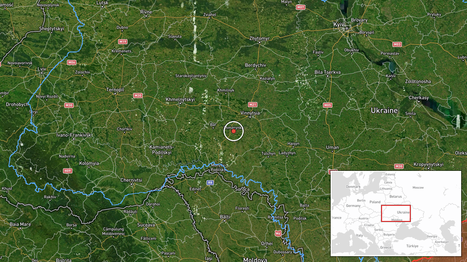
Ukrainian air monitoring services reported tracking one Russian jet-powered Shahed (Geran-3) drone heading toward Zhmerynka on October 13 at 17:57 UTC. The report was posted by the Kyiv Post Special Operations Command (@kpszsu) on Telegram. Zhmerynka is a city in central Vinnytsia Oblast. No attack outcome was specified in the available reporting.
Context and assessment
Zhmerynka is a regional administrative center and transport hub in Vinnytsia Oblast, located along major road and rail routes. The October 13 tracking represents part of a sustained Russian drone campaign across the oblast that day, with Ukrainian air defense monitoring at least five separate Geran-3 transits between 13:28 and 17:57 UTC targeting or passing through locations including Sharhorod, Nemyriv, and Mohyliv-Podilskyy. The pattern suggests either a coordinated wave of strikes or reconnaissance activity. Vinnytsia Oblast, roughly 200 kilometers west of front lines, has been a recurrent target for Russian long-range drone and missile strikes throughout 2024–2026, often targeting civilian infrastructure and transport networks.
Sources and confidence
Single-source report via Telegram (@kpszsu), the Kyiv Post Special Operations Command channel. Confidence score of 8.0 reflects high reliability of the Ukrainian monitoring source but limited independent cross-confirmation. Score would rise with corroborating reports from other air defense monitors or civilian accounts; it would lower if the drone was intercepted or failed to reach the reported location.
Location
Zhmerynka, a city of roughly 35,000 in Vinnytsia Oblast, located at 49.04°N, 28.11°E. The settlement sits on the Southern Buh River in central-western Ukraine, approximately 250 kilometers southwest of Kyiv. Geolocation determined to settlement precision based on Ukrainian air monitoring coordinates.
Related events nearby
- Ukrainian air monitoring: 2+ Russian jet-powered Shahed (Geran-3) drones heading toward Bar.2026-10-13 18:21 UTC · Drone Transit · Bar, Ukraine
- Ukrainian air monitoring: 1 Russian jet-powered Shahed (Geran-3) drone heading toward Sharhorod.2026-10-13 13:29 UTC · Drone Transit · Sharhorod, Ukraine
- Ukrainian air monitoring: 1 Russian jet-powered Shahed (Geran-3) drone passing Vinnytsia Oblast, heading north2026-10-13 15:12 UTC · Drone Transit · Vinnytsia Oblast, Ukraine
- Ukrainian air monitoring: 1 Russian jet-powered Shahed (Geran-3) drone from Odesa Oblast toward Vinnytsia Obla2026-10-13 14:50 UTC · Drone Transit · Vinnytsia Oblast, Ukraine
- Ukrainian air monitoring: 1 Russian jet-powered Shahed (Geran-3) drone heading toward Nemyriv.2026-10-13 17:50 UTC · Drone Transit · Nemyriv, Ukraine
▶ View this event on the live map

Intel Mapper aggregates open-source reports from monitored Telegram and X channels, geolocates them, cross-checks duplicates across sources and assigns a confidence score. Entries are updated as new confirmations arrive. Read how we verify events.