Russian Geran-3 drone tracked toward Brovary east of Kyiv
What happened
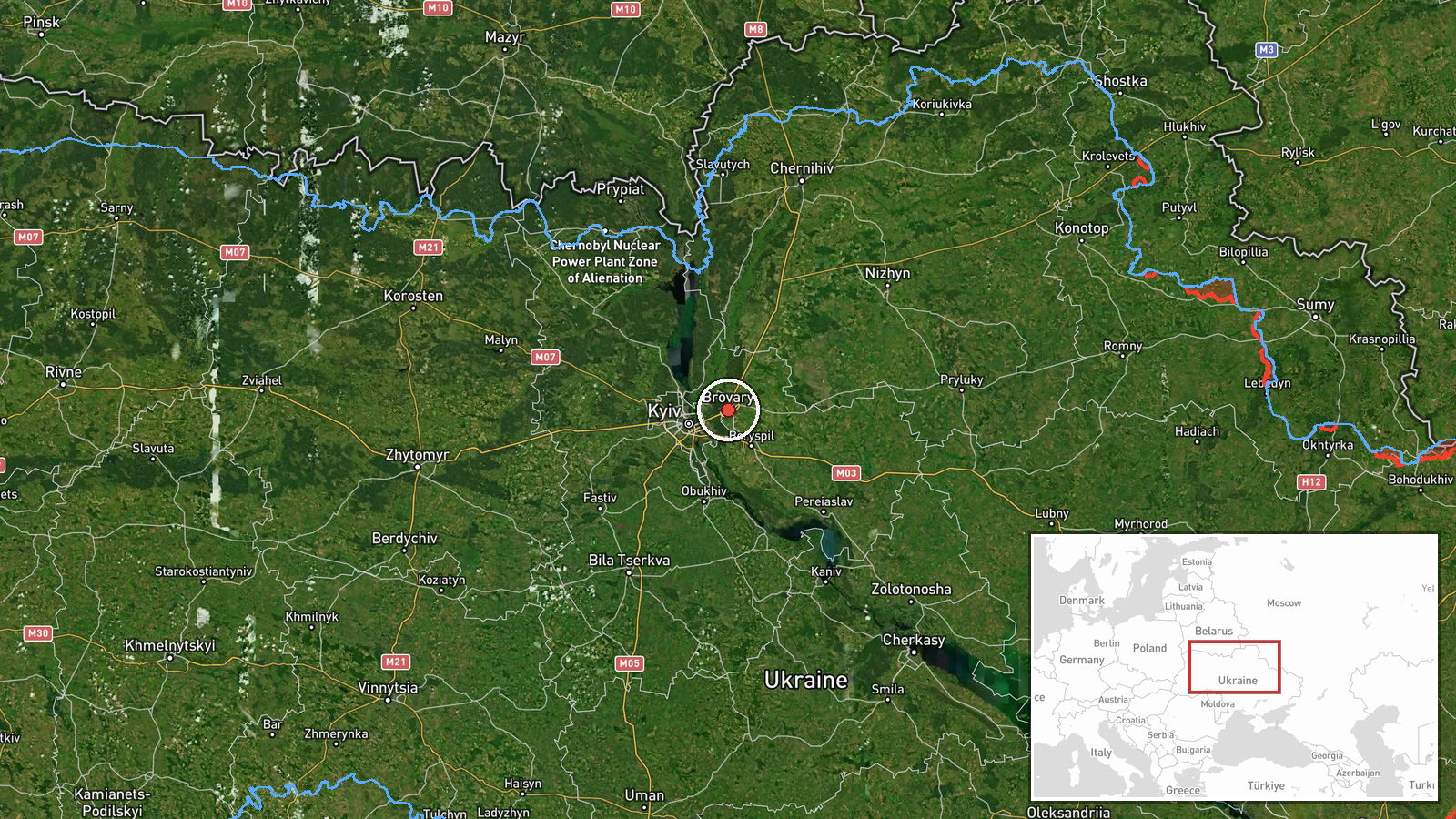
Ukrainian air monitoring detected one Russian jet-powered Shahed drone, identified as a Geran-3 variant, transiting over Kyiv Oblast with a reported course toward Brovary on the evening of October 13. The alert was issued by the Kyiv civil protection service. Brovary lies approximately 30 kilometers northeast of central Kyiv. The drone remained in transit at the time of reporting, with no immediate strike confirmation provided in the source material.
Context and assessment
Brovary is a major suburban settlement on Kyiv's eastern flank and sits near critical transport corridors and infrastructure. This sighting occurred during an active pattern of Geran-3 operations across the Kyiv region on October 13, with related air monitoring reports documenting similar drone transits over Velyka Dymerka and Kharkivskyi Masyv earlier that day. Ukrainian officials acknowledged on October 13 that novel Russian tactics, possibly including modified flight paths or deceptive approaches, have complicated air defense coordination and early warning. The repetition of jet-powered Shahed variants suggests Russia may be testing or intensifying strikes against targets in or near the capital's metropolitan area.
Sources and confidence
Single source: Telegram channel @kpszsu (Kyiv Civil Protection). No cross-confirmation from other Ukrainian monitoring channels or independent verification noted. Confidence score of 8.0 reflects the official status of the source and consistency with parallel drone detections on the same date, but the lack of multiple independent confirmations and absence of strike outcome reporting prevent higher confidence. Additional reports from other air defense or emergency services would strengthen the assessment.
Location
Brovary, a settlement of approximately 110,000 people located roughly 30 kilometers northeast of Kyiv center (50.51°N, 30.79°E). The town sits in relatively flat terrain on the eastern edge of the Kyiv metropolitan area, near the Dnipro River's course and major highway corridors. Precision is set at settlement level based on the reported course destination rather than pinpoint coordinates.
Related events nearby
- Ukrainian air monitoring: 1 Russian jet-powered Shahed (Geran-3) drone from Kyiv Oblast toward Velyka Dymerka.2026-10-13 14:46 UTC · Drone Transit · Velyka Dymerka, Ukraine
- Ukrainian air monitoring: 1 Russian jet-powered Shahed (Geran-3) drone over Kharkivskyi Masyv, Kyiv.2026-10-13 14:20 UTC · Drone Transit · Kharkivskyi Masyv, Kyiv, Ukraine
- President Zelensky claims partners failed to warn Ukraine of Russian ballistic missile strike on Kyiv. Five ba2026-10-13 19:04 UTC · Statement · Kyiv, Ukraine
- Former Ukrainian military commander-in-chief Oleksandr Syrskyi states Ukrainian forces have stabilized the fro2026-10-13 18:06 UTC · Statement · Kyiv, Ukraine
- Ukrainian Foreign Minister Sybiha confirms receipt of US intelligence and attributes delayed air raid alerts d2026-10-13 11:14 UTC · Statement · Kyiv, Ukraine
▶ View this event on the live map

Intel Mapper aggregates open-source reports from monitored Telegram and X channels, geolocates them, cross-checks duplicates across sources and assigns a confidence score. Entries are updated as new confirmations arrive. Read how we verify events.