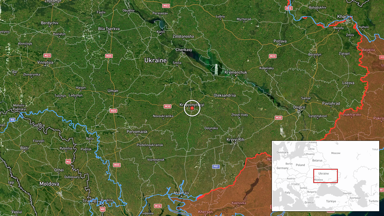
Russian Shahed drone tracked approaching Kropyvnytskyi from the east
What happened
Ukrainian air monitoring detected one Russian Shahed-type drone heading toward Kropyvnytskyi from the east on 13 October at 19:09 UTC. The report was posted by the Kyiv Post Strategic Communications unit via Telegram. No confirmation of impact or interception was immediately available. The sighting occurred as part of a broader pattern of Russian drone activity across central Ukraine on the same date.
Context and assessment
Kropyvnytskyi, a major industrial and administrative center in central Kirovohrad Oblast, has been a recurring target for Russian long-range strikes throughout the conflict. The city's industrial base and regional importance make it strategically significant. The drone approach from the east aligns with typical Russian ingress routes across the Dnipro. Earlier on 13 October, Ukrainian forces tracked multiple Shahed drones across Cherkasy and Kirovohrad oblasts, suggesting a coordinated wave of attacks. The General Staff reported 203 engagements and 90 airstrikes by Russia that day, indicating sustained pressure on Ukrainian air defenses and civilian infrastructure.
Sources and confidence
Single source: Kyiv Post Strategic Communications (@kpszsu) Telegram channel. No cross-confirmation reported. Confidence score of 8.0 reflects the reliability of official Ukrainian air monitoring channels but the absence of secondary confirmation or impact reports. Confirmation would be strengthened by interception footage, damage reports, or independent verification from other Ukrainian defense sources.
Location
Kropyvnytskyi, Kirovohrad Oblast, central Ukraine (48.51°N, 32.27°E). Settlement-level precision. The city sits west of the Dnipro River in the steppe region, approximately 360 kilometers south of Kyiv and 280 kilometers from the nearest active front line.
Related events nearby
- Ukrainian MiG-29 fighter jet shot down a Russian attack drone using an R-73 air-to-air missile. Cockpit footag2026-10-13 08:40 UTC · Drone Shootdown · Ukraine (location not reported)
- Ukrainian air monitoring: 1 Russian jet-powered Shahed (Geran-3) drone over Cherkasy Oblast.2026-10-13 17:44 UTC · Drone Transit · Cherkasy Oblast, Ukraine
- Ukrainian air monitoring: 1 Russian Shahed-type drone heading toward Kremenchuk.2026-10-13 17:40 UTC · Drone Transit · Kremenchuk, Ukraine
- Ukrainian air monitoring: 1 Russian jet-powered Shahed (Geran-3) drone from Cherkasy Oblast toward Zvenyhorodk2026-10-13 17:32 UTC · Drone Transit · Zvenyhorodka, Ukraine
- Ukrainian General Staff reports 203 combat engagements in past 24 hours (as of 08:00 13 Oct 2026). Russia cond2026-10-13 05:04 UTC · Report · Ukraine
▶ View this event on the live map

Intel Mapper aggregates open-source reports from monitored Telegram and X channels, geolocates them, cross-checks duplicates across sources and assigns a confidence score. Entries are updated as new confirmations arrive. Read how we verify events.