Russian Geran-3 drone tracked toward Tulchyn in Vinnytsia Oblast
What happened
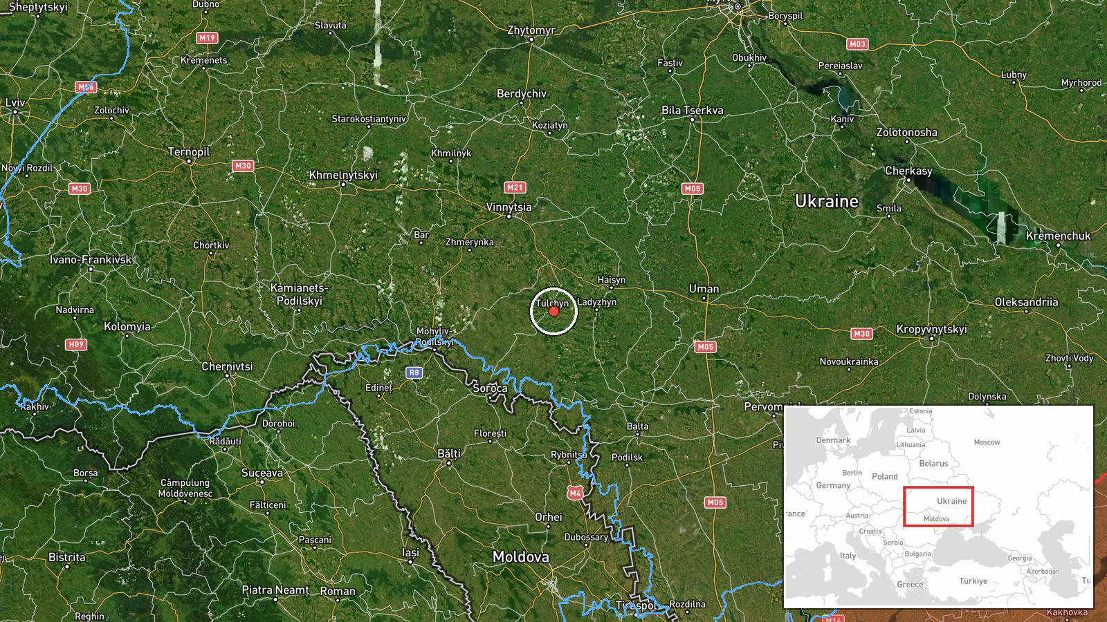
Ukrainian air monitoring detected one Russian jet-powered Shahed (Geran-3) attack drone on a course toward Tulchyn in Vinnytsia Oblast on the evening of October 13, 2026, at approximately 19:37 UTC. The observation was reported by the Ukrainian joint press center for strategic communications (@kpszsu) via Telegram. Geran-3 drones are cruise missiles capable of sustained flight over extended distances and are commonly used in strikes against civilian and military infrastructure.
Context and assessment
Tulchyn lies in central Vinnytsia Oblast, a region that has faced repeated Russian drone operations throughout the conflict. The detection comes as part of a broader pattern of Geran-3 transits across the oblast on October 13, with simultaneous or near-simultaneous reports of drones heading toward nearby towns including Kryzhopil, Nemyriv, and Sharhorod. This clustering of drone activity within a several-hour window suggests a coordinated multi-target strike campaign or saturation attack aimed at stretching Ukrainian air defenses across the region. Vinnytsia has historically been targeted for its infrastructure, positioning along supply routes, and symbolic significance.
Sources and confidence
Report sourced from @kpszsu on Telegram, the official Ukrainian joint press center for strategic communications. Single-source confirmation; no corroborating reports from independent monitors or other official Ukrainian channels are noted in available data. Confidence score of 8.0 reflects credibility of the official source and consistency with related events tracked the same day, though lack of secondary confirmation creates modest hedging.
Location
Tulchyn is a town in central Vinnytsia Oblast, approximately 165 kilometers southwest of Kyiv. Located at 48.67°N, 28.87°E with settlement-level precision. The town sits along major road networks and near the Southern Buh River, a geographic feature that structures movement across the region.
Related events nearby
- Ukrainian air monitoring: 2+ Russian jet-powered Shahed (Geran-3) drones heading toward Kryzhopil.2026-10-13 18:11 UTC · Drone Transit · Kryzhopil, Ukraine
- Ukrainian air monitoring: 1 Russian jet-powered Shahed (Geran-3) drone heading toward Kryzhopil.2026-10-13 17:01 UTC · Drone Transit · Kryzhopil, Ukraine
- Ukrainian air monitoring: 1 Russian jet-powered Shahed (Geran-3) drone heading toward Kryzhopil.2026-10-13 13:29 UTC · Drone Transit · Kryzhopil, Ukraine
- Ukrainian air monitoring: 1 Russian jet-powered Shahed (Geran-3) drone over Nemyriv.2026-10-13 20:26 UTC · Drone Transit · Nemyriv, Ukraine
- Ukrainian air monitoring: 1 Russian jet-powered Shahed (Geran-3) drone heading toward Nemyriv.2026-10-13 17:50 UTC · Drone Transit · Nemyriv, Ukraine
▶ View this event on the live map

Intel Mapper aggregates open-source reports from monitored Telegram and X channels, geolocates them, cross-checks duplicates across sources and assigns a confidence score. Entries are updated as new confirmations arrive. Read how we verify events.