Russian Shahed drone tracked toward Poltava Oblast in overnight transit
What happened
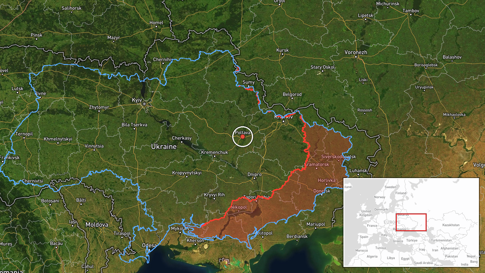
Ukrainian air monitoring reported a single Russian jet-powered Shahed (Geran-3) drone heading toward Poltava Oblast early on 14 October at 00:32 UTC. The alert was issued by the Telegram channel @kpszsu, which tracks Russian air activity in real time. The drone's exact intended target within the oblast was not specified in the monitoring report, which noted transit rather than impact.
Context and assessment
Poltava Oblast in central Ukraine has been subject to repeated drone strikes and transit activity over the preceding hours. Related air monitoring reports from 13 October documented at least four other Shahed sorties in the region, including tracks toward the city of Poltava itself, Kremenchuk, Myrhorod, and Semenivka. These incidents align with a broader pattern: Ukrainian General Staff reported 66 Russian airstrikes and 5,602 kamikaze drone deployments across all sectors on 13 October alone. Poltava Oblast, a logistics and industrial hub west of the front line, remains within Russian strike range and appears to be under sustained air pressure.
Sources and confidence
The report originated from @kpszsu, a Telegram channel operated by Ukrainian air defence authorities. This single-source report carries low confidence (8.0) due to lack of independent cross-confirmation in available data. Confidence would increase with reports of interception, impact, or corroboration from other monitoring channels. Absence of follow-up reports within hours might suggest successful air defence engagement.
Location
Poltava Oblast, Ukraine's central region. The report specifies regional-level precision with low geographic confidence; the drone's track toward the oblast is logged but no settlement or specific facility was named. Poltava city lies roughly 50 km north of the coordinates cited. The oblast sits approximately 180 km behind the primary Pokrovsk-sector frontline.
Related events nearby
- Ukrainian air monitoring: 1 Russian jet-powered Shahed (Geran-3) drone heading toward Poltava.2026-10-13 21:13 UTC · Drone Transit · Poltava, Ukraine
- Ukrainian air monitoring: 1 Russian jet-powered Shahed (Geran-3) drone from Poltava Oblast toward Myrhorod.2026-10-13 17:47 UTC · Drone Transit · Myrhorod, Ukraine
- Ukrainian General Staff operational summary: 206 combat clashes across all sectors (13 Oct 2026, 22:00). Russi2026-10-13 19:03 UTC · Report · Multiple sectors, Ukraine (Pokrovsk axis primary)
- Ukrainian air monitoring: 1 Russian jet-powered Shahed (Geran-3) drone heading toward Semenivka.2026-10-13 14:37 UTC · Drone Transit · Semenivka, Ukraine
- Ukrainian air monitoring: 1 Russian Shahed-type drone heading toward Kremenchuk.2026-10-13 17:40 UTC · Drone Transit · Kremenchuk, Ukraine
▶ View this event on the live map

Intel Mapper aggregates open-source reports from monitored Telegram and X channels, geolocates them, cross-checks duplicates across sources and assigns a confidence score. Entries are updated as new confirmations arrive. Read how we verify events.