Russian Geran-3 drone tracked toward Fastiv in overnight strike wave
What happened
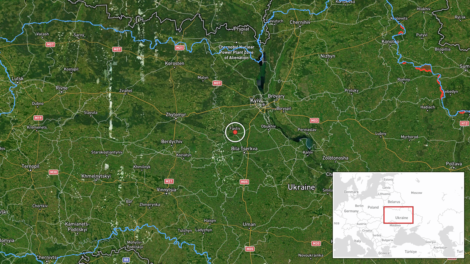
Ukrainian air monitoring detected one Russian jet-powered Shahed (Geran-3) drone heading toward Fastiv on the morning of October 15 at 02:32 UTC. The report was released by the Kyiv Operational Command (@kpszsu) via Telegram. Fastiv lies approximately 75 kilometers southwest of Kyiv. The sighting occurred as part of a broader overnight drone operation, with multiple Geran-3 aircraft tracked across the Kyiv region between 01:53 and 02:45 UTC targeting various settlements.
Context and assessment
Fastiv, a city in Kyiv Oblast hosting railway and industrial infrastructure, has been a recurring target in Russian drone campaigns. The detection of this Geran-3 follows a pattern of coordinated multi-vector drone strikes observed throughout October 15, with simultaneous tracks over Makariv, Uzyn, and other settlements in the region. The Geran-3, a jet-powered variant offering greater range and speed than earlier Shahed models, suggests Russia is conducting sustained strikes against civilian and logistics infrastructure in the Kyiv region. Related activity on October 14 included drone transits over Vasylkiv and Obukhiv, indicating persistent pressure on the western approaches to the capital.
Sources and confidence
Report sourced from Kyiv Operational Command (@kpszsu) Telegram channel. Single-source reporting limits independent cross-confirmation; confidence of 8.0 reflects institutional reliability of Ukrainian official monitoring but absence of secondary verification. Corroborating Geran-3 detections at nearby Makariv and Uzyn the same evening provide supporting context. Confidence would increase with independent air defense acknowledgment or attack outcome confirmation.
Location
Fastiv identified at settlement level (50.078°N, 29.920°E) in Kyiv Oblast, approximately 75 kilometers southwest of Kyiv city center. The city sits on major rail corridors and hosts industrial facilities. Surrounding area contains dispersed settlements and agricultural land; nearby towns include Vasylkiv to the south and Koziatyn to the west.
Related events nearby
- Ukrainian air monitoring: 1 Russian Shahed-type drone over Vasylkiv.2026-10-14 07:11 UTC · Drone Transit · Vasylkiv, Ukraine
- Ukrainian air monitoring: 1 Russian jet-powered Shahed (Geran-3) drone passing Pivdennyi, heading toward Makar2026-10-15 02:45 UTC · Drone Transit · Makariv, Ukraine
- Ukrainian air monitoring: 1 Russian jet-powered Shahed (Geran-3) drone heading toward Makariv.2026-10-15 01:53 UTC · Drone Transit · Makariv, Ukraine
- Ukrainian air monitoring: 1 Russian jet-powered Shahed (Geran-3) drone heading toward Uzyn.2026-10-15 02:27 UTC · Drone Transit · Uzyn, Ukraine
- Ukrainian air monitoring: 1 Russian jet-powered Shahed (Geran-3) drone over Obukhiv; 1 Russian Shahed-type dro2026-10-14 07:10 UTC · Drone Transit · Obukhiv, Ukraine
▶ View this event on the live map

Intel Mapper aggregates open-source reports from monitored Telegram and X channels, geolocates them, cross-checks duplicates across sources and assigns a confidence score. Entries are updated as new confirmations arrive. Read how we verify events.