Russian Shahed kamikaze drones tracked transiting from Chernihiv toward Kyiv Oblast
What happened
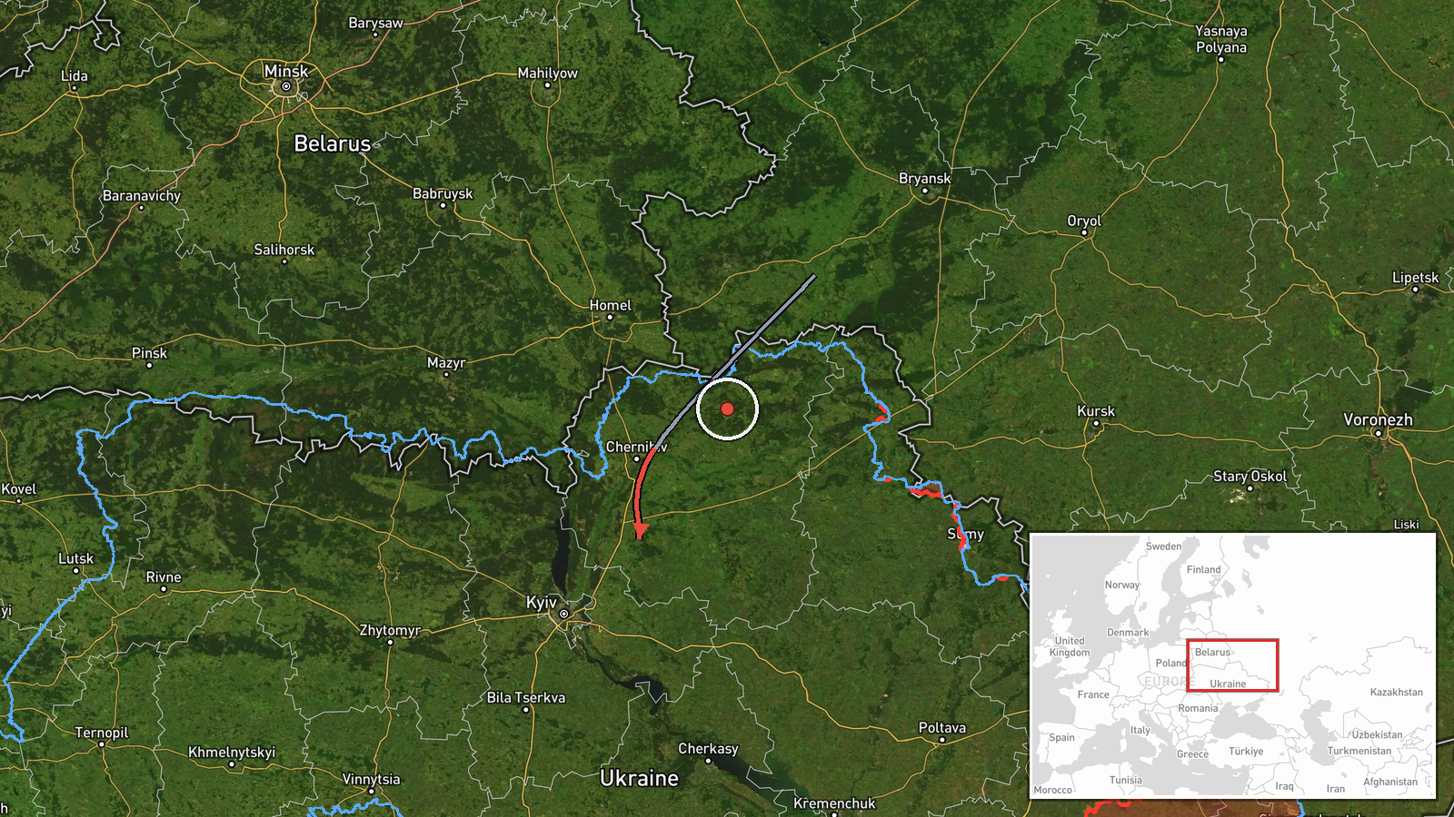
Ukrainian air monitoring reported multiple Russian jet-powered Shahed kamikaze drones (also known as Geran-3) tracked in transit from northern Chernihiv Oblast southward toward northern Kyiv Oblast on the morning of October 15 at approximately 04:42 UTC. The report, posted via Telegram by the Ukrainian Air Force command, documented the drone movement across the border region without specifying the number of aircraft or their intended target.
Context and assessment
This drone transit occurs within an active Russian air campaign targeting Ukrainian infrastructure and populated areas. On October 14, Russia launched approximately 167 weapons including 39 ballistic missiles and 128 drones, destroying Kyiv's Darnytska CHP-4 thermal power plant and striking residential areas in Desnyanski District, killing at least three civilians. The Shahed-type drones observed transiting on October 15 likely represent a continuation of this sustained offensive targeting energy infrastructure and civilian populations across northeastern Ukraine. Such drone sorties typically precede or accompany strikes on power generation facilities, water systems, and populated centers. The transit route from Chernihiv suggests drones may be targeting Kyiv or surrounding regions.
Sources and confidence
Single source via Telegram channel of the Ukrainian Armed Forces General Staff (@kpszsu). No cross-confirmation from independent international monitors or other Ukrainian sources reported. Confidence score of 8.0 reflects reliable Ukrainian official reporting channel but limited corroboration. Score would increase with visual confirmation from ground observers or secondary official sources; would decrease if subsequent attack reports fail to materialize or contradict transit details.
Location
Northern Kyiv Oblast, approximately 50.7°N, 31.1°E, determined by Ukrainian air monitoring coordinates with low precision (region-level rather than specific facility). Located in the northeastern approaches to Kyiv, roughly 50–70 km north of the capital. Transit originated from northern Chernihiv Oblast to the north. Geographic area includes relatively open terrain with sparse settlement density.
Related events nearby
- Ukrainian air monitoring: 1 Russian Shahed-type drone over Kalynivka.2026-10-14 08:54 UTC · Drone Transit · Kalynivka, Ukraine
- Ukrainian air monitoring warns of Russian tactical aircraft and aviation strike weapon activity across northea2026-10-15 04:59 UTC · Siren · Northern and Eastern Ukraine
- Russia launched 167 weapons (39 ballistic missiles, 128 drones) targeting Ukrainian energy infrastructure. Bal2026-10-14 07:09 UTC · Ballistic Missile · Darnytska CHP-4 Power Plant, Kyiv, Ukraine
- President Zelensky announces Ukraine will resume strikes on Russian oil refineries after Moscow continued atta2026-10-15 05:24 UTC · Statement · Kyiv, Ukraine
- President Zelensky reiterates that only the Ukrainian people can elect Ukraine's president, rejecting any fore2026-10-14 18:56 UTC · Statement · Kyiv, Ukraine
▶ View this event on the live map

Intel Mapper aggregates open-source reports from monitored Telegram and X channels, geolocates them, cross-checks duplicates across sources and assigns a confidence score. Entries are updated as new confirmations arrive. Read how we verify events.