Ukraine warns of Russian tactical aircraft and Shahed drones crossing northeastern airspace
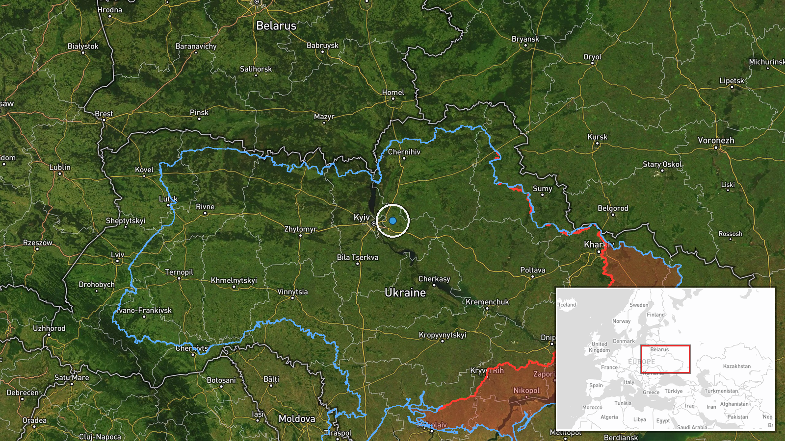
What happened
Ukrainian air monitoring issued an alert on October 15 at 04:59 UTC warning of active Russian tactical aviation across northeastern Ukraine. The alert reported tracking multiple Shahed-type kamikaze drones and fighter jets transiting across several regions toward frontline and rear areas. The specific trajectory and intended targets were not detailed in the Ukrainian military monitoring channel's public warning.
Context and assessment
The alert reflects an ongoing pattern of Russian aerial operations targeting Ukrainian territory. On October 14, Russian forces launched 167 weapons including 39 ballistic missiles and 128 drones, destroying Kyiv's Darnytska CHP-4 power plant and striking residential areas in Kyiv's Desnyanski District, killing at least three civilians. Multiple individual Shahed drone transits were tracked crossing northern Kyiv Oblast and other regions during the same period. Northeastern Ukraine has remained under sustained pressure from Russian aviation assets, suggesting continued efforts to pressure Ukrainian air defenses and strike both military and civilian infrastructure across multiple regions simultaneously.
Sources and confidence
Reported solely by Ukrainian military official monitoring channel Telegram (@kpszsu) at 04:59 UTC on October 15. Single-source warning with no immediate cross-confirmation from other Ukrainian channels or independent monitoring groups. Confidence score of 8.0 reflects the official source's reliability but lack of corroborating reports. Confirmation from impact reports or defense ministry statements would strengthen confidence; absence of follow-up strike claims could indicate disrupted operations.
Location
Alert covers northeastern Ukraine spanning multiple regions, centered approximately on coordinates 50.5°N, 31.0°E, though precision is regional rather than site-specific. Related tracked transits occurred over Kalynivka, Brovary, Hnidyn, and northern Kyiv Oblast and Chernihiv Oblast. Northeastern approach vectors suggest potential routes toward Kyiv and surrounding metropolitan areas.
Related events nearby
- Ukrainian air monitoring: 1 Russian Shahed-type drone over Kalynivka.2026-10-14 08:54 UTC · Drone Transit · Kalynivka, Ukraine
- Russia launched 167 weapons (39 ballistic missiles, 128 drones) targeting Ukrainian energy infrastructure. Bal2026-10-14 07:09 UTC · Ballistic Missile · Darnytska CHP-4 Power Plant, Kyiv, Ukraine
- Ukrainian air monitoring: 1 Russian jet-powered Shahed (Geran-3) drone passing Brovary, heading toward Hnidyn.2026-10-14 13:51 UTC · Drone Transit · Hnidyn, Ukraine
- Ukrainian air monitoring: Multiple Russian jet-powered Shahed (Geran-3) kamikaze drones tracked transiting fro2026-10-15 04:42 UTC · Drone Transit · Northern Kyiv Oblast, Ukraine
- President Zelensky announces Ukraine will resume strikes on Russian oil refineries after Moscow continued atta2026-10-15 05:24 UTC · Statement · Kyiv, Ukraine
▶ View this event on the live map

Intel Mapper aggregates open-source reports from monitored Telegram and X channels, geolocates them, cross-checks duplicates across sources and assigns a confidence score. Entries are updated as new confirmations arrive. Read how we verify events.