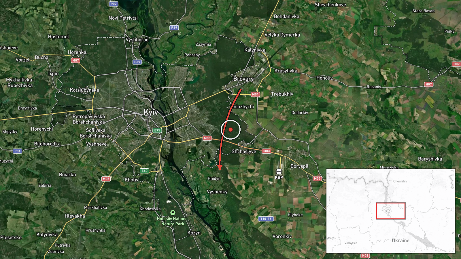
Russian Geran-3 drone tracked crossing Brovary toward Hnidyn northeast of Kyiv
What happened
Ukrainian air monitoring reported a single Russian jet-powered Shahed (Geran-3) drone passing over Brovary on October 14 at approximately 13:51 UTC, traveling in the direction of Hnidyn. The report was logged by war monitoring channels tracking Russian aerial activity over the Kyiv region. No interception or impact was specified in the available data.
Context and assessment
This drone transit occurred during a sustained Russian aerial campaign against Ukrainian targets. On the same day, Russia launched 167 weapons including 39 ballistic missiles and 128 drones targeting energy infrastructure, with confirmed strikes on Kyiv's Darnytska CHP-4 power plant and residential areas in the Desnyanski District. Multiple Shahed-type drones were detected across the Kyiv region throughout October 13–14, including transits near Kharkivskyi Masyv, Kozyn, and Boryspil. The concentration of drone activity and the earlier large-scale combined missile-and-drone strike suggest Russia may be conducting reconnaissance, follow-up strikes, or attempting to overwhelm air defenses through sustained operations.
Sources and confidence
Reported by Telegram channel @war_monitor on October 14. Single source only; no cross-confirmation from other monitoring channels provided in available data. Confidence is moderate (6.0) due to reliance on one source. Confirmation by multiple independent Ukrainian air monitoring networks or official statements would increase confidence; absence of corroboration or contradictory reports would lower it.
Location
Hnidyn is a settlement in Kyiv Oblast approximately 25–30 kilometers northeast of central Kyiv, situated in relatively open terrain east of the Dnieper River. Brovary, the reference point for the drone's position, lies roughly 15 kilometers northeast of Kyiv city center and marks a common transit zone for Russian air operations heading toward targets in or beyond the capital region.
Related events nearby
- Ukrainian air monitoring: 1 Russian Shahed-type drone over Kozyn; 1 Russian Shahed-type drone over Katiuzhanka2026-10-14 08:44 UTC · Drone Transit · Kozyn, Ukraine
- Russia launched 167 weapons (39 ballistic missiles, 128 drones) targeting Ukrainian energy infrastructure. Bal2026-10-14 07:09 UTC · Ballistic Missile · Darnytska CHP-4 Power Plant, Kyiv, Ukraine
- Ukrainian air monitoring: 1 Russian jet-powered Shahed (Geran-3) drone heading toward Boryspil.2026-10-13 22:36 UTC · Drone Transit · Boryspil, Ukraine
- Russian ballistic missile strikes 9-story residential building in Desnyanski District, Kyiv. 3 killed, 21 inju2026-10-14 05:25 UTC · Ballistic Missile · Dniprovsky District, Kyiv, Ukraine
- Zelensky warns that the U.S. has cautioned Ukraine it may halt intelligence sharing if Ukraine continues attac2026-10-14 07:11 UTC · Statement · Kyiv, Ukraine
▶ View this event on the live map

Intel Mapper aggregates open-source reports from monitored Telegram and X channels, geolocates them, cross-checks duplicates across sources and assigns a confidence score. Entries are updated as new confirmations arrive. Read how we verify events.