Ukrainian monitoring reports 2+ Russian Shahed drones transiting Black Sea toward Mykolaiv
What happened
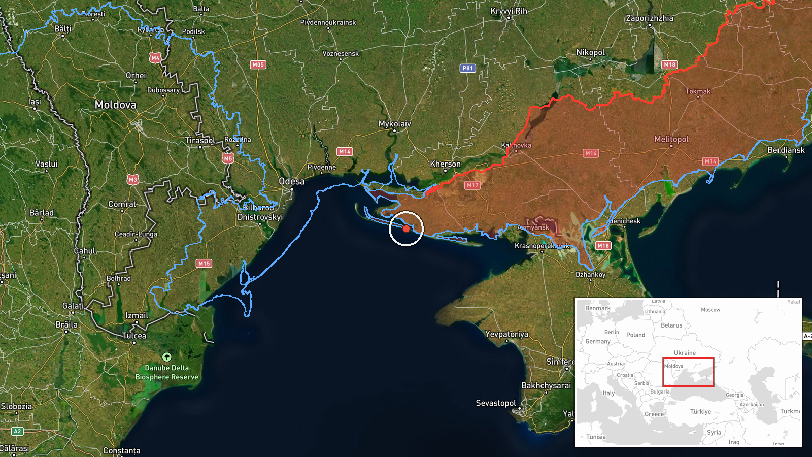
Ukrainian air defense monitoring detected at least two Russian jet-powered Shahed (Geran-3) drones over the Black Sea south of Mykolaiv Oblast on October 15 at 05:26 UTC, reportedly heading northward from open water toward Ukrainian territory. The sighting was reported by the Ukrainian command post for air defense forces via Telegram. The drones' trajectory suggested potential targeting of coastal or inland objectives in the Mykolaiv region.
Context and assessment
Shahed drones, particularly the jet-powered Geran-3 variant, have been a persistent tool in Russian strikes against Ukrainian infrastructure and populated areas throughout the conflict. The Black Sea transit route allows Russia to launch attacks from beyond coastal air defenses, a pattern documented in numerous previous operations. A related sighting approximately three hours earlier detected similar drones over Beryslav district heading northwest, suggesting a possible coordinated drone operation or multiple waves. Such approaches typically precede strikes on energy infrastructure, military facilities, or urban centers in southern Ukraine. The frequency of these transits indicates ongoing Russian capability to sustain drone operations despite Ukrainian air defense deployments.
Sources and confidence
Single source: Ukrainian Air Defense Command official Telegram channel (@kpszsu). No corroborating reports from independent observers or international monitoring agencies noted. Confidence score of 8.0 reflects official Ukrainian military reporting but limited redundancy. Confirmation from satellite imagery, damage reports, or additional independent monitors would strengthen assessment. Lower corroboration or contradictory timing from other sources would reduce confidence.
Location
Black Sea waters south of Mykolaiv Oblast, Ukraine, at approximately 46.15°N, 32.13°E. Geolocation determined at regional precision level based on Ukrainian air monitoring coordinates. The area lies roughly 40–50 km offshore from the Mykolaiv coast, within Ukrainian air defense surveillance range but outside most ground-based radar coverage limits. Nearby reference points include the port city of Mykolaiv to the north and the Beryslav district inland.
Related events nearby
- Ukrainian air monitoring: 2+ Russian jet-powered Shahed (Geran-3) drones passing Beryslav district, heading no2026-10-15 01:54 UTC · Drone Transit · Beryslav district, Ukraine
▶ View this event on the live map

Intel Mapper aggregates open-source reports from monitored Telegram and X channels, geolocates them, cross-checks duplicates across sources and assigns a confidence score. Entries are updated as new confirmations arrive. Read how we verify events.