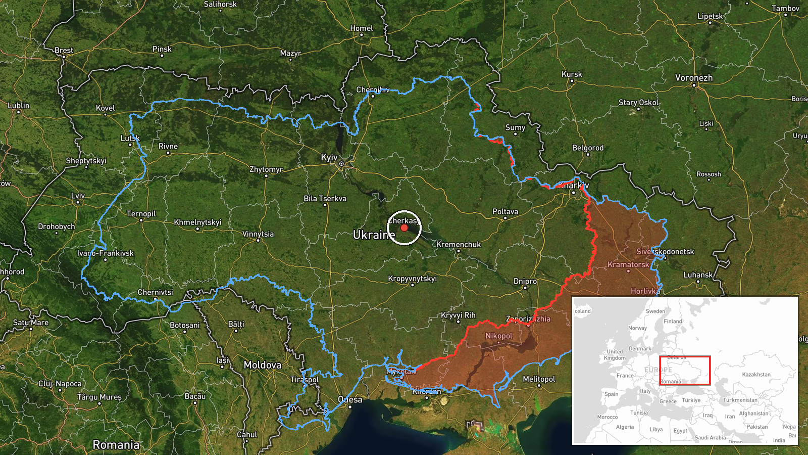
Russian Geran-3 drone tracked transiting Cherkasy Oblast heading northwest
What happened
Ukrainian air monitoring detected one Russian jet-powered Shahed-type drone (Geran-3) passing through Cherkasy Oblast in central Ukraine on the morning of 15 October, traveling in a northwestern direction. The report came from official Ukrainian air defense monitoring channels. No immediate interception or impact was reported in this specific transit notice.
Context and assessment
The sighting occurred during an intense overnight Russian aerial campaign. Ukrainian air defenses reportedly engaged 536 Shahed-type and decoy drones across the night of 14–15 October, indicating sustained Russian drone attack operations. Multiple similar transit reports from nearby regions—including a comparable Geran-3 passage through Kirovohrad Oblast hours earlier and six Shahed-type drones detected near Kremenchuk—suggest a coordinated wave of drone strikes across central Ukraine. These transits typically indicate targeting runs toward populated areas or infrastructure in western and northwestern Ukraine, with drones following similar flight corridors to evade or saturate air defenses.
Sources and confidence
Single source: Telegram channel @kpszsu (official Ukrainian air defense monitoring). No cross-confirmation from other channels reported. Confidence score of 8.0 reflects the official Ukrainian source but limited corroboration. Score would rise with secondary confirmation from other air monitoring channels or visible interception reports; would lower if subsequent air defense data contradicted the transit claim.
Location
Cherkasy Oblast, central Ukraine, near Kamyanka settlement (coordinates 49.44°N, 32.06°E). Located approximately 150 km southeast of Kyiv. Precision is regional rather than point-specific. The oblast lies along typical drone transit corridors from Russian-held territory toward western Ukrainian cities and infrastructure.
Related events nearby
- Ukrainian air defenses downed/suppressed 536 Russian Shahed-type drones, Geran drones, and decoy drones from n2026-10-15 05:03 UTC · Air Defense · Ukraine
- Intelligence suggests Russia is preparing a large-scale missile and drone attack on Ukraine. Report indicates 2026-10-14 20:00 UTC · Statement · Ukraine
- Ukrainian air monitoring: 1 Russian jet-powered Shahed (Geran-3) drone passing Kirovohrad Oblast, heading nort2026-10-15 01:55 UTC · Drone Transit · Kirovohrad Oblast, Ukraine
- Air raid alert issued for Kropivnytskyi and Oleksandriia sectors in central Ukraine. Civilian population advis2026-10-14 19:21 UTC · Siren · Kropivnytskyi to Oleksandriia sector, Kirovohrad O
- Ukrainian air monitoring: 1 Russian Shahed-type drone passing Bohodukhiv, heading toward Oleksandriya.2026-10-14 14:49 UTC · Drone Transit · Oleksandriya, Ukraine
▶ View this event on the live map

Intel Mapper aggregates open-source reports from monitored Telegram and X channels, geolocates them, cross-checks duplicates across sources and assigns a confidence score. Entries are updated as new confirmations arrive. Read how we verify events.