Jet-powered Geran-3 drone reported heading toward Rivne Oblast, Ukraine
What happened
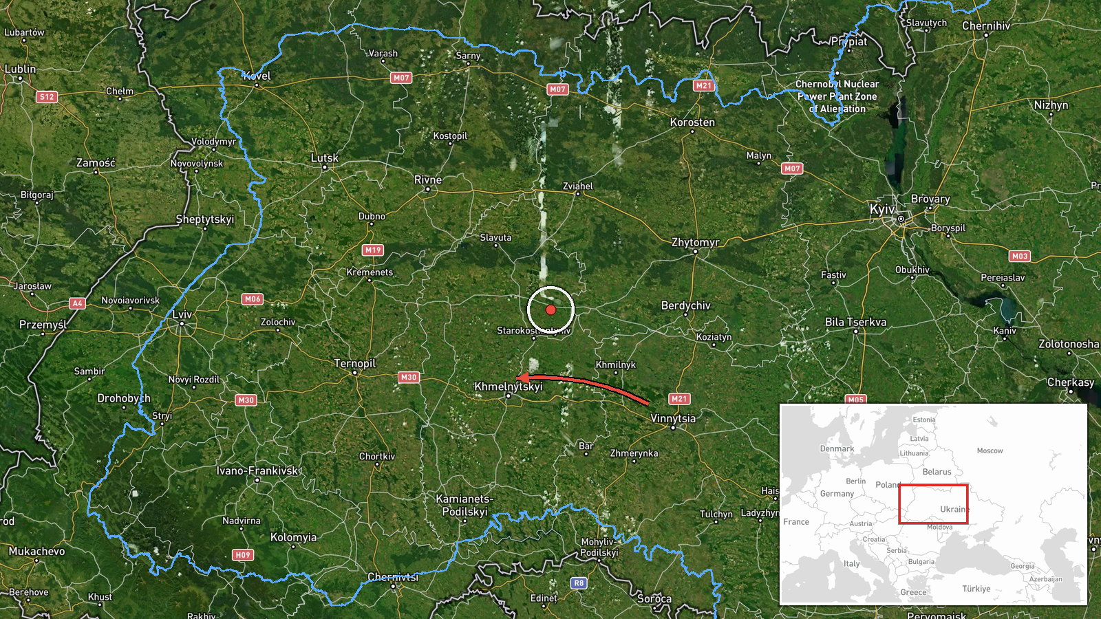
Ukrainian air monitoring reported on Telegram channel @kpszsu on 16 October 2026 at 01:04 UTC that a single Russian jet-powered Shahed (Geran-3) drone was moving from the north of Khmelnytskyi Oblast toward Rivne Oblast in northwestern Ukraine. The same post described a separate group of two or more jet-powered drones south of Vinnytsia, heading toward Khmelnytskyi Oblast. The summary used for this page says the second group was 'passing Vinnytsia,' but the original Ukrainian wording places them south of the city, so the more precise phrasing is that they were south of Vinnytsia. The report gives no impact, damage, or casualty details, and the event is recorded as a transit rather than a strike.
Context and assessment
Rivne Oblast sits in the northwest of the country, in the Polissia belt of forests and wetlands, and it lies on routes that drones often take when moving between eastern launch areas and western Ukraine. The related reports show a sustained pattern. Earlier on 15 October, a drone was logged moving from Khmelnytskyi Oblast toward Rivne at 09:48 UTC and was reported over Rivne at 17:19 UTC. On 16 October, a drone came from Zhytomyr Oblast toward Rivne at 01:05 UTC, was again reported over the oblast at 01:42 UTC, and a further group of two or more was reported heading toward Rivne at 01:47 UTC. The repetition suggests a recurring corridor through the region rather than one isolated track. Operationally, such transits may reflect routing toward targets farther west or south, loitering or re-routing around air defence, or simple flight paths. Transit reports alone do not establish intended targets, and the data here does not show what, if anything, the drones struck.
Sources and confidence
The event rests on one Telegram channel, @kpszsu, and the source count is one. The related events are logged from the same monitoring stream and do not add independent confirmation. The confidence score of 8.0 reflects a credible official-linked air monitoring source with a consistent sequence of related reports. It is held below the maximum because no second outlet or official statement independently confirms the track. Confidence would rise if other Ukrainian or independent monitoring sources, or official air force statements, corroborated the drone's path. It would fall if later reporting retracted the track, placed the drone elsewhere, or showed no further movement.
Location
The location is recorded at region level, so the coordinates of 50.62 N, 26.25 E approximate the centre of Rivne Oblast rather than any settlement, facility, or specific point on the flight path. Location confidence is rated low for this reason. Rivne Oblast lies in northwestern Ukraine within the Polissia lowlands, an area of forests, marshes, and rivers. The Horyn River flows through the region, and the oblast borders Belarus to the north. The data does not place the drone at any particular town.
Related events nearby
- Ukrainian air monitoring: 2+ Russian jet-powered Shahed (Geran-3) drones heading toward Rivne Oblast.2026-10-16 01:47 UTC · Drone Transit · Rivne Oblast, Ukraine
- Ukrainian air monitoring: 1 Russian jet-powered Shahed (Geran-3) drone over Rivne Oblast.2026-10-16 01:42 UTC · Drone Transit · Rivne Oblast, Ukraine
- Ukrainian air monitoring: 1 Russian jet-powered Shahed (Geran-3) drone from Zhytomyr Oblast toward Rivne Oblas2026-10-16 01:05 UTC · Drone Transit · Rivne Oblast, Ukraine
- Ukrainian air monitoring: 1 Russian jet-powered Shahed (Geran-3) drone over Rivne Oblast.2026-10-15 17:19 UTC · Drone Transit · Rivne Oblast, Ukraine
- Ukrainian air monitoring: 1 Russian jet-powered Shahed (Geran-3) drone from Khmelnytskyi Oblast toward Rivne O2026-10-15 09:48 UTC · Drone Transit · Rivne Oblast, Ukraine
▶ View this event on the live map

Intel Mapper aggregates open-source reports from monitored Telegram and X channels, geolocates them, cross-checks duplicates across sources and assigns a confidence score. Entries are updated as new confirmations arrive. Read how we verify events.