Jet-powered Shahed-type drone reported passing Dubno, Rivne Oblast, on course toward Volyn Oblast
What happened
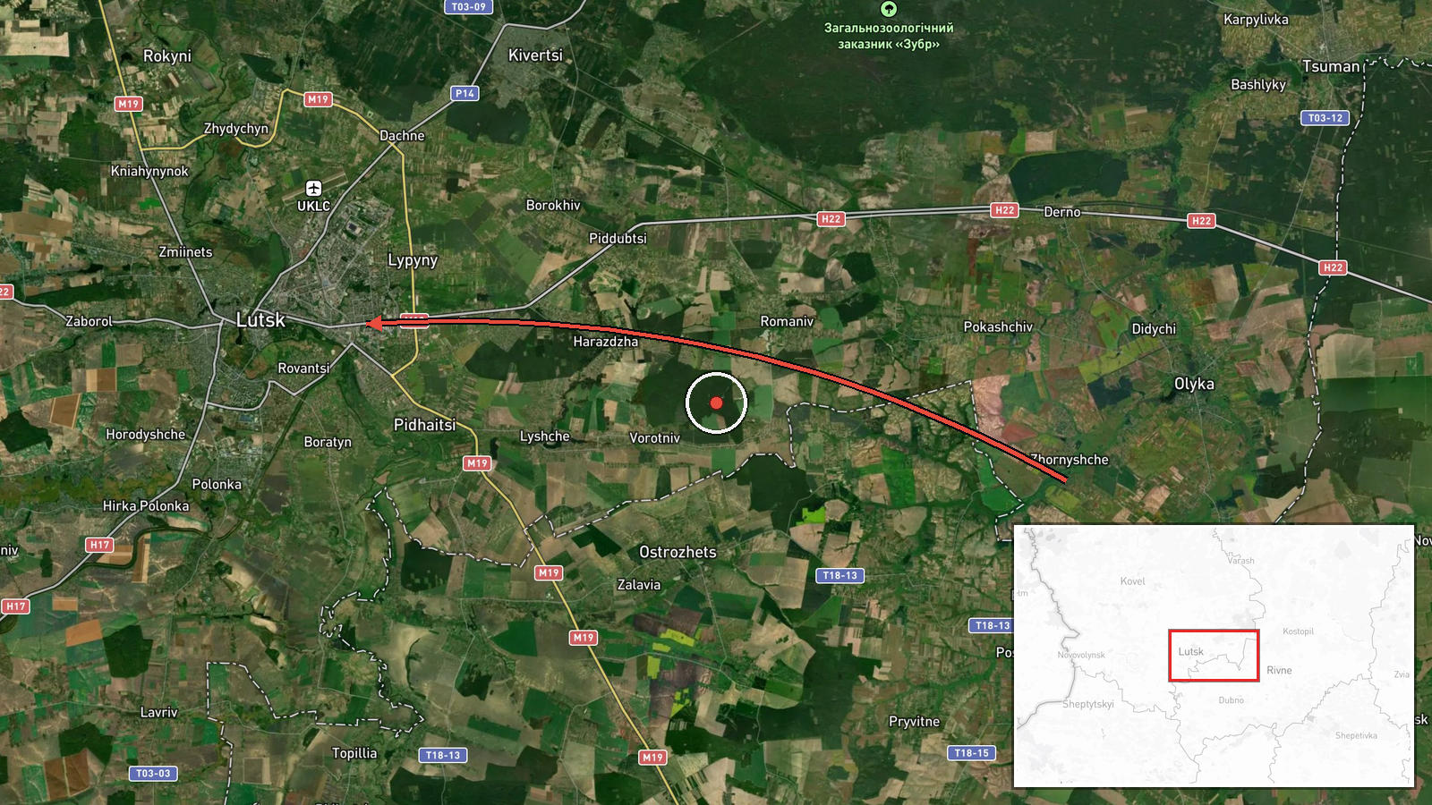
Ukraine's air monitoring channel on Telegram (@kpszsu) reported at 01:05 UTC on 16 October 2026 that a single Russian jet-powered Shahed, designated Geran-3, was passing Dubno in Rivne Oblast on a course toward Volyn Oblast, with Lutsk named as the likely destination. The original Ukrainian wording describes a 'реактивний БпЛА' (jet-type unmanned aerial vehicle) on a heading 'курс на Волинь (Луцьк)'. The report does not mention impacts, casualties, or damage, and it does not say whether the drone was intercepted. The event is categorised as a drone transit, meaning an airborne threat tracked in flight rather than a confirmed strike. Subsequent updates in the same sequence follow the drone's track into Volyn.
Context and assessment
Lutsk, the regional capital of Volyn Oblast, is a city of several hundred thousand people in northwestern Ukraine, relatively close to the Polish border. Its airspace has been crossed repeatedly by drones in recent updates. Between 16:34 and 18:02 UTC on 15 October, the air monitoring channel logged three separate reports of Geran-3 drones heading toward or over Lutsk. Early on 16 October, a Shahed-type drone was reported passing Berezne, near the Rivne and Volyn boundary, before the Dubno report and a further update heading toward Volyn. Taken together, the sequence suggests a sustained flight corridor that runs from the Rivne area into Volyn, rather than a single isolated sighting. Operationally, this pattern may indicate that Russian drones are being routed across western Ukraine toward targets in the region, or that multiple drones are following similar tracks. Because the jet-powered Geran-3 is faster than piston-engine Shahed variants, it leaves less time for interception once it is detected. These are inferences from the reporting pattern only, and the data does not confirm the intended target.
Sources and confidence
The event rests on a single Telegram channel, @kpszsu, which posts Ukrainian air monitoring alerts. No independent outlet or official confirmation appears in the event data, so cross-confirmation is absent. The confidence score of 8.0 reflects the channel's consistent use in this sequence, the internal coherence of the related updates, and the specificity of the track description. It is held below the maximum because the report is unverified, single-source, and carries no impact or interception outcome. Confidence would rise with corroboration from other Ukrainian air force or regional military administration channels, or with reports of an interception or impact in the named area. It would fall if the track were contradicted, if the drone were reported downed elsewhere, or if the channel issued a correction.
Location
The location is recorded at regional precision, with coordinates of 50.75 N, 25.33 E, which correspond approximately to Lutsk. The marker does not represent the drone's actual position or any impact point. The reported track runs from Dubno, in Rivne Oblast, toward Lutsk in Volyn Oblast. The setting is the Polissia lowlands, a flat to gently rolling terrain of forests, wetlands, and river valleys. Lutsk sits on the Styr River, and Dubno lies on the Ikva River.
Related events nearby
- Ukrainian air monitoring: 1 Russian jet-powered Shahed (Geran-3) drone heading toward Lutsk.2026-10-16 02:26 UTC · Drone Transit · Lutsk, Ukraine
- Ukrainian air monitoring: 1 Russian jet-powered Shahed (Geran-3) drone heading toward Lutsk.2026-10-16 01:57 UTC · Drone Transit · Lutsk, Ukraine
- Ukrainian air monitoring: 1 Russian jet-powered Shahed (Geran-3) drone heading toward Volyn Oblast.2026-10-16 01:07 UTC · Drone Transit · Volyn Oblast, Ukraine
- Ukrainian air monitoring: 1 Russian Shahed-type drone passing Berezne, heading toward Volyn Oblast.2026-10-16 01:06 UTC · Drone Transit · Volyn Oblast, Ukraine
- Ukrainian air monitoring: 1 Russian jet-powered Shahed (Geran-3) drone over Lutsk.2026-10-15 18:02 UTC · Drone Transit · Lutsk, Ukraine
▶ View this event on the live map

Intel Mapper aggregates open-source reports from monitored Telegram and X channels, geolocates them, cross-checks duplicates across sources and assigns a confidence score. Entries are updated as new confirmations arrive. Read how we verify events.