Jet-powered Shahed drone reported en route to Lutsk, per Ukrainian air monitoring
What happened
Ukrainian air monitoring reported on 16 October 2026 at about 02:26 UTC that one Russian jet-powered Shahed-type drone, identified in the wording as a Geran-3, was heading toward Lutsk, the administrative centre of Volyn Oblast in northwestern Ukraine. The report was carried by the Telegram channel @kpszsu. The original Ukrainian post is brief and, in translation, reads simply 'Jet-powered UAV toward Lutsk.' It gives no information on impact, damage, casualties, or whether the drone was intercepted. The event is classed as a drone transit, meaning a report of an aircraft in flight rather than a confirmed strike. The entry has not been corrected.
Context and assessment
Lutsk lies in the Volyn region close to the Polish and Belarusian borders, which makes it a useful waypoint for tracking drones moving across the northwest of Ukraine. The related reports show a sequence over roughly an hour. At 01:05 UTC a jet-powered Geran-3 was reported moving from Rivne Oblast toward Volyn Oblast, followed at 01:06 by a Shahed-type drone passing Berezne, then at 01:07 by another Geran-3 heading into Volyn, and at 01:57 by the report targeting Lutsk itself. The pattern suggests a track or tracks moving through the region in sequence rather than a single isolated sighting. The previous day, a UAS strike on Lutsk at 22:31 UTC was reportedly followed by electricity outages across the city, according to a Turkish OSINT account on X, which suggests the city has been a repeated focus. Operationally, a cluster of jet-powered drones on this axis may indicate a route toward western targets, a probing pattern, or a diversionary track. The jet variant is generally faster than piston-engine Shaheds, which can complicate interception timelines. These readings remain tentative, since the dataset does not show intent, impact, or outcome.
Sources and confidence
The report rests on a single Telegram channel, @kpszsu, which posts Ukrainian air monitoring alerts. No independent outlet, official follow-up, or second channel in the dataset confirms the drone's track, and the related events are themselves largely single-source air alerts. The confidence score of 8.0 reflects the alert's origin in a monitoring channel and the high location confidence, offset by the absence of cross-confirmation and any stated outcome. Confidence would rise with official Ukrainian air force statements, local authority reports, or independent imagery of an intercept or impact. It would fall if the alert were withdrawn, reclassified as a false alarm, or contradicted by later updates.
Location
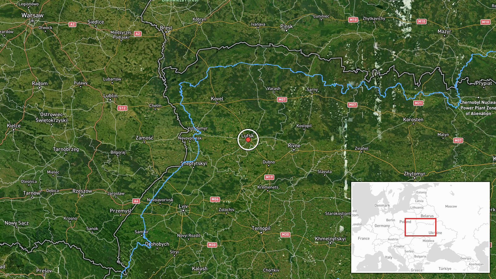
The location is set at settlement level, with coordinates of 50.75 latitude and 25.33 longitude placing the marker at the centre of Lutsk. The location confidence is rated high, since the report names the city directly. Lutsk is a city on the Styr River in western Ukraine, serving as the regional capital of Volyn Oblast. Its historic core includes Lubart's Castle, a notable landmark. The city sits in flat, wooded terrain of the Polesia lowlands, near the Polish and Belarusian borders.
Related events nearby
- Ukrainian air monitoring: 1 Russian jet-powered Shahed (Geran-3) drone heading toward Lutsk.2026-10-16 01:57 UTC · Drone Transit · Lutsk, Ukraine
- Ukrainian air monitoring: 1 Russian jet-powered Shahed (Geran-3) drone heading toward Volyn Oblast.2026-10-16 01:07 UTC · Drone Transit · Volyn Oblast, Ukraine
- Ukrainian air monitoring: 1 Russian Shahed-type drone passing Berezne, heading toward Volyn Oblast.2026-10-16 01:06 UTC · Drone Transit · Volyn Oblast, Ukraine
- Ukrainian air monitoring: 1 Russian jet-powered Shahed (Geran-3) drone from Rivne Oblast toward Volyn Oblast.2026-10-16 01:05 UTC · Drone Transit · Volyn Oblast, Ukraine
- Russian attacks on Lutsk were followed by electricity outages across the city, per a Turkish OSINT report on X2026-10-15 22:31 UTC · UAS Strike · Lutsk, Ukraine
▶ View this event on the live map

Intel Mapper aggregates open-source reports from monitored Telegram and X channels, geolocates them, cross-checks duplicates across sources and assigns a confidence score. Entries are updated as new confirmations arrive. Read how we verify events.