Ukrainian Air Force reports one drone in southern Zhytomyr Oblast heading toward Vinnytsia Oblast
What happened
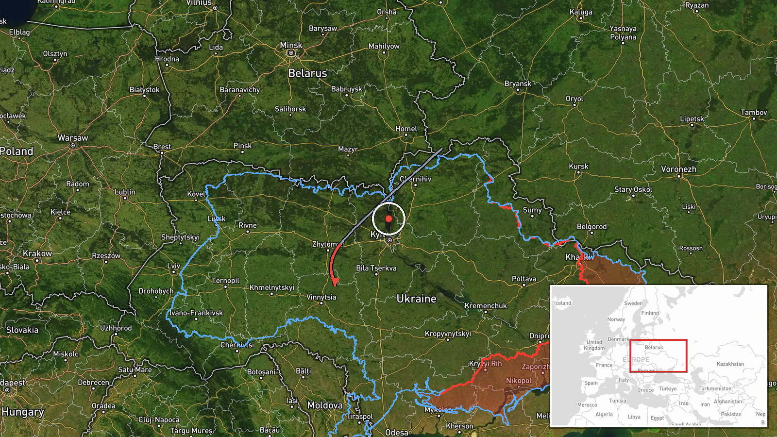
Ukraine's Air Force monitoring channel on Telegram, @kpszsu, reported at 01:06 UTC on 16 October 2026 that one unmanned aerial vehicle was tracked in the south of Zhytomyr Oblast on a course toward Vinnytsia Oblast. The original Ukrainian wording, 'БпЛА на півдні Житомирщини, курс на Вінниччину,' does not name a model. The Shahed-type classification in the summary reflects a reading of the wider pattern rather than an explicit identification in the post. The report gives no impact, damage, or casualty information and does not say whether the drone was intercepted. It is logged as a transit, meaning a drone observed in flight rather than a confirmed strike on a specific target, and the entry is not marked as corrected.
Context and assessment
Vinnytsia Oblast sits in central-west Ukraine, between the southern frontier regions and the western half of the country, so drones routed across it are often moving toward targets further west or north. The related reports show a dense series of single-drone tracks over roughly 24 hours. On 15 October, separate entries logged jet-powered Shahed (Geran-3) drones from Kirovohrad Oblast, Odesa Oblast, and Vinnytsia Oblast itself, with additional tracks near Stryzhavka and Voronovytsya. The 16 October report from Zhytomyr fits that sequence, suggesting sustained flights along a corridor crossing central Ukraine rather than a single isolated incursion. Operationally, such repeated transits may indicate route-testing, saturation of air defenses, or movement toward distant objectives. None of the reports in this series establishes an intended target, and the tracking data cannot show whether a drone continued on its course or was shot down.
Sources and confidence
This event rests on a single channel, the official Telegram account of the Ukrainian Air Force, which is generally a reliable first source for airspace warnings. The confidence score of 8.0 reflects that official origin and the specificity of the report, but it is held below the top range because there is no independent confirmation from another outlet, regional administration, or observer. The related events come from the same type of monitoring feed, so they add pattern context but not independent verification. Confidence would rise with corroboration from regional military administrations, reports of interception or debris, or matching radar reporting. It would fall if later updates contradicted the course, or if no further trace of the drone appears in official or local sources.
Location
The location is recorded at region level, with the coordinates set near the approximate centre of Vinnytsia Oblast rather than at any settlement, because the original post names no town. The origin is given as southern Zhytomyr Oblast, which lies north of the destination region. Vinnytsia Oblast is largely a rolling upland landscape of the Podillia region, drained by the Southern Bug River, which runs through its territory. Its broad agricultural terrain offers little natural cover for low-flying drones.
Related events nearby
- Ukrainian air monitoring: jet-powered Shahed (Geran-3) drones tracked over western Kirovohrad Oblast, heading 2026-10-16 01:16 UTC · Drone Transit · Vinnytsia, Ukraine
- Ukrainian air monitoring: 1 Russian jet-powered Shahed (Geran-3) drone from Odesa Oblast toward Vinnytsia Obla2026-10-15 17:01 UTC · Drone Transit · Vinnytsia Oblast, Ukraine
- Ukrainian air monitoring: 1 Russian jet-powered Shahed (Geran-3) drone from Kirovohrad Oblast toward Vinnytsia2026-10-15 08:58 UTC · Drone Transit · Vinnytsia Oblast, Ukraine
- Ukrainian air monitoring: 1 Russian jet-powered Shahed (Geran-3) drone heading toward Stryzhavka.2026-10-15 12:23 UTC · Drone Transit · Stryzhavka, Ukraine
- Ukrainian air monitoring: 1 Russian Shahed-type drone heading toward Lypovets.2026-10-16 01:43 UTC · Drone Transit · Lypovets, Ukraine
▶ View this event on the live map

Intel Mapper aggregates open-source reports from monitored Telegram and X channels, geolocates them, cross-checks duplicates across sources and assigns a confidence score. Entries are updated as new confirmations arrive. Read how we verify events.