Jet-powered drones reported south of Kyiv on westward course, per Ukrainian monitoring
What happened
Ukrainian air monitoring reported via the Telegram channel @kpszsu that jet-powered unmanned aerial vehicles were operating south of Kyiv at about 02:16 UTC on 16 October 2026, on a course toward the west. The original Ukrainian wording, 'Реактивні БпЛА на півдні від Києва, курс на захід,' describes reactive UAVs and gives a heading only, without a count or an impact point. The summary attributes the sighting to two or more Russian Geran-3 jet-powered Shahed-type drones, a classification that reflects the channel's framing. The report names no casualties, interceptions, or damage, and it describes the drones as transiting the Kyiv area rather than striking a specific target.
Context and assessment
Kyiv has been a recurring focus of Russian long-range drone activity, and the sequence logged in the hours before this report shows repeated transits rather than a single isolated sighting. At 18:10 UTC on 15 October, two or more jet-powered Geran-3 drones were reported heading toward the capital. At 01:08 a single drone was tracked over western Chernihiv Oblast moving toward Kyiv Oblast, and at 01:58 one drone was reported passing Boryspil, east of the city. The 02:16 report places a group south of the city on a westward course, which may indicate a route skirting the urban core or a separate group using a different corridor. Parallel reporting adds pressure to the picture. A Ukrainian official reportedly said only about 10 Patriot interceptors remained as of 7 October and were nearly exhausted, with deliveries irregular since May. Advisors reportedly urged Zelenskyy to authorize drone strikes on Russia's air industry, which he has reportedly resisted. These items do not establish a direct link to this event. Operationally, a westward track south of Kyiv could be consistent with a transit or decoy role, though that remains inference.
Sources and confidence
The report comes from a single Telegram channel, @kpszsu, which is widely understood to be the Ukrainian Air Force's monitoring channel. No second outlet in the dataset independently confirms this 02:16 sighting, although the earlier entries in the same sequence come from the same channel. The confidence score of 8.0 reflects the channel's official standing and the consistency of the sequence, offset by single-source status and the lack of independent radar, visual, or debris confirmation. Confidence would rise with corroboration from a second monitoring source, impact reports, or a follow-up official statement. It would fall if later updates revise the drone count or course.
Location
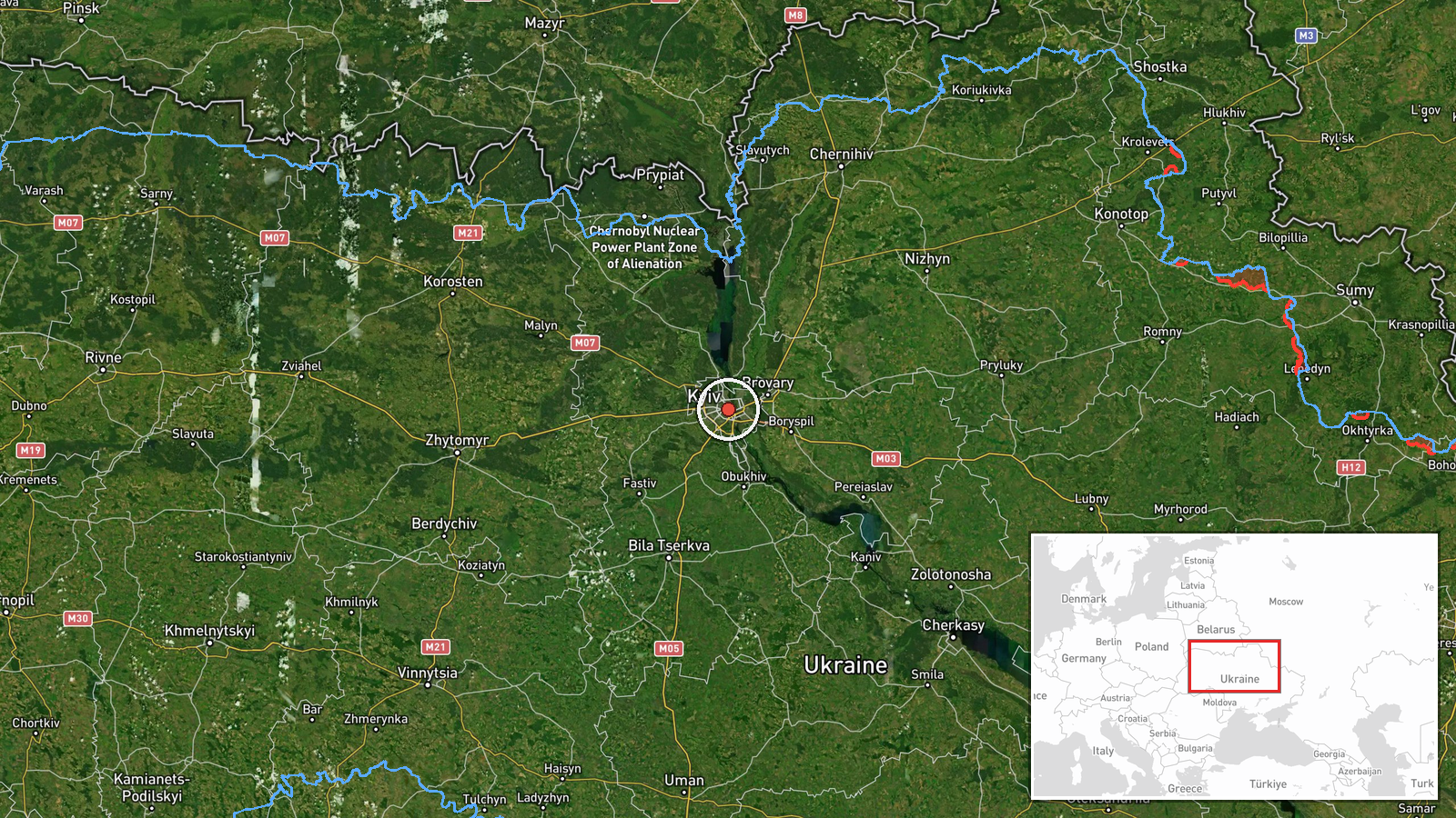
The location is recorded at settlement level for Kyiv, Ukraine, at coordinates 50.45 N, 30.52 E, a city-centre point rather than a track position. Because the report places the drones south of the city, the pin likely overstates precision for the actual flight path. Kyiv sits on the Dnipro River, and nearby Boryspil airport lies to the east. Location confidence is rated high at settlement level.
Related events nearby
- Ukrainian air monitoring: 1 Russian jet-powered Shahed (Geran-3) drone passing Boryspil, heading toward Kyiv.2026-10-16 01:58 UTC · Drone Transit · Kyiv, Ukraine
- Ukrainian air monitoring: one Russian jet-powered Shahed (Geran-3) drone tracked over western Chernihiv Oblast2026-10-16 01:08 UTC · Drone Transit · Kyiv Oblast, Ukraine
- A Ukrainian official said only about 10 Patriot interceptors remained on October 7, now nearly exhausted; deli2026-10-15 23:49 UTC · Report · Kyiv, Ukraine
- Ukrainian advisors reportedly urge Zelenskyy to authorize drone strikes on Russia's air industry to disrupt ai2026-10-15 22:34 UTC · Statement · Kyiv, Ukraine
- Ukrainian air monitoring: 2+ Russian jet-powered Shahed (Geran-3) drones heading toward Kyiv.2026-10-15 18:10 UTC · Drone Transit · Kyiv, Ukraine
▶ View this event on the live map

Intel Mapper aggregates open-source reports from monitored Telegram and X channels, geolocates them, cross-checks duplicates across sources and assigns a confidence score. Entries are updated as new confirmations arrive. Read how we verify events.