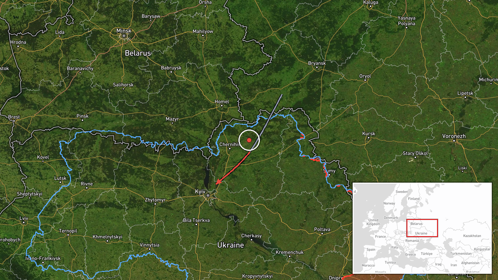
Single jet-powered Shahed drone tracked over western Chernihiv Oblast heading toward Kyiv Oblast
What happened
Ukrainian air monitoring reported on Telegram via the channel @kpszsu that one Russian jet-powered Shahed (Geran-3) drone was tracked over western Chernihiv Oblast, on a course toward Kyiv Oblast. The post was brief and described the object as a jet-type UAV ("Реактивний БпЛА") moving toward Kyiv region. The report was timestamped 16 October 2026 at 01:08 UTC and was attributed to Russia. It gives no impact, damage, or casualty information, and it does not state whether the drone was intercepted or lost track of. The location on the map is set to the Kyiv Oblast centroid, reflecting the direction of travel rather than a confirmed point of impact.
Context and assessment
This report belongs to a sequence of drone transit alerts over central Ukraine on 15 and 16 October 2026. Earlier that afternoon, monitoring logged single and multiple Geran-3 drones moving from Cherkasy Oblast toward Kyiv Oblast, followed by reports of two or more drones over Kyiv itself and later of several heading toward the capital region. The pattern suggests a sustained effort to route jet-powered Shaheds along corridors that cross Kyiv's approaches rather than a one-off launch. Jet-powered variants are generally faster and harder to intercept than the older piston-engine Shahed design, so repeated transits can strain air defence coverage and early warning. Operationally, the trajectory from western Chernihiv toward Kyiv Oblast may indicate a targeting interest in the capital and its surrounding infrastructure, though the available data does not confirm specific targets. Because the chain consists almost entirely of monitoring alerts, it documents movement rather than effects.
Sources and confidence
The report comes from a single Telegram channel, @kpszsu, which is the Ukrainian Air Force's official channel and carries the routine air-threat notices that other outlets relay. No second independent channel is recorded for this event, so cross-confirmation is absent. The confidence score of 8.0 reflects the official origin of the post and its consistency with the surrounding alerts from the same afternoon and evening. It is held below the maximum because the post reports only a track, not an impact, and because no independent observer confirmed the flight path. Confidence would rise with corroboration from regional military administrations, debris or impact reports, or wire coverage. It would fall if later official updates revised the drone's route or reported it as lost from tracking.
Location
The location was set at the Kyiv Oblast level, with a precision marked as region rather than settlement, because the alert names an oblast-level direction of travel and no specific village or facility. The origin is recorded as western Chernihiv Oblast, which is a broad northern area bordering Belarus. Kyiv Oblast surrounds the national capital and includes extensive farmland, river valleys such as those of the Dnipro and its tributaries, and dense suburban settlement. The point shown should be read as an approximate regional marker, not a precise track.
Related events nearby
- Ukrainian air monitoring: 2+ Russian jet-powered Shahed (Geran-3) drones over Kyiv.2026-10-16 02:16 UTC · Drone Transit · Kyiv, Ukraine
- Ukrainian air monitoring: 1 Russian jet-powered Shahed (Geran-3) drone passing Boryspil, heading toward Kyiv.2026-10-16 01:58 UTC · Drone Transit · Kyiv, Ukraine
- Ukrainian air monitoring: 2+ Russian jet-powered Shahed (Geran-3) drones heading toward Kyiv.2026-10-15 18:10 UTC · Drone Transit · Kyiv, Ukraine
- Ukrainian air monitoring: 2+ Russian jet-powered Shahed (Geran-3) drones from Cherkasy Oblast toward Kyiv Obla2026-10-15 17:32 UTC · Drone Transit · Kyiv Oblast, Ukraine
- Ukrainian air monitoring: 2+ Russian jet-powered Shahed (Geran-3) drones over Kyiv.2026-10-15 16:38 UTC · Drone Transit · Kyiv, Ukraine
▶ View this event on the live map

Intel Mapper aggregates open-source reports from monitored Telegram and X channels, geolocates them, cross-checks duplicates across sources and assigns a confidence score. Entries are updated as new confirmations arrive. Read how we verify events.