Single jet-powered Shahed drone reported moving through northern Vinnytsia toward Zhytomyr Oblast
What happened
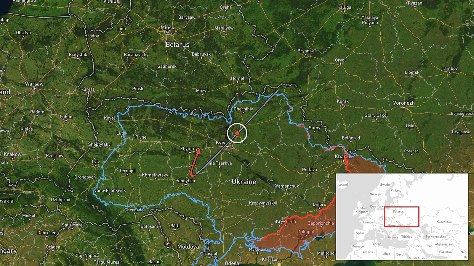
Ukrainian air monitoring, relayed through the Telegram channel @kpszsu, reported one Russian jet-powered Shahed, identified as a Geran-3, in northern Vinnytsia Oblast at about 03:56 UTC on 16 October 2026, on a course toward Zhytomyr Oblast. The original Ukrainian post, roughly 'reactive UAV in the north of Vinnytsia region, heading toward Zhytomyr region,' is a short monitoring notice. It names no impact, damage, casualties, or intended target. The event is logged as a drone transit rather than a confirmed strike. The location is recorded at regional level. The report is one of several Geran-3 transit alerts across Zhytomyr and neighboring oblasts over the preceding day.
Context and assessment
Zhytomyr Oblast sits on the main northwest corridor between Kyiv and the western regions, so drones crossing it can be heading for targets in several directions. The related events show a sustained pattern. On 15 October, monitoring logged a Geran-3 transiting northern Zhytomyr Oblast toward Rivne Oblast, then another over the oblast, then one heading toward Kozyatyn, which lies near the Vinnytsia boundary. Early on 16 October, two or more drones were reported heading toward Zhytomyr Oblast, and the present report describes a single drone moving along a similar axis. This repetition suggests a steady flow of single or small groups along a corridor rather than one isolated launch. Operationally, the cluster may indicate route-testing, reconnaissance by a launch wave, or pressure on air defense across a wide area. Those readings remain hedged, because transit reports alone do not show intent or the final target. The sequence of times in the feed also means the chronology should be read with some care.
Sources and confidence
The event rests on a single Telegram channel, @kpszsu, which is an official Ukrainian air-monitoring source with a generally strong record for drone tracking. No independent outlet, radar feed, or second channel is listed as confirming this specific track. The confidence score of 8.0 reflects that institutional origin and the consistency of the track with the surrounding reports, offset by the absence of cross-confirmation. Confidence would rise if a second monitoring channel or regional administration reported the same drone, or if a later update placed it precisely. It would fall if the track were revised, withdrawn, or contradicted by an air force update.
Location
The location is recorded at region level, centered on Zhytomyr Oblast, rather than at a specific settlement or facility, so the coordinates mark the oblast's approximate center. The origin point is given as northern Vinnytsia Oblast, a rural area of farmland, forest belts, and river valleys. Zhytomyr Oblast is largely flat to gently rolling terrain with extensive forest, including the Polissia region to the north, which offers low-altitude cover for drones.
Related events nearby
- Ukrainian air monitoring: 2+ Russian jet-powered Shahed (Geran-3) drones heading toward Zhytomyr Oblast.2026-10-16 02:56 UTC · Drone Transit · Zhytomyr Oblast, Ukraine
- Ukrainian air monitoring: 1 Russian jet-powered Shahed (Geran-3) drone over Zhytomyr Oblast.2026-10-15 17:51 UTC · Drone Transit · Zhytomyr Oblast, Ukraine
- Ukrainian air monitoring reports 1+ Russian jet-powered Shahed (Geran-3) drone(s) transiting northern Zhytomyr2026-10-15 12:10 UTC · Drone Transit · Zhytomyr Oblast, Ukraine
- Ukrainian air monitoring: 1 Russian Shahed-type drone from Zhytomyr Oblast toward Berdychiv.2026-10-16 04:02 UTC · Drone Transit · Berdychiv, Ukraine
- Ukrainian air monitoring: 1 Russian jet-powered Shahed (Geran-3) drone heading toward Kozyatyn.2026-10-15 18:12 UTC · Drone Transit · Kozyatyn, Ukraine
▶ View this event on the live map

Intel Mapper aggregates open-source reports from monitored Telegram and X channels, geolocates them, cross-checks duplicates across sources and assigns a confidence score. Entries are updated as new confirmations arrive. Read how we verify events.