Single jet-powered Shahed (Geran-3) drone reported moving toward Nemyriv, Vinnytsia Oblast
What happened
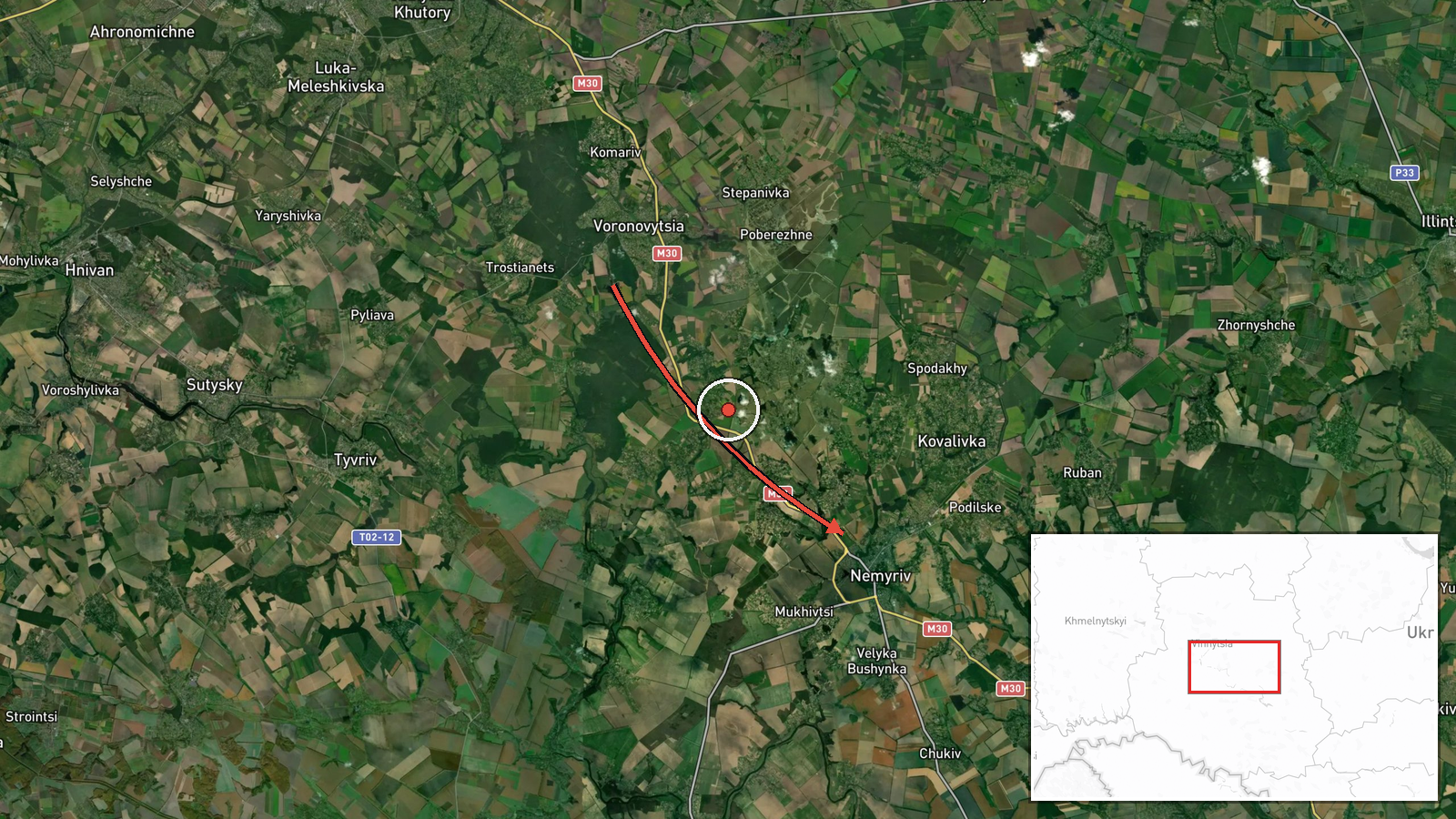
Ukrainian air monitoring reportedly flagged one Russian jet-powered Shahed-type drone, identified as a Geran-3, heading toward Nemyriv in Vinnytsia Oblast at about 05:23 UTC on 16 October 2026. The original Ukrainian-language post, published on the Telegram channel @kpszsu, describes a jet-powered UAV approaching Nemyriv from the east. The report does not state whether the drone struck anything, was intercepted, or caused damage, and no casualties or impacts are mentioned. The alert is a transit warning rather than a confirmed strike, and its wording reflects real-time monitoring of an airborne object rather than a post-impact assessment.
Context and assessment
Nemyriv is a small town in western Vinnytsia Oblast, a region that has repeatedly appeared on air-alert and drone-transit reporting as Shahed-type drones cross central Ukraine from the south and east. The related events on the same map show a clear pattern over roughly one day. Drones were reported moving from Vinnytsia Oblast toward Tulchyn on 15 October, then toward Lypovets and Bratslav on 16 October, with groups of two or more on several occasions. The Nemyriv report fits that sequence: it lies to the west along a similar corridor, and the direction of travel suggests the track of drones that were being followed across the oblast rather than a separate, isolated launch. Operationally, repeated single-drone and small-group reports along one axis may indicate either route-testing, decoy activity, or a sustained effort to saturate air defense across several districts at once. Such patterns are hedged inferences only; the data does not establish the intended target of any individual drone. The Geran-3 jet variant is generally considered faster and harder to intercept than propeller-driven Shaheds, which is why its appearance in monitoring reports is closely watched.
Sources and confidence
The report comes from a single channel, Telegram @kpszsu, which is the official account of the Ukrainian Air Force's monitoring and alert operations. No independent outlet in the dataset has yet reproduced or corroborated the Nemyriv warning. The confidence score of 8.0 reflects a credible official source with a clear, specific description of the drone type and direction, but it is held below the top of the scale because there is only one reporting source and no confirmation of impact or interception. Confidence would rise with a second independent confirmation, an official air-force statement on the outcome, or local reporting from Nemyriv. It would fall if the alert were revised or withdrawn, or if later reporting described the track as belonging to another area.
Location
The coordinates are placed at the settlement level for Nemyriv, a town in Vinnytsia Oblast in west-central Ukraine, with high location confidence because the source names the settlement directly. The placement is not a precise facility or street location, and the drone's actual endpoint is not known. The town lies on the Southern Bug River basin, in a mostly agricultural landscape of farmland and river valleys. Nearby features include the Southern Bug and the broader rolling terrain of the Podillia region, which shapes the low-altitude flight corridors that drones often follow.
Related events nearby
- Ukrainian air monitoring: 1 Russian jet-powered Shahed (Geran-3) drone from Vinnytsia Oblast toward Bratslav.2026-10-16 02:50 UTC · Drone Transit · Bratslav, Ukraine
- Ukrainian air monitoring: 2+ Russian jet-powered Shahed (Geran-3) drones from Vinnytsia Oblast toward Bratslav2026-10-16 01:46 UTC · Drone Transit · Bratslav, Ukraine
- Ukrainian air monitoring: 1 Russian Shahed-type drone heading toward Lypovets.2026-10-16 01:43 UTC · Drone Transit · Lypovets, Ukraine
- Ukrainian air monitoring: 2+ Russian jet-powered Shahed (Geran-3) drones from Vinnytsia Oblast toward Lypovets2026-10-16 01:27 UTC · Drone Transit · Lypovets, Ukraine
- Ukrainian air monitoring: 1 Russian jet-powered Shahed (Geran-3) drone from Vinnytsia Oblast toward Tulchyn.2026-10-15 09:29 UTC · Drone Transit · Tulchyn, Ukraine
▶ View this event on the live map

Intel Mapper aggregates open-source reports from monitored Telegram and X channels, geolocates them, cross-checks duplicates across sources and assigns a confidence score. Entries are updated as new confirmations arrive. Read how we verify events.