Ukrainian air monitoring reports one Shahed-type drone heading toward Kharkiv from the north
What happened
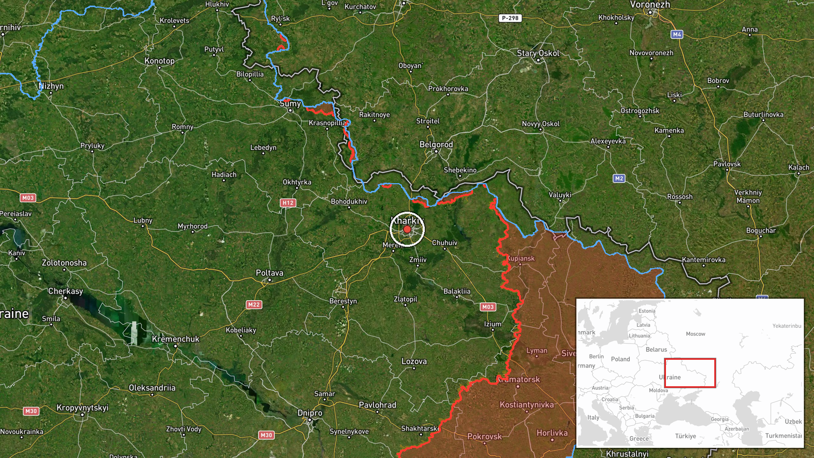
Ukrainian air monitoring, as relayed by the Telegram channel @kpszsu, reported one Russian Shahed-type drone heading toward Kharkiv on 16 October 2026 at 06:24 UTC. The original Ukrainian-language post, which reads roughly as a warning that a UAV is approaching Kharkiv from the north, does not specify altitude, impact, or damage. The report is a transit warning rather than a confirmed strike, so no casualties or hits are recorded here. The event is logged at the city of Kharkiv in northeastern Ukraine, and the source attributes the drone to Russia. Because the wording describes a drone in flight, the outcome remains unknown unless later reporting confirms interception or impact.
Context and assessment
Kharkiv has been a repeated focus of Russian strikes since the early phases of the full-scale war, given its size, its proximity to the Russian border, and its role as a regional logistics and command hub for the northeast. The related events in the record show a dense sequence over roughly 24 hours. On 15 October, a Shahed-type drone transit toward Kharkiv was logged at 16:17 UTC, and a Banderol mini cruise missile was reported moving from Kharkiv Oblast toward Lozova at 13:49. Separately, guided aerial bombs were reported striking northern Kharkiv Oblast, and Ukrainian units reportedly repelled 22 attacks in the South Slobozhansky direction on 16 October. A security case in Kharkiv, involving a detained Russian soldier suspected of killing five Ukrainian servicemen, is also in the record. Taken together, the pattern suggests coordinated pressure across air, glide-bomb and ground axes. Drone transits of this kind may be used to probe air defense, stretch monitoring, or accompany other strikes, but the record alone cannot establish intent.
Sources and confidence
The report comes from a single Telegram channel, @kpszsu, and no independent second source is listed in the event data. The channel is tied to Ukrainian air monitoring, which gives it operational relevance, yet the post is brief and has not been verified by imagery or official follow-up. The confidence score of 8.0 reflects a credible monitoring source and high location certainty, offset by single-source status and the absence of outcome data. Confidence would rise with corroboration from additional monitoring channels, regional military administration statements, or interception reports, and would fall if later updates contradicted the heading or the target city.
Location
The location is recorded at settlement precision for Kharkiv, Ukraine, with coordinates of 49.99 latitude and 36.23 longitude, and the location confidence is rated high. The city lies in northeastern Ukraine, close to the Russian border, where the Kharkiv and Lopan rivers meet within the wider Siverskyi Donets basin. The report's reference to approach from the north is directional rather than a pinpoint, so the marker represents the city as a whole rather than any specific facility.
Related events nearby
- Ukrainian air monitoring: 1 Russian Shahed-type drone heading toward Kharkiv.2026-10-15 16:17 UTC · Drone Transit · Kharkiv, Ukraine
- Ukrainian security forces detained a Russian soldier suspected of killing five Ukrainian servicemen in Kharkiv2026-10-15 09:36 UTC · Security · Kharkiv, Kharkiv Oblast, Ukraine
- Ukrainian units repelled 22 Russian attacks near Starytsia, Izbytske, Chuhunivka, Buzove and Radkivka in the S2026-10-16 05:04 UTC · Combat · Starytsia, Kharkiv Oblast, Ukraine
- Ukrainian air monitoring: 2+ Russian jet-powered Shahed (Geran-3) drones passing eastern Kharkiv Oblast, headi2026-10-16 04:55 UTC · Drone Transit · eastern Kharkiv Oblast, Ukraine
- Ukrainian air monitoring: 1 Russian guided glide bomb (KAB) heading toward northern Kharkiv Oblast.2026-10-15 18:06 UTC · Airstrike · northern Kharkiv Oblast, Ukraine
▶ View this event on the live map

Intel Mapper aggregates open-source reports from monitored Telegram and X channels, geolocates them, cross-checks duplicates across sources and assigns a confidence score. Entries are updated as new confirmations arrive. Read how we verify events.