Ukraine reports one Russian guided glide bomb heading toward Zaporizhzhya Oblast
What happened
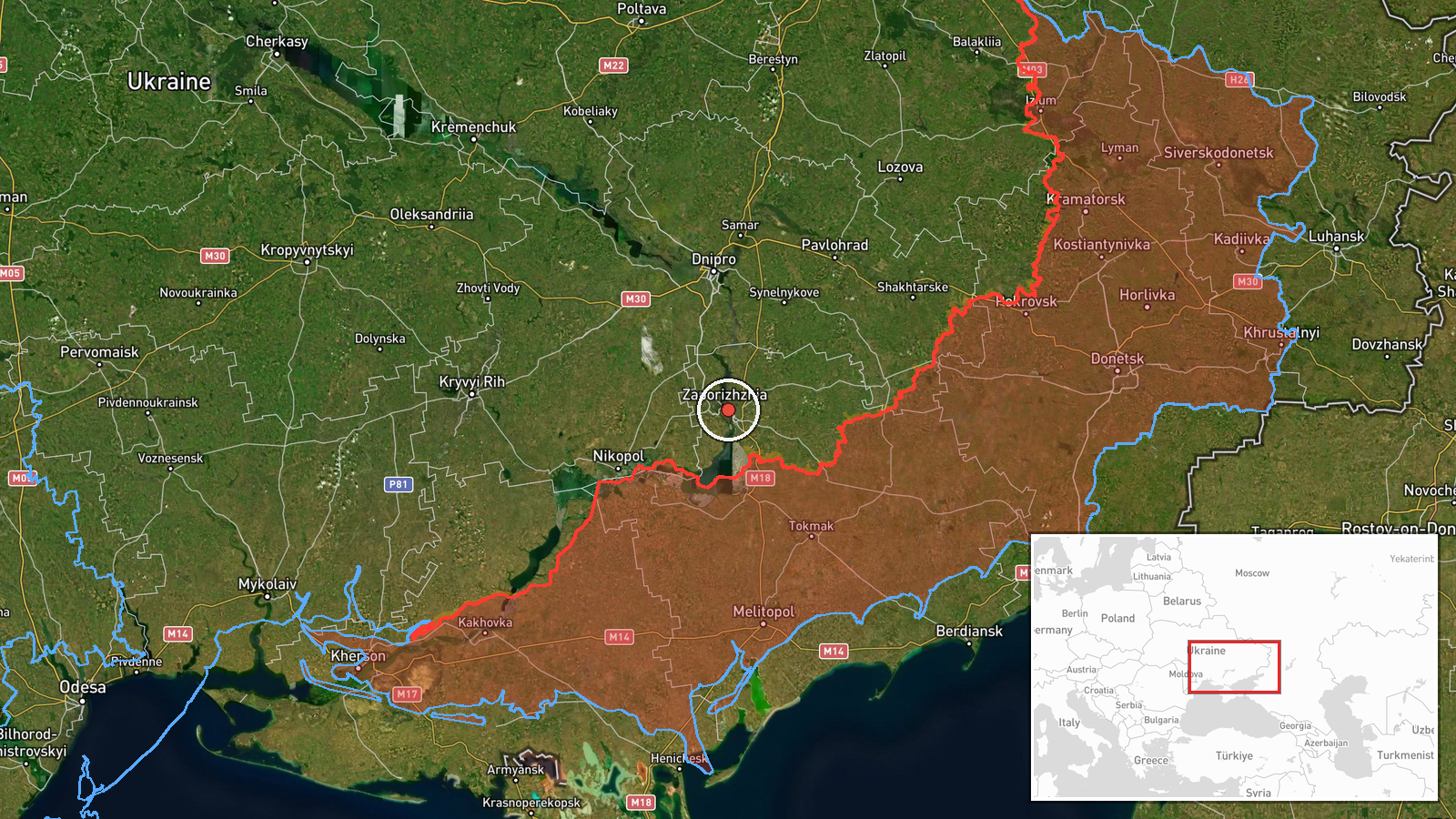
Ukrainian air monitoring, relayed through the Telegram channel @kpszsu, reported on 16 October 2026 at 08:34 UTC that one Russian guided aerial bomb, referred to by the Ukrainian abbreviation KAB, was heading toward Zaporizhzhya Oblast. The original Ukrainian wording is brief, reading roughly as 'KABs toward Zaporizhzhya Oblast,' and does not specify a target, impact point, or damage. The event is mapped to a settlement-level point in the oblast at approximately 47.84 N, 35.14 E. The report describes a warning of an incoming munition rather than a confirmed strike, and it states no casualties or damage.
Context and assessment
Glide bombs of this type are typically Soviet-era free-fall bombs fitted with wings and a guidance kit, released by aircraft at standoff distance from their targets. They are most often used against frontline positions, logistics nodes, and towns within reach of the front, which makes the oblast a recurring destination for them. The location sits within a broader pattern visible in the surrounding data. Earlier on 15 October, Ukrainian monitoring logged Shahed-type drone transits toward Zaporizhzhia at 17:24 and 18:08 UTC, and a jet-powered Geran-3 was reported from Dnipropetrovsk Oblast toward Synelnykove at 16:18 UTC. On 16 October another Geran-3 was logged toward Zaporizhzhia at 06:39 UTC. A General Staff report at 05:07 UTC described 20 Russian assaults on the Huliaipole direction and two toward Pavlivka on the Orikhiv axis. The sequence may indicate sustained pressure on the city, a coordinated effort combining drones and glide bombs, or reconnaissance ahead of further strikes. These links are inferred from timing and geography, and the data does not confirm a common plan or target.
Sources and confidence
The report comes from a single Telegram channel, @kpszsu, and no independent outlet in the provided data corroborates it. Its confidence score of 8.0 reflects the channel's official status and the routine nature of such air-monitoring alerts, but the single-source basis holds it below the level of a confirmed event. Confidence would rise with matching alerts from regional military administrations, impact reports, or wire agency coverage. It would fall if subsequent updates retracted the alert or if no detonation or impact were reported in the area.
Location
The location is classified at settlement precision with high location confidence. The coordinates, approximately 47.84 N and 35.14 E, appear consistent with the city of Zaporizhzhia itself, so the point likely reflects the city centre rather than a specific facility. Zaporizhzhia Oblast lies in southeastern Ukraine, on mostly flat steppe. Major features nearby include the Dnipro River and the Kakhovka reservoir to the southwest, and the oblast's frontline districts lie to the south and east.
Related events nearby
- Ukrainian air monitoring: 1 Russian jet-powered Shahed (Geran-3) drone heading toward Zaporizhzhia.2026-10-16 06:39 UTC · Drone Transit · Zaporizhzhia, Ukraine
- Ukrainian air monitoring: 1 Russian Shahed-type drone heading toward Zaporizhzhia.2026-10-15 18:08 UTC · Drone Transit · Zaporizhzhia, Ukraine
- Ukrainian air monitoring: 1 Russian jet-powered Shahed (Geran-3) drone heading toward Zaporizhzhia.2026-10-15 17:24 UTC · Drone Transit · Zaporizhzhia, Ukraine
- Ukrainian air monitoring: 1 Russian jet-powered Shahed (Geran-3) drone from Dnipropetrovsk Oblast toward Synel2026-10-15 16:18 UTC · Drone Transit · Synelnykove, Ukraine
- Ukrainian General Staff reports 20 Russian assaults on Huliaipole direction toward Rizdvianka, Dolynka, Hirkyi2026-10-16 05:07 UTC · Combat · Rizdvianka, Zaporizhzhia Oblast, Ukraine
▶ View this event on the live map

Intel Mapper aggregates open-source reports from monitored Telegram and X channels, geolocates them, cross-checks duplicates across sources and assigns a confidence score. Entries are updated as new confirmations arrive. Read how we verify events.