Russian Geran-3 drone reported transiting toward Synelnykove in Dnipropetrovsk Oblast
What happened
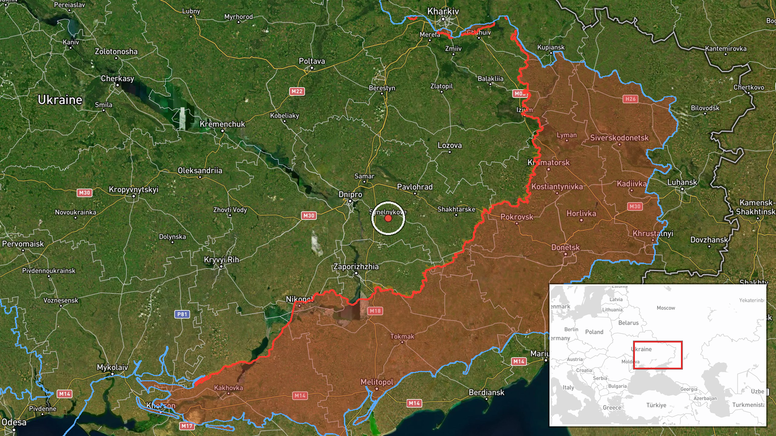
Ukrainian air monitoring on 15 October at 16:18 UTC reported detection of a single Russian jet-powered Shahed-type drone, designated Geran-3, in flight from Dnipropetrovsk Oblast with a course toward Synelnykove. The report was logged by the Kyiv Post Special Operations (@kpszsu) Telegram channel. The drone's trajectory and intended target or impact point were not specified in the available monitoring data.
Context and assessment
Synelnykove is a major industrial and transport hub in southeastern Dnipropetrovsk Oblast, lying roughly 130 kilometres south of the regional capital Dnipro. The settlement hosts rail and highway infrastructure of strategic importance to Ukrainian logistics. This sighting forms part of a sustained pattern of Russian long-range unmanned and guided weapon employment across the oblast on 15 October, including at least four other aerial operations: two Shahed transits, one glide bomb strike toward Slavhorod, and one cruise missile targeting Dnipro. The repeated focus on Dnipropetrovsk Oblast suggests a coordinated air campaign, possibly targeting industrial capacity, transport nodes, or military installations in the region.
Sources and confidence
Report sourced from Telegram channel @kpszsu (Kyiv Post Special Operations), a Ukrainian military monitoring account. Single-source reporting limits independent verification; confidence score of 8.0 reflects typical reliability of Ukrainian official air monitoring channels but absence of cross-confirmation from other tracking networks. Confidence would increase with corroboration from independent air defence channels or post-strike reporting.
Location
Synelnykove is a settled area in southeastern Dnipropetrovsk Oblast at approximately 48.32°N, 35.53°E. The town sits in the steppe landscape of the Luhansk–Dnipropetrovsk border region, serving as a regional rail and road junction. Notable nearby features include industrial facilities and the north–south transport corridor linking central Ukraine to the Sea of Azov.
Related events nearby
- Ukrainian air monitoring: 1 Russian Shahed-type drone from Dnipropetrovsk Oblast toward Synelnykove.2026-10-15 02:54 UTC · Drone Transit · Synelnykove, Ukraine
- Ukrainian air monitoring: 1 Russian guided glide bomb (KAB) from Dnipropetrovsk Oblast toward Slavhorod.2026-10-15 01:57 UTC · Airstrike · Slavhorod, Ukraine
- Ukrainian air monitoring: 1 Russian jet-powered Shahed (Geran-3) drone passing Pavlohrad, heading north.2026-10-15 15:45 UTC · Drone Transit · Pavlohrad, Ukraine
- Ukrainian air monitoring: 1 Russian Banderol mini cruise missile heading toward Dnipro.2026-10-15 10:41 UTC · Cruise Missile · Dnipro, Ukraine
- Ukrainian air monitoring: 1 Russian Shahed-type drone passing Dnipropetrovsk Oblast, heading northwest.2026-10-15 06:12 UTC · Drone Transit · Dnipropetrovsk Oblast, Ukraine
▶ View this event on the live map

Intel Mapper aggregates open-source reports from monitored Telegram and X channels, geolocates them, cross-checks duplicates across sources and assigns a confidence score. Entries are updated as new confirmations arrive. Read how we verify events.