Russian Shahed drone tracked toward Synelnykove in Dnipropetrovsk Oblast
What happened
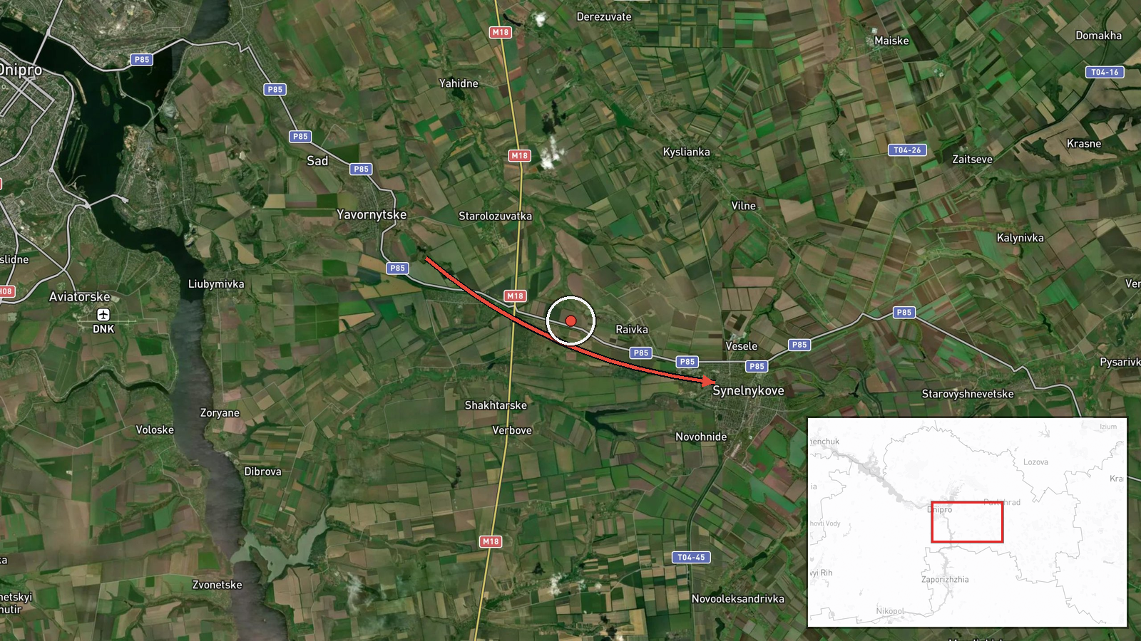
Ukrainian air monitoring services reported detecting one Russian Shahed-type unmanned aerial vehicle transiting toward Synelnykove in Dnipropetrovsk Oblast on the morning of October 15. The report, issued at 02:54 UTC, indicated the drone was approaching from the southeast. No strike confirmation or casualties were reported in the available data.
Context and assessment
Synelnykove is a settlement of roughly 50,000 residents in central Dnipropetrovsk Oblast, located south of the regional capital Dnipro. The detection follows a concentrated wave of Russian strikes across the region in the preceding minutes—multiple guided glide bombs (KAB) were reported heading toward Dnipro, Slavhorod, and surrounding areas between 01:52 and 01:59 UTC. This pattern suggests either a coordinated multi-vector strike operation or rapid sequential targeting across the oblast. Shahed drones, Iranian-designed loitering munitions, are typically employed for area targets, infrastructure, or saturation attacks when combined with other systems.
Sources and confidence
The report originates from a single Ukrainian official source (@kpszsu, the State Special Communications Service). With one reporting channel and no cross-confirmation from independent sources or Russian statements, confidence remains moderate at 8.0/10. Confirmation would require Ukrainian civil-military reports of impact or emergency service responses; lower confidence would follow if follow-up sources contradicted the detection.
Location
Synelnykove is located at 48.32°N, 35.53°E in south-central Dnipropetrovsk Oblast, roughly 45 kilometers south-southeast of Dnipro. The settlement sits on the Oril River valley in relatively open terrain. Precision is rated high at settlement level based on official air monitoring designation.
Related events nearby
- Ukrainian air monitoring: 1 Russian guided glide bomb (KAB) from Dnipropetrovsk Oblast toward Slavhorod.2026-10-15 01:57 UTC · Airstrike · Slavhorod, Ukraine
- Ukrainian air monitoring: 1 Russian guided glide bomb (KAB) heading toward Dnipropetrovsk Oblast.2026-10-15 01:59 UTC · Airstrike · Dnipropetrovsk Oblast, Ukraine
- Ukrainian air monitoring: 1 Russian guided glide bomb (KAB) heading toward Dnipro.2026-10-15 01:57 UTC · Airstrike · Dnipro, Ukraine
- Ukrainian air monitoring: 1 Russian guided glide bomb (KAB) heading toward Zaporizhzhya Oblast.2026-10-15 01:55 UTC · Airstrike · Zaporizhzhya Oblast, Ukraine
- Ukrainian air monitoring: 1 Russian guided glide bomb (KAB) heading toward Zaporizhzhya Oblast.2026-10-15 01:52 UTC · Airstrike · Zaporizhzhya Oblast, Ukraine
▶ View this event on the live map

Intel Mapper aggregates open-source reports from monitored Telegram and X channels, geolocates them, cross-checks duplicates across sources and assigns a confidence score. Entries are updated as new confirmations arrive. Read how we verify events.