Russian guided glide bomb reported heading toward Zaporizhzhya Oblast
What happened
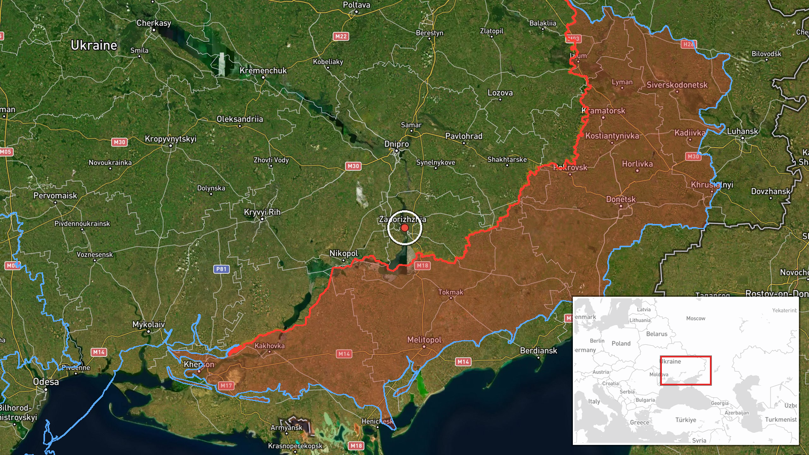
Ukrainian air monitoring detected one Russian guided glide bomb (KAB) heading toward Zaporizhzhya Oblast on October 15 at 01:55 UTC, according to the Telegram channel of Ukraine's Air Force command. The report was posted in real time as the weapon was in transit. No immediate impact assessment was provided in the alert.
Context and assessment
Zaporizhzhya Oblast has remained under sustained Russian air and missile pressure throughout 2026. The detection on October 15 occurred as part of a broader salvo; related reports from the same timeframe indicate simultaneous Russian guided bomb strikes directed at Dnipropetrovsk Oblast, Dnipro city, and Slavhorod. Guided glide bombs, or KABs, are gravity-released munitions equipped with guidance fins, typically deployed from stand-off range by Russian fighter jets. The geographic spread of reported targets across multiple oblasts suggests a coordinated multi-axis airstrike campaign. Prior activity in the oblast, including a Shahed drone detection on October 14, indicates sustained Russian air operations in the region.
Sources and confidence
Reported by Telegram channel @kpszsu (Ukrainian Air Force command). Single source with high location confidence based on active air monitoring infrastructure. Confidence score of 8.0 reflects real-time detection capability and institutional reliability of the source, though lack of cross-confirmation and absence of impact assessment prevent higher certainty. Confirmation from secondary Ukrainian sources or Russian claims would raise confidence; failure to produce impact evidence would lower it.
Location
Zaporizhzhya Oblast, southeastern Ukraine, located at approximate coordinates 47.84°N, 35.14°E. The settlement-level precision indicates a specific populated area rather than an oblast-wide alert. The oblast borders the Dnipro River to the west and lies in the region between Russian-held Crimea and the industrial Donbas heartland.
Related events nearby
- Ukrainian air monitoring: 1 Russian guided glide bomb (KAB) heading toward Zaporizhzhya Oblast.2026-10-15 01:52 UTC · Airstrike · Zaporizhzhya Oblast, Ukraine
- Ukrainian air monitoring: 1 Russian guided glide bomb (KAB) from Dnipropetrovsk Oblast toward Slavhorod.2026-10-15 01:57 UTC · Airstrike · Slavhorod, Ukraine
- Ukrainian air monitoring: 1 Russian Shahed-type drone from Dnipropetrovsk Oblast toward Synelnykove.2026-10-15 02:54 UTC · Drone Transit · Synelnykove, Ukraine
- Ukrainian air monitoring: 1 Russian Shahed-type drone passing Nikopol district, heading north.2026-10-15 02:43 UTC · Drone Transit · Nikopol district, Ukraine
- Ukrainian air monitoring: 1 Russian guided glide bomb (KAB) heading toward Dnipropetrovsk Oblast.2026-10-15 01:59 UTC · Airstrike · Dnipropetrovsk Oblast, Ukraine
▶ View this event on the live map

Intel Mapper aggregates open-source reports from monitored Telegram and X channels, geolocates them, cross-checks duplicates across sources and assigns a confidence score. Entries are updated as new confirmations arrive. Read how we verify events.