Russian guided glide bomb reported heading toward Dnipropetrovsk Oblast
What happened
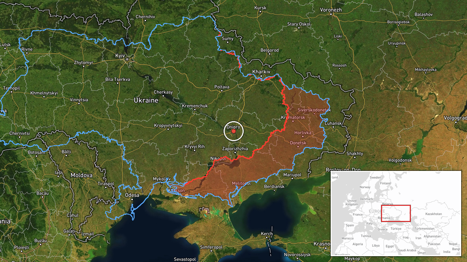
Ukrainian air monitoring detected one Russian guided glide bomb (KAB) heading toward Dnipropetrovsk Oblast on 15 October at approximately 02:00 UTC, according to a Telegram alert from the official Ukrainian air force channel (@kpszsu). The report provided no additional details on intended target, impact assessment, or casualties. This detection occurred amid a broader Russian air operation targeting multiple locations across central and eastern Ukraine within the same two-minute window.
Context and assessment
Dnipropetrovsk Oblast remains a consistent target for Russian glide bomb attacks, particularly its industrial and logistics infrastructure. The oblast hosts significant military-related manufacturing and is a key transit zone for Ukrainian supplies moving eastward. On 15 October alone, Ukrainian air monitoring detected multiple KAB strikes directed at Dnipro city, Zaporizhzhya Oblast, and the Slavhorod area, suggesting a coordinated multi-vector airstrike campaign. Glide bombs, guided remotely or semi-autonomously, allow Russian aircraft to strike from stand-off range and represent a persistent asymmetric pressure tactic against Ukrainian rear areas.
Sources and confidence
Single source: Telegram channel @kpszsu (Ukrainian air force official channel). No cross-confirmation from independent observers or Ukrainian regional officials reported. Confidence score of 8.0 reflects the source's official status but the lack of corroboration and regional-level rather than specific-target precision. Confirmation by regional administration or damage reports would raise confidence; absence of follow-up official acknowledgment would lower it.
Location
Alert issued for Dnipropetrovsk Oblast with region-level precision (low confidence). Dnipropetrovsk Oblast lies in south-central Ukraine; the approximate coordinates (48.46°N, 35.05°E) place the alert near the oblast's eastern industrial zone. The oblast contains the city of Dnipro and numerous manufacturing facilities along the Dnieper River.
Related events nearby
- Ukrainian air monitoring: 1 Russian guided glide bomb (KAB) heading toward Dnipro.2026-10-15 01:57 UTC · Airstrike · Dnipro, Ukraine
- Ukrainian air monitoring: 1 Russian Shahed-type drone from Dnipropetrovsk Oblast toward Synelnykove.2026-10-15 02:54 UTC · Drone Transit · Synelnykove, Ukraine
- Ukrainian air monitoring: 1 Russian guided glide bomb (KAB) from Dnipropetrovsk Oblast toward Slavhorod.2026-10-15 01:57 UTC · Airstrike · Slavhorod, Ukraine
- Ukrainian air monitoring: 1 Russian guided glide bomb (KAB) heading toward Zaporizhzhya Oblast.2026-10-15 01:55 UTC · Airstrike · Zaporizhzhya Oblast, Ukraine
- Ukrainian air monitoring: 1 Russian guided glide bomb (KAB) heading toward Zaporizhzhya Oblast.2026-10-15 01:52 UTC · Airstrike · Zaporizhzhya Oblast, Ukraine
▶ View this event on the live map

Intel Mapper aggregates open-source reports from monitored Telegram and X channels, geolocates them, cross-checks duplicates across sources and assigns a confidence score. Entries are updated as new confirmations arrive. Read how we verify events.