Russian Shahed drone tracked crossing Dnipropetrovsk Oblast heading northwest
What happened
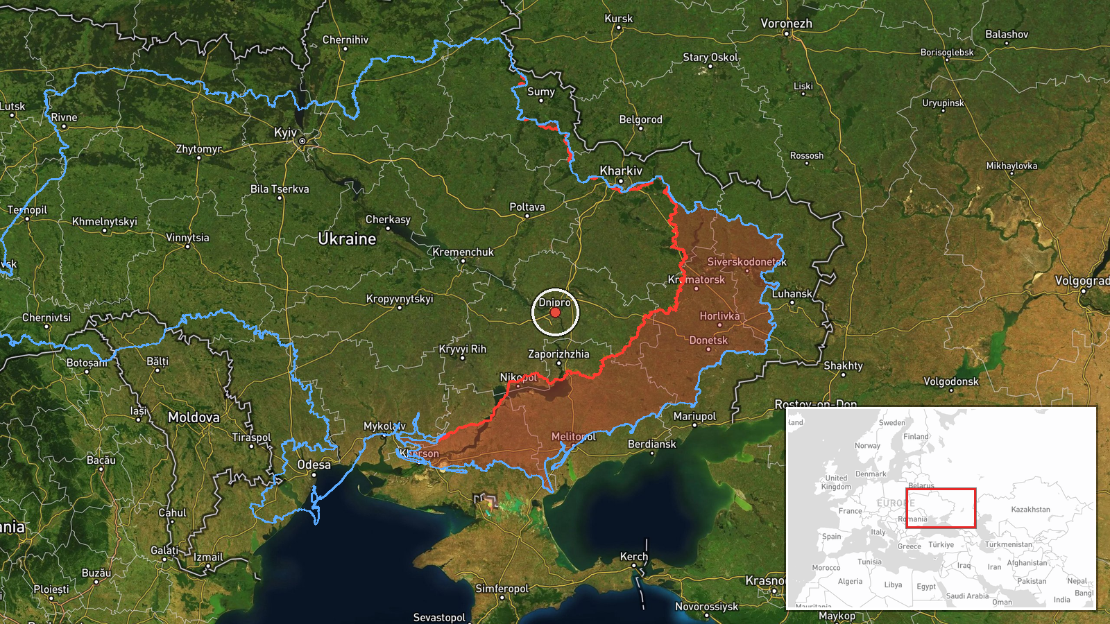
Ukrainian air monitoring detected one Russian Shahed-type unmanned aerial vehicle passing near Hubynykha in Dnipropetrovsk Oblast on the morning of 15 October, traveling in a northwesterly direction. The observation was reported by the Telegram channel of the Ukrainian Air Force command (@kpszsu) at 06:12 UTC. No immediate outcome or interception was specified in the report.
Context and assessment
The detection occurred as part of a broader Russian air operation across central and eastern Ukraine. Earlier the same morning, Ukrainian monitoring had tracked multiple Russian guided glide bombs (KAB) directed at targets including Dnipro, Slavhorod, and Zaporizhzhya Oblast, as well as another Shahed drone operating near Synelnykove. Dnipropetrovsk Oblast, home to the industrial city of Dnipro and significant military-adjacent infrastructure, remains a frequent target for Russian airstrikes. The pattern suggests a coordinated multi-platform attack sequence, with drones potentially serving reconnaissance or secondary strike roles alongside precision-guided munitions.
Sources and confidence
Reported solely by the Telegram channel @kpszsu (Ukrainian Air Force command), a primary Ukrainian official source for real-time air monitoring. Single-source reporting lowers confidence to 8.0 out of 10. Cross-confirmation from independent observers or secondary Ukrainian air defense channels would strengthen assessment. Confidence would rise with reports of interception or secondary impacts; it would fall if contradicted by alternative Ukrainian sources.
Location
The drone was detected near Hubynykha (also Hubinykha), a settlement in Dnipropetrovsk Oblast in central Ukraine. The coordinates (48.46°N, 35.05°E) place it within the oblast's boundaries. Precision is limited to regional level; exact flight path coordinates depend on Ukrainian radar coverage and reporting specificity. The northwesterly heading suggests potential transit toward Kyiv Oblast or beyond.
Related events nearby
- Ukrainian air monitoring: 1 Russian guided glide bomb (KAB) heading toward Dnipropetrovsk Oblast.2026-10-15 01:59 UTC · Airstrike · Dnipropetrovsk Oblast, Ukraine
- Ukrainian air monitoring: 1 Russian guided glide bomb (KAB) heading toward Dnipro.2026-10-15 01:57 UTC · Airstrike · Dnipro, Ukraine
- Ukrainian air monitoring: 1 Russian Shahed-type drone from Dnipropetrovsk Oblast toward Synelnykove.2026-10-15 02:54 UTC · Drone Transit · Synelnykove, Ukraine
- Ukrainian air monitoring: 1 Russian guided glide bomb (KAB) from Dnipropetrovsk Oblast toward Slavhorod.2026-10-15 01:57 UTC · Airstrike · Slavhorod, Ukraine
- Ukrainian air monitoring: 1 Russian guided glide bomb (KAB) heading toward Zaporizhzhya Oblast.2026-10-15 01:55 UTC · Airstrike · Zaporizhzhya Oblast, Ukraine
▶ View this event on the live map

Intel Mapper aggregates open-source reports from monitored Telegram and X channels, geolocates them, cross-checks duplicates across sources and assigns a confidence score. Entries are updated as new confirmations arrive. Read how we verify events.