Shahed-type drones reported transiting Vinnytsia Oblast westward and toward Zhytomyr Oblast
What happened
Ukrainian air monitoring, as relayed by the Telegram channel @kpszsu, reported on 16 October 2026 at 14:40 UTC that Russian Shahed-type drones were moving through Vinnytsia Oblast. The original Ukrainian-language post described strike drones in the area of Kopaygorod heading west, and a second group near Hlukhivtsi and west of Koziatyn heading toward Zhytomyr Oblast. The summary counts one drone on each track. The post does not specify the drone variant. The phrase 'ударні БпЛА' denotes unmanned aerial vehicles of a strike type, not a confirmed impact. No strike, damage, or casualties are described. The event is recorded as a drone transit, meaning a sighting of airborne objects in motion rather than a reported hit on a target.
Context and assessment
Related entries from the same day show a repeated pattern. Reports at 09:18, 10:18, 12:28, 14:31 and 14:32 UTC place drones over or heading toward Vinnytsia Oblast, two of them originating in Odesa Oblast. Several of these are described as jet-powered Geran-3 variants, and the 14:32 report mentions two or more drones passing west. Taken together, the sequence suggests a sustained series of inbound flights crossing central-west Ukraine over several hours rather than one isolated event. Operationally, a southern-origin track bending toward western and northern oblasts may indicate that drones are being routed deeper into western Ukraine, possibly toward infrastructure or areas with thinner air defense coverage. Transit reports alone, however, do not establish intended targets. Vinnytsia Oblast lies along a plausible corridor between southern Ukraine and the north-west, so repeated crossings are consistent with long-range routing. The provided data does not state whether any of these drones were intercepted or reached a target. The related reports rely on similar monitoring feeds, so the overall picture rests on a limited set of sources.
Sources and confidence
The report comes from a single channel, Telegram @kpszsu, which carries Ukrainian air monitoring updates. No independent outlet in the provided data confirms it, so cross-confirmation is absent. The confidence score of 8.0 reflects a specific, direct wording from a channel that publishes air monitoring, offset by single-sourcing and an unspecified drone variant. Confidence would rise if independent air force or regional administration statements, or wire reports, named the same tracks and times, or if later reports described impacts or interceptions. It would fall if subsequent updates corrected the headings, or if the objects were later identified as something other than the drones described.
Location
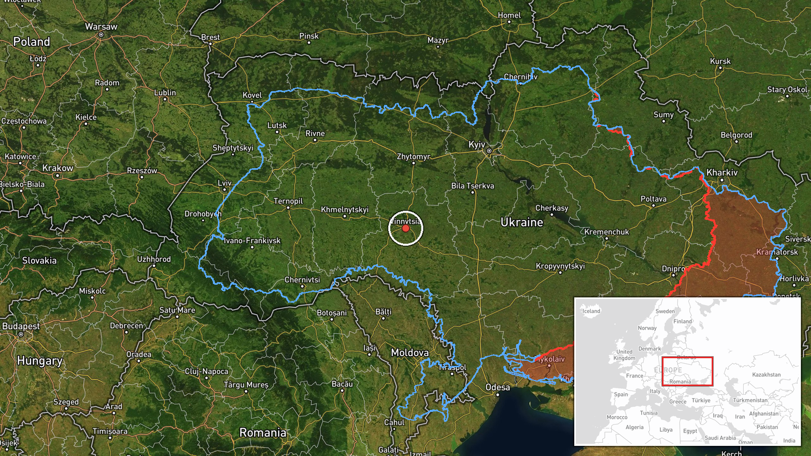
The location is approximate. The post names Kopaygorod, Hlukhivtsi and an area west of Koziatyn, but geo precision is recorded at region level and location confidence as low. The coordinates 49.23, 28.47 therefore represent the oblast rather than a specific point. Vinnytsia Oblast lies in west-central Ukraine, bordering Zhytomyr Oblast to the north, and the Southern Bug River flows through the region. The terrain is largely agricultural plains, with settlements dispersed across the countryside.
Related events nearby
- Ukrainian air monitoring: 2+ Russian jet-powered Shahed (Geran-3) drones passing Vinnytsia Oblast, heading wes2026-10-16 14:32 UTC · Drone Transit · Vinnytsia Oblast, Ukraine
- Ukrainian air monitoring: 1 Russian jet-powered Shahed (Geran-3) drone over Vinnytsia.2026-10-16 14:31 UTC · Drone Transit · Vinnytsia, Ukraine
- Ukrainian air monitoring: 1 Russian jet-powered Shahed (Geran-3) drone from Odesa Oblast toward Vinnytsia Obla2026-10-16 12:28 UTC · Drone Transit · Vinnytsia Oblast, Ukraine
- Ukrainian air monitoring: 1 Russian jet-powered Shahed (Geran-3) drone from Odesa Oblast toward Vinnytsia Obla2026-10-16 10:18 UTC · Drone Transit · Vinnytsia Oblast, Ukraine
- Ukrainian air monitoring: 1 Russian jet-powered Shahed (Geran-3) drone heading toward Vinnytsia.2026-10-16 09:18 UTC · Drone Transit · Vinnytsia, Ukraine
▶ View this event on the live map

Intel Mapper aggregates open-source reports from monitored Telegram and X channels, geolocates them, cross-checks duplicates across sources and assigns a confidence score. Entries are updated as new confirmations arrive. Read how we verify events.