Ukrainian air monitoring reports one jet-powered Shahed drone moving toward Volyn Oblast
What happened
Ukrainian air monitoring reported on Telegram that one jet-powered Shahed-type drone, identified in the post as a Geran-3, was moving through northern Rivne Oblast on a course toward Volyn Oblast. The alert was posted at 19:09 UTC on 16 October 2026 and is classified as a drone transit rather than a strike. The report does not describe impacts, damage, or casualties. The original Ukrainian wording, a short alert marked with a jet icon, refers to a 'jet-powered UAV' moving 'through the north of Rivne region on course for Volyn.' The sole source is the Telegram channel @kpszsu, which is widely understood to carry Ukrainian air force monitoring messages. Russia is listed as the actor based on the Geran designation and the broader pattern of long-range drone activity.
Context and assessment
Volyn and neighboring Lutsk have appeared repeatedly in recent air monitoring alerts on this date. Reports at 01:57 and 02:26 UTC referred to single drones heading toward Lutsk, a 12:15 UTC report described a drone from Rivne Oblast toward the city, and a 12:33 UTC alert noted two or more drones on the same Rivne-to-Volyn axis. A 14:32 UTC report then described a single drone from northern Rivne toward Volyn, and this 19:09 UTC alert continues that sequence. The repeated northern Rivne origin suggests a consistent corridor rather than isolated launches. Operationally, transit reports of this kind usually indicate that drones are crossing western Ukraine, which may mean routing toward targets farther west, toward Volyn itself, or simply passing through during longer flight paths. Transit reports do not confirm a target. The Geran-3 jet variant is faster than earlier piston-engined Shahed models, which would shorten the warning window for communities along the route. The pattern is consistent with sustained, distributed launches designed to keep air defenses and alert systems active across the region for much of the day.
Sources and confidence
Only one source is listed: the Telegram channel @kpszsu. No independent confirmation from another Ukrainian official channel, regional military administration, or news agency was available when this page was prepared, so cross-confirmation is absent. The confidence score of 8.0 reflects the channel's established role in issuing air alerts and the specificity of the message, which states the drone type, count, origin direction, and destination region. It is held below the top range because the report is single-sourced and describes an observation in progress rather than a verified outcome. Confidence would rise with corroboration from another monitoring channel or regional authorities, or with confirmed sightings or impacts. It would fall if the alert were corrected, withdrawn, or contradicted by later official statements. The corrected flag is currently false.
Location
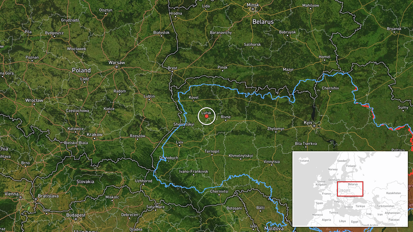
The location is recorded at region level: Volyn Oblast, with coordinates 50.75, 25.33 serving as an approximate regional reference point rather than a confirmed position of the drone. Location confidence is rated low. Volyn lies in northwestern Ukraine, bordering Poland to the west and Belarus to the north. Rivne Oblast lies immediately to the east, and the northern parts of both oblasts fall within the Polissia lowlands, an area of forests, wetlands, and rivers. Lutsk, the regional center, is the most notable urban reference point in the area.
Related events nearby
- Ukrainian air monitoring: 1 Russian jet-powered Shahed (Geran-3) drone from northern Rivne Oblast toward Volyn2026-10-16 14:32 UTC · Drone Transit · Volyn Oblast, Ukraine
- Ukrainian air monitoring: 2+ Russian jet-powered Shahed (Geran-3) drones from Rivne Oblast toward Volyn Oblast2026-10-16 12:33 UTC · Drone Transit · Volyn Oblast, Ukraine
- Ukrainian air monitoring: 1 Russian jet-powered Shahed (Geran-3) drone from Rivne Oblast toward Lutsk.2026-10-16 12:15 UTC · Drone Transit · Lutsk, Ukraine
- Ukrainian air monitoring: 1 Russian jet-powered Shahed (Geran-3) drone heading toward Lutsk.2026-10-16 02:26 UTC · Drone Transit · Lutsk, Ukraine
- Ukrainian air monitoring: 1 Russian jet-powered Shahed (Geran-3) drone heading toward Lutsk.2026-10-16 01:57 UTC · Drone Transit · Lutsk, Ukraine
▶ View this event on the live map

Intel Mapper aggregates open-source reports from monitored Telegram and X channels, geolocates them, cross-checks duplicates across sources and assigns a confidence score. Entries are updated as new confirmations arrive. Read how we verify events.