Single Shahed-type drone reported passing Kopaihorod, Vinnytsia, heading northwest
What happened
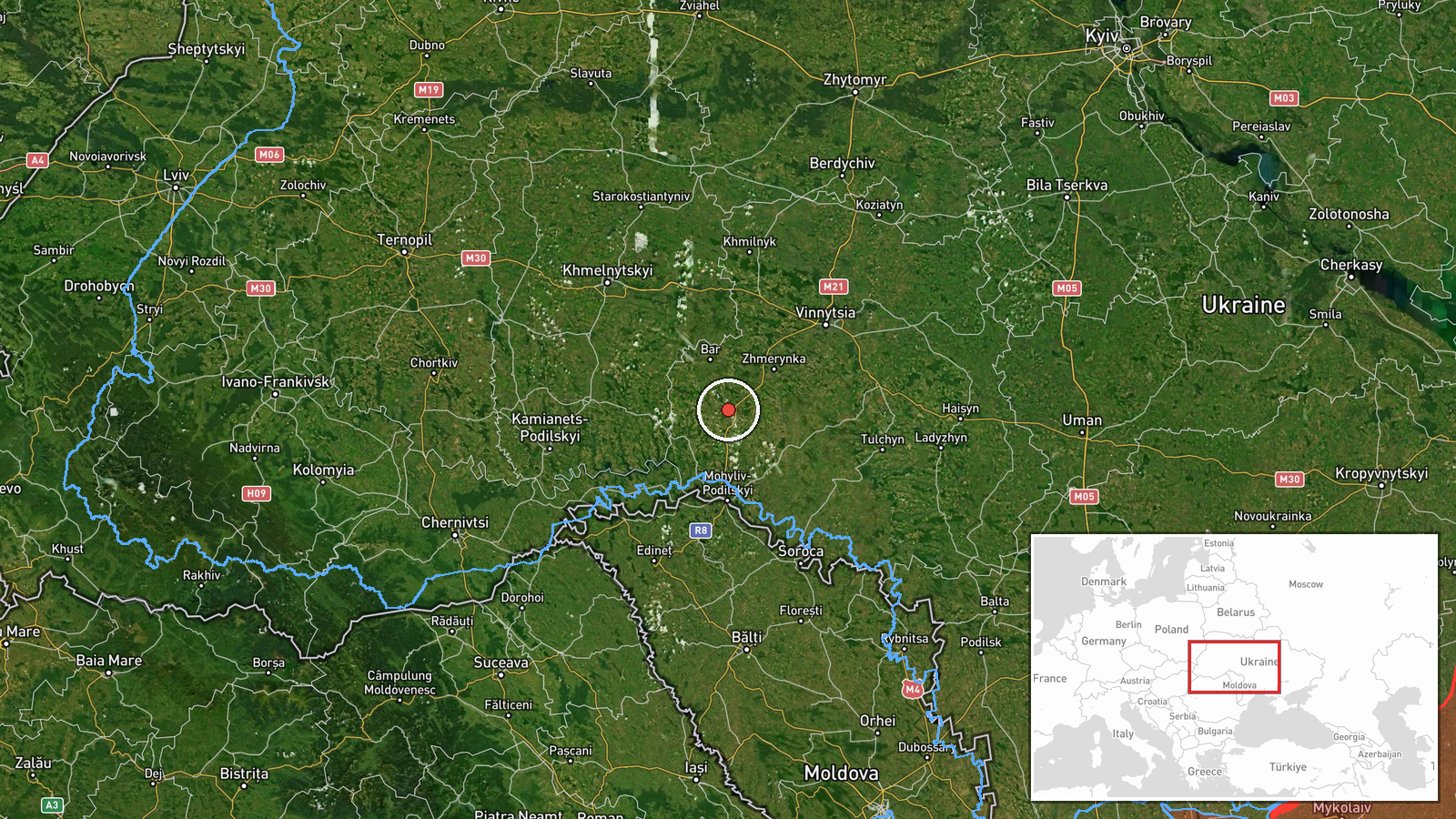
Ukrainian air monitoring channel @kpszsu reported on 17 October 2026 at 03:25 UTC that one Russian Shahed-type unmanned aerial vehicle was passing Kopaihorod, a settlement in Vinnytsia oblast, on a north-western heading. The original Ukrainian-language post uses the phrase повз Копайгород, which translates as passing by Kopaihorod, and describes the course as north-western. The report does not say the drone struck anything, entered the settlement, or was shot down, and it gives no information on altitude, payload, or whether the track changed afterward. The entry is classed as a Drone Transit, attributed to Russia as the operator of the aircraft type. It is a single-source, real-time air-alert style notice, so the details reflect what monitors observed at the time rather than any confirmed outcome.
Context and assessment
Vinnytsia oblast sits in central-western Ukraine and has repeatedly appeared in air alerts as drones move between the south and the west of the country. Its rail hub at Zhmerynka is a recurring reference point in the recent pattern. On 16 October 2026, the monitoring feed logged several reports of Shahed-type drones heading toward Zhmerynka at 10:34, 12:43, and 14:31 UTC, with the 14:31 entry describing two or more jet-powered Geran-3 aircraft, and a further single drone heading toward Zhmerynka at 17:28 UTC. Overnight, a single jet-powered Geran-3 was reported heading toward Derazhnya at 03:27 UTC on 17 October, roughly two minutes after the Kopaihorod report. Derazhnya lies in neighbouring Khmelnytskyi oblast. Taken together, the sequence suggests that drones travelling along corridors across this part of the country are being tracked as they move, rather than a discrete strike on one site. Operationally, transits of this kind are often used by monitoring networks to anticipate where a drone may arrive, though nothing in these entries confirms a final target. The Kopaihorod entry describes the drone as passing, not heading toward a named point, so it is best read as a waypoint in a route rather than an aim point.
Sources and confidence
Only one channel, the Telegram account @kpszsu, reported this item, so cross-confirmation is absent at this stage. The score of 8.0 reflects a credible official-style monitoring feed with a clear original post and a precise timestamp, but it is not higher because no second outlet, radar record, or official statement has been matched. Confidence would rise if independent monitors or regional military administrations confirmed the track, or if the Derazhnya entry were shown to be the same drone. It would fall if later corrections changed the heading or if the feed were found to have reposted unverified material. The event is not marked as corrected.
Location
Kopaihorod was placed at settlement precision with high location confidence, meaning the point marks the named village rather than a specific facility or a precise track position. The coordinates sit at about 48.85 north and 27.80 east within Vinnytsia oblast in the Podillia upland of western-central Ukraine. The area is largely agricultural, with rolling terrain, river valleys, and small villages. Zhmerynka and Derazhnya appear in related entries but are not the mapped point for this event.
Related events nearby
- Ukrainian air monitoring: 1 Russian Shahed-type drone heading toward Zhmerynka.2026-10-16 17:28 UTC · Drone Transit · Zhmerynka, Ukraine
- Ukrainian air monitoring: 2+ Russian jet-powered Shahed (Geran-3) drones heading toward Zhmerynka.2026-10-16 14:31 UTC · Drone Transit · Zhmerynka, Ukraine
- Ukrainian air monitoring: 2+ Russian jet-powered Shahed (Geran-3) drones heading toward Zhmerynka.2026-10-16 12:43 UTC · Drone Transit · Zhmerynka, Ukraine
- Ukrainian air monitoring: 2+ Russian jet-powered Shahed (Geran-3) drones heading toward Zhmerynka.2026-10-16 10:34 UTC · Drone Transit · Zhmerynka, Ukraine
- Ukrainian air monitoring: 1 Russian jet-powered Shahed (Geran-3) drone heading toward Derazhnya.2026-10-17 03:27 UTC · Drone Transit · Derazhnya, Ukraine
▶ View this event on the live map

Intel Mapper aggregates open-source reports from monitored Telegram and X channels, geolocates them, cross-checks duplicates across sources and assigns a confidence score. Entries are updated as new confirmations arrive. Read how we verify events.