Shahed-type drone group reported heading north through Synelnykove district, Dnipropetrovsk
What happened
Ukrainian air monitoring reported on Telegram that a group of unmanned aerial vehicles was moving through Synelnykove district in Dnipropetrovsk Oblast, traveling in a north and northwest direction. The post was timestamped 06:35 UTC on 17 October 2026. The original Ukrainian wording refers only to a group of БпЛА, meaning drones, and does not name the type or the operator. The Shahed-type and Russian attribution comes from the summary applied to the alert. The report gives no impact points, no casualty information, and no indication of whether the drones were intercepted or continued on course. It is a single-channel monitoring alert, so the movement it describes should be read as a reported flight path rather than a confirmed strike.
Context and assessment
Dnipropetrovsk Oblast sits on a major north-south corridor between the eastern front and central Ukraine, and the Dnipro city area has repeatedly been a destination for long-range drones. Related alerts from the same night and morning show a sustained pattern. Earlier, a Shahed-type drone was reported heading toward Pavlohrad, which lies to the northeast of Synelnykove, and a ballistic missile was reported moving from Kharkiv Oblast toward the same city. Shortly after, further single Shahed-type drones were reported heading toward Dnipro at 00:57 and 03:24 UTC, and one of the earlier alerts described jet-powered Geran-3 drones passing over northern Chernihiv Oblast. Taken together, this suggests a broad, multi-axis raid in which drones were routed across several oblasts at once. A drone track that turns northwest past Synelnykove may indicate either a route toward Dnipro or a feint designed to draw air defense resources. Because the picture rests on monitoring alerts rather than impact reports, the operational intent cannot be established from this event alone.
Sources and confidence
The only source for this event is a single Telegram channel, @kpszsu, which is associated with Ukrainian air force monitoring. No second channel, official statement, or media outlet has been found in the provided data to confirm the alert. The confidence score of 8 reflects a credible official-linked channel with a consistent pattern of related alerts that same morning, but it is held below the top range because the report is unconfirmed by any independent source and gives no detail beyond movement. Confidence would rise with corroboration from regional military administration statements, reports of interceptions or impacts in Synelnykove or nearby settlements, or imagery. It would fall if later updates contradict the direction of travel or if the alert is revised or withdrawn.
Location
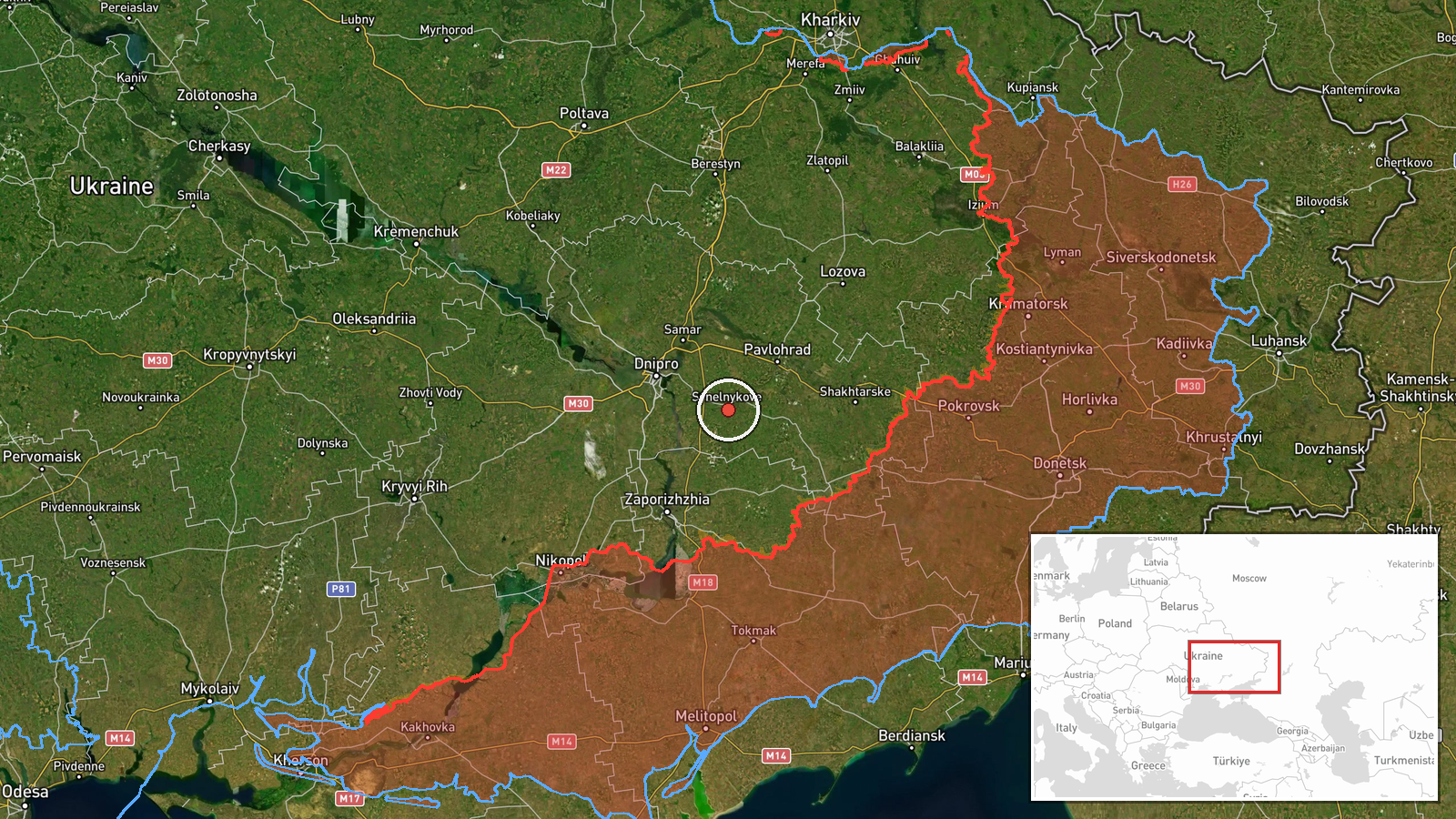
The event is tagged to Synelnykove, a town in Dnipropetrovsk Oblast, with coordinates at the town center. The geo precision is recorded as regional, and no location confidence value was assigned, so the point marks the district rather than a specific site or track position. The surrounding area is largely flat steppe farmland drained by rivers that feed into the Dnipro basin. Pavlohrad and Dnipro lie to the north and northwest, along the routes the alerts describe.
Related events nearby
- Ukrainian air monitoring: 1 Russian ballistic missile from Kharkiv Oblast toward Pavlohrad.2026-10-17 01:46 UTC · Ballistic Missile · Pavlohrad, Ukraine
- Ukrainian air monitoring: 1 Russian Shahed-type drone heading toward Pavlohrad.2026-10-16 23:54 UTC · Drone Transit · Pavlohrad, Ukraine
- Ukrainian air monitoring: 1 Russian Shahed-type drone passing Dnipropetrovsk Oblast, heading northwest.2026-10-17 06:32 UTC · Drone Transit · Dnipropetrovsk Oblast, Ukraine
- Ukrainian air monitoring: 1 Russian Shahed-type drone heading toward Dnipro.2026-10-17 03:24 UTC · Drone Transit · Dnipro, Ukraine
- Ukrainian air monitoring: 1 Russian Shahed-type drone heading toward Dnipro; 2+ Russian jet-powered Shahed (Ge2026-10-17 00:57 UTC · Drone Transit · Dnipro, Ukraine
▶ View this event on the live map

Intel Mapper aggregates open-source reports from monitored Telegram and X channels, geolocates them, cross-checks duplicates across sources and assigns a confidence score. Entries are updated as new confirmations arrive. Read how we verify events.