Drone reported heading for Dnipro as jet-powered Shaheds track over northern Chernihiv
What happened
Ukrainian air monitoring reported at 00:57 UTC on 17 October 2026 that one Russian Shahed-type drone was flying toward Dnipro, described in the original post as approaching from the east. The same update noted two or more jet-powered Shahed-type drones, identified as Geran-3, passing over northern Chernihiv Oblast on a southwesterly heading. The report was published on Telegram by the channel @kpszsu and is recorded as a single-channel post, so the details rest on that one feed. The post does not describe any impact, damage, or casualties, and it gives no interception result. The alert is therefore best read as a transit warning rather than a confirmed strike. Its terse wording and course notation suggest a live operational alert written for rapid circulation.
Context and assessment
Dnipro is a major industrial and transport city on the Dnipro River in central-eastern Ukraine. It has repeatedly appeared in Russian long-range strike activity as a location with rail, energy, defence-industrial, and logistics significance. This alert sits within a dense run of activity over the preceding day. Earlier on 16 October, monitoring reports logged a guided glide bomb heading toward Dnipropetrovsk Oblast at 07:00, a Shahed-type drone moving from Kherson Oblast toward the same oblast at 14:31, and a Geran-3 heading toward Dnipro at 02:29. Further reports placed jet drones north of the city at 01:24 and a group of two or more heading toward Kamianske district at 14:34. Taken together, the pattern points to repeated drone traffic through the Dnipro corridor from the south and east, with jet-powered variants appearing alongside older piston-engine types. Low-count transits of this kind are often consistent with reconnaissance, route testing, or sustained pressure meant to stretch air defence attention across several oblasts at once. The data alone cannot distinguish these purposes. Because this specific event reports no impact, the most defensible reading is continued drone activity over the region rather than a confirmed attack on a particular target within the city.
Sources and confidence
The alert rests on one Telegram channel, @kpszsu, which is the only listed source, so there is no cross-confirmation at the time of logging. The confidence score of 8.0 is relatively high for a single-channel report, reflecting the channel's role as an air monitoring feed, the specificity of the course, and consistency with surrounding reports. It stays below the maximum because no second outlet, official statement, or sighting has been recorded for this exact transit. Confidence would rise with independent confirmation from other monitoring sources or regional authorities. It would fall if later updates contradict the course or show the drone was downed before reaching the city.
Location
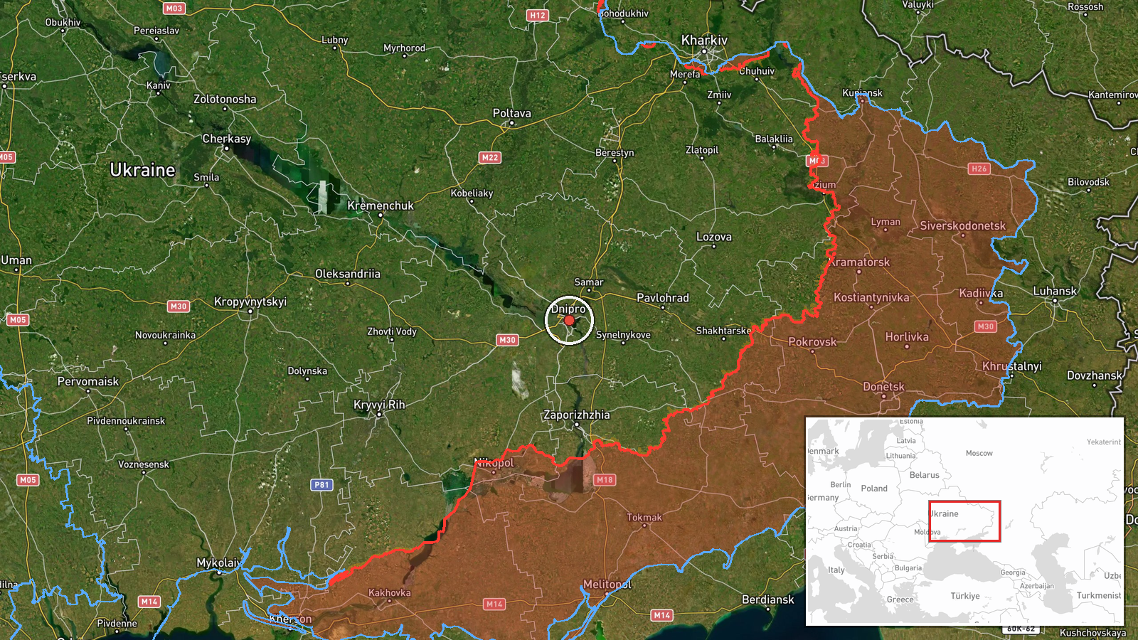
The marker corresponds to the city of Dnipro and is recorded at settlement precision with high location confidence, so it reflects the city rather than a specific facility. The city lies on both banks of the Dnipro River, which bends through the urban area and offers a visible landmark for air defence and monitoring. The surrounding Dnipropetrovsk Oblast landscape is largely steppe, with agricultural land, industrial zones, and scattered settlements.
Related events nearby
- Ukrainian air monitoring: 1 Russian Shahed-type drone from Kherson Oblast toward Dnipropetrovsk Oblast.2026-10-16 14:31 UTC · Drone Transit · Dnipropetrovsk Oblast, Ukraine
- Ukrainian air monitoring: 1 Russian guided glide bomb (KAB) heading toward Dnipropetrovsk Oblast.2026-10-16 07:00 UTC · Airstrike · Dnipropetrovsk Oblast, Ukraine
- Ukrainian air monitoring: 1 Russian jet-powered Shahed (Geran-3) drone heading toward Dnipro; 1 Russian jet-po2026-10-16 02:29 UTC · Drone Transit · Dnipro, Ukraine
- Ukrainian air monitoring: 2+ Russian jet-powered Shahed (Geran-3) drones heading toward Kamianske district.2026-10-16 14:34 UTC · Drone Transit · Kamianske district, Ukraine
- Ukrainian air monitoring: 1 Russian Shahed-type drone heading toward Pavlohrad.2026-10-16 23:54 UTC · Drone Transit · Pavlohrad, Ukraine
▶ View this event on the live map

Intel Mapper aggregates open-source reports from monitored Telegram and X channels, geolocates them, cross-checks duplicates across sources and assigns a confidence score. Entries are updated as new confirmations arrive. Read how we verify events.