Ukrainian air monitoring reports 2+ jet-powered Geran-3 drones heading toward Kamianske district
What happened
Ukrainian air monitoring channel @kpszsu reportedly posted on Telegram on 16 October 2026 at 14:34 UTC that two or more Russian jet-powered Shahed (Geran-3) drones were moving toward Kamianske district from the north. The original post is brief, using a motorcycle-style emoji and the phrase reactive UAV movement in the direction of Kamianske from the north. The report does not state whether any drones struck a target, were shot down, or changed course. It appears to be a real-time transit warning rather than a confirmed impact report. Because the report comes from a single channel, details beyond the direction and approximate count should be treated as provisional.
Context and assessment
Kamianske sits in Dnipropetrovsk Oblast along the Dnipro corridor, a region that has repeatedly appeared in Ukrainian air alerts since the full-scale invasion. The related events in this feed show a dense sequence of drone movements across the same oblast over roughly ninety minutes earlier on the same day. Reports moved from northern Dnipropetrovsk Oblast at 01:06 UTC, to a drone passing north of Dnipro heading west at 01:24, to a drone heading toward Dnipro at 02:29, and then to a Shahed-type drone from Kherson Oblast at 14:31. A guided glide bomb was also logged heading toward the oblast at 07:00. This pattern suggests sustained reconnaissance or strike flights crossing the region rather than a single isolated launch. Jet-powered Geran-3 variants are generally associated with higher speed and a greater warhead load than piston-engine Shaheds, which makes repeated tracks of this type a notable signal. Operationally, such clusters may indicate efforts to saturate air defenses or to probe approaches to industrial and logistics nodes, though the feed alone cannot confirm targeting intent.
Sources and confidence
The event rests on a single Telegram channel, @kpszsu, which is the only source listed. Cross-confirmation is absent at the time of writing, so the confidence score of 8.0 reflects a credible official-style monitoring channel with a high-precision location but no independent corroboration. Confidence would rise if regional military administrations, national air force statements, or additional monitoring accounts reported matching tracks, or if impact or interception reports followed. It would fall if later updates contradicted the direction of travel or if the drones were not confirmed beyond the initial alert.
Location
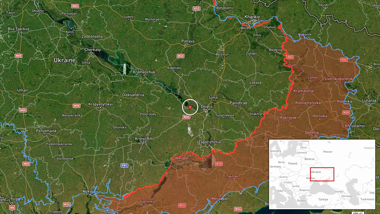
The location is recorded at settlement precision for Kamianske district in Dnipropetrovsk Oblast, with coordinates near 48.52 N and 34.61 E and a high location confidence. The coordinates mark the district area rather than a specific facility, and the drone report names a direction of approach rather than a fixed point. The district lies on the Dnipro River's left bank region in central-eastern Ukraine, an area of plains, river valleys, and industrial towns. The Dnipro River and its reservoirs are prominent nearby features that shape flight routes.
Related events nearby
- Ukrainian air monitoring: 1 Russian Shahed-type drone from Kherson Oblast toward Dnipropetrovsk Oblast.2026-10-16 14:31 UTC · Drone Transit · Dnipropetrovsk Oblast, Ukraine
- Ukrainian air monitoring: 1 Russian guided glide bomb (KAB) heading toward Dnipropetrovsk Oblast.2026-10-16 07:00 UTC · Airstrike · Dnipropetrovsk Oblast, Ukraine
- Ukrainian air monitoring: 1 Russian jet-powered Shahed (Geran-3) drone heading toward Dnipro; 1 Russian jet-po2026-10-16 02:29 UTC · Drone Transit · Dnipro, Ukraine
- Ukrainian air monitoring: 1 Russian jet-powered Shahed (Geran-3) drone passing north of Dnipro, heading west.2026-10-16 01:24 UTC · Drone Transit · north of Dnipro, Ukraine
- Ukrainian air monitoring: 2+ Russian jet-powered Shahed (Geran-3) drones passing northern Dnipropetrovsk Oblas2026-10-16 01:06 UTC · Drone Transit · northern Dnipropetrovsk Oblast, Ukraine
▶ View this event on the live map

Intel Mapper aggregates open-source reports from monitored Telegram and X channels, geolocates them, cross-checks duplicates across sources and assigns a confidence score. Entries are updated as new confirmations arrive. Read how we verify events.