Single jet-powered Shahed (Geran-3) drone reported in transit over Dnipro, heading west
What happened
Ukrainian air monitoring reported one jet-powered Shahed-type drone, identified as a Geran-3, on the northern approach to Dnipro with its course set to the west. The report was posted on Telegram by the channel @kpszsu and is timestamped 16 October 2026 at 01:24 UTC. The original Ukrainian wording is brief: a jet-powered UAV north of Dnipro, heading west. The message says nothing about impact, damage, or casualties. The report attributes the drone to Russia and classifies the event as a drone transit, which means it documents the object's movement rather than a confirmed strike on a target. Because the message gives no detail beyond direction and type, the flight path and any later events cannot be established from this source alone.
Context and assessment
Dnipro is a major city on the Dnipro River in central-eastern Ukraine, and its industrial and transport infrastructure has made it a recurring destination for Russian long-range fire. The related events show a dense sequence over roughly 24 hours. On 15 October, a guided glide bomb was reported heading toward Dnipro and then toward Dnipropetrovsk Oblast, followed by a Shahed-type drone passing through the oblast on a northwesterly heading. Later that day, a Banderol mini cruise missile was reported heading toward Dnipro. The jet-powered Geran-3 tracked over northern Dnipropetrovsk Oblast at 01:06 UTC, and this Dnipro transit followed ten minutes later. The pattern suggests a sustained effort that combines drones, cruise missiles, and glide bombs across the same oblast. Jet-powered variants are generally faster and harder to intercept than propeller-driven Shaheds, so tracking them is an important part of air defense warning. Operationally, the sequence may point to probing of air defense coverage or an attempt to saturate it, though the data alone cannot confirm intent.
Sources and confidence
The event rests on a single Telegram channel, @kpszsu, and the source count is one. The channel is the only listed reporter, so the detail that the drone was jet-powered and heading west has not been independently cross-checked here. The confidence score of 8.0 reflects a clear, specific, and timely report from a channel tied to Ukrainian air monitoring, along with a consistent pattern in the surrounding reports. It is held below the top of the scale because there is no second source. Confidence would rise with corroboration from other Ukrainian air force statements, regional military administration reports, or independent trackers that place the same object. It would fall if later reporting contradicts the type or heading, or if no related impact or interception is ever confirmed.
Location
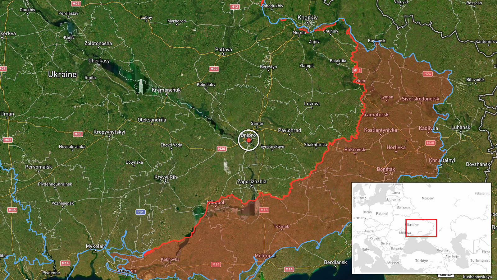
The coordinates, 48.46 N and 35.05 E, mark the centre of Dnipro, and the location is classed as settlement-level precision with high confidence. The report's phrase north of Dnipro is directional, so the point is a city reference rather than a fixed site. Dnipro lies on both banks of the Dnipro River, which runs north to south through the city. The surrounding terrain is largely flat steppe, which offers little natural cover for low-flying aircraft and gives the river valley a prominent visual reference.
Related events nearby
- Ukrainian air monitoring: 1 Russian Banderol mini cruise missile heading toward Dnipro.2026-10-15 10:41 UTC · Cruise Missile · Dnipro, Ukraine
- Ukrainian air monitoring: 1 Russian Shahed-type drone passing Dnipropetrovsk Oblast, heading northwest.2026-10-15 06:12 UTC · Drone Transit · Dnipropetrovsk Oblast, Ukraine
- Ukrainian air monitoring: 1 Russian guided glide bomb (KAB) heading toward Dnipropetrovsk Oblast.2026-10-15 01:59 UTC · Airstrike · Dnipropetrovsk Oblast, Ukraine
- Ukrainian air monitoring: jet-powered Shahed (Geran-3) drones tracked over northern Dnipropetrovsk Oblast, hea2026-10-16 01:06 UTC · Drone Transit · Northern Dnipropetrovsk Oblast, Ukraine
- Ukrainian air monitoring: 1 Russian Banderol mini cruise missile heading toward Samar.2026-10-15 10:38 UTC · Cruise Missile · Samar, Ukraine
▶ View this event on the live map

Intel Mapper aggregates open-source reports from monitored Telegram and X channels, geolocates them, cross-checks duplicates across sources and assigns a confidence score. Entries are updated as new confirmations arrive. Read how we verify events.