Jet-powered Shahed drones reported heading west over northern Dnipropetrovsk Oblast
What happened
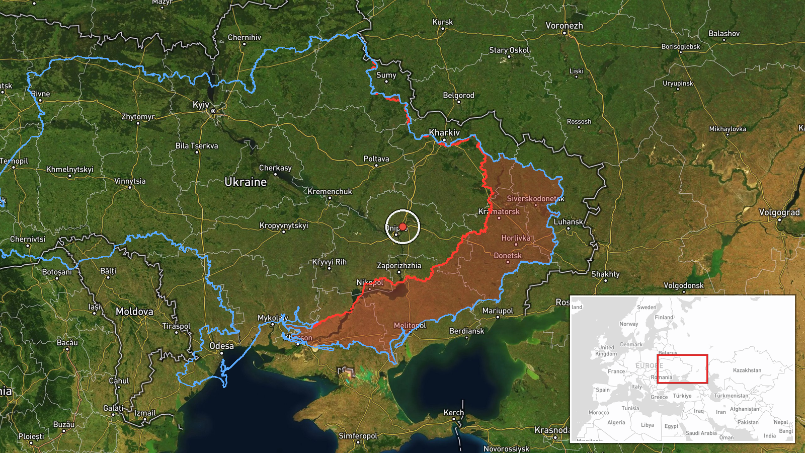
Ukraine's Air Force monitoring channel on Telegram, @kpszsu, reported at 01:06 UTC on 16 October 2026 that jet-powered drones, identified in the post as Shahed-type Geran-3 models, were tracked over the northern part of Dnipropetrovsk Oblast and moving west. The original Ukrainian-language post reads, in translation, as jet-powered UAVs in the north of the Dnipropetrovsk region, heading west. It names no specific settlement, target, or impact. The item is a brief air-monitoring alert rather than a damage report, and no strike, casualties, or losses are described. The report comes from a single channel, so its details rest on that one source at this stage.
Context and assessment
Northern Dnipropetrovsk lies within a corridor that Russian long-range drone and missile activity has repeatedly crossed toward central and eastern Ukraine, and the city of Dnipro, the oblast's largest urban center, appears several times in the surrounding reports. The related events show a dense sequence over about 24 hours. Shortly after 01:59 UTC on 15 October, a guided glide bomb was reported heading toward the oblast. Later that morning, Banderol mini cruise missiles were reported heading toward Samar and then Dnipro, minutes apart. At 06:12 that day, a Shahed-type drone was logged passing the oblast heading northwest. A Geran-3 was then reported over Dnipro at 01:24 UTC on 16 October, after the northern-oblast alert at 01:06. Taken together, the pattern points to several weapon types using overlapping corridors across the region rather than one isolated launch. Operationally, a westward heading may indicate transit toward targets farther west or a route that changes course. The record does not show which, so these readings remain interpretations rather than confirmed intent.
Sources and confidence
The item comes from one Telegram channel, @kpszsu, which is widely cited as the Ukrainian Air Force's public monitoring feed. No second channel, wire service, or official statement in the record independently confirms this track. The score of 8.0 is relatively high for a single-source item because the channel has an established role in air-alert reporting and the surrounding events are consistent with it. It is not higher because the report lacks cross-confirmation and a precise position. Confidence would rise with corroboration from a second monitoring source, or with a clearer time and track. It would fall if the channel issued a correction, which it has not, or if later reports contradicted the drone type or direction.
Location
The location is recorded only at region level. The coordinates, 48.6 north and 35.2 east, are an approximate point for the northern part of Dnipropetrovsk Oblast, not a settlement or facility, and location confidence is low. The oblast is a large region of steppe, farmland, and river valleys. The Dnipro River crosses it and runs through the city of Dnipro near the center of the oblast. Its northern districts border neighboring oblasts, so the actual track could lie anywhere across a wide area.
Related events nearby
- Ukrainian air monitoring: 1 Russian Banderol mini cruise missile heading toward Samar.2026-10-15 10:38 UTC · Cruise Missile · Samar, Ukraine
- Ukrainian air monitoring: 1 Russian jet-powered Shahed (Geran-3) drone heading toward Dnipro.2026-10-16 02:29 UTC · Drone Transit · Dnipro, Ukraine
- Ukrainian air monitoring: 1 Russian jet-powered Shahed (Geran-3) drone over Dnipro.2026-10-16 01:24 UTC · Drone Transit · Dnipro, Ukraine
- Ukrainian air monitoring: 1 Russian Banderol mini cruise missile heading toward Dnipro.2026-10-15 10:41 UTC · Cruise Missile · Dnipro, Ukraine
- Ukrainian air monitoring: 1 Russian Shahed-type drone passing Dnipropetrovsk Oblast, heading northwest.2026-10-15 06:12 UTC · Drone Transit · Dnipropetrovsk Oblast, Ukraine
▶ View this event on the live map

Intel Mapper aggregates open-source reports from monitored Telegram and X channels, geolocates them, cross-checks duplicates across sources and assigns a confidence score. Entries are updated as new confirmations arrive. Read how we verify events.