Air monitoring: one Russian guided glide bomb reported heading toward Dnipropetrovsk Oblast
What happened
Ukrainian air monitoring reported on 16 October 2026, at about 07:00 UTC, that one Russian guided glide bomb, known in Ukrainian as a KAB, was heading toward Dnipropetrovsk Oblast in central-eastern Ukraine. The alert was posted on Telegram by the channel @kpszsu. Its original wording was a short notice, 'KABs to Dnipropetrovsk region,' accompanied by a bomb emoji. The report describes a single munition in transit. It does not name a target, a settlement, or any impact, and it states no casualties or damage. The message is an early-warning style notice rather than a confirmed strike report, so the event should be read as a reported approaching munition only.
Context and assessment
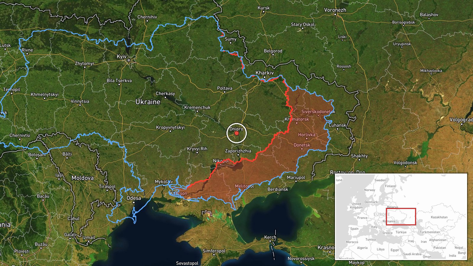
Dnipropetrovsk Oblast lies along the middle Dnipro, and it includes the city of Dnipro, a major industrial, rail, and logistics hub. That helps explain why the area recurs in air-threat reporting. This alert belongs to a sequence logged within roughly a day. On 15 October at 10:38 UTC, a Banderol mini cruise missile was reported heading toward Samar, and at 10:41 UTC another was reported heading toward Dnipro. On 15 October at 16:18 UTC, a jet-powered Geran-3 drone was reported moving from Dnipropetrovsk Oblast toward Synelnykove. Early on 16 October, Geran-3 drones were logged passing north of Dnipro heading west at 01:24 UTC and heading toward Dnipro at 02:29 UTC. The pattern shows several aerial systems cycling through the same oblast, with Dnipro the most frequently named point. Guided glide bombs are usually released by aircraft at a standoff distance, so an alert of this kind may point to an aircraft-launched strike aimed at targets in or near the oblast, though the data does not establish the intended target. The overlap with cruise missile and drone reports suggests a multi-axis pattern rather than an isolated launch, but that inference rests mainly on timing.
Sources and confidence
The alert comes from one Telegram channel, @kpszsu, and no other outlet in the supplied data reports the same munition. The platform assigns a confidence score of 8.0. That score reflects a specific, official-style monitoring source and a clear claim, offset by the lack of cross-confirmation and the single-channel basis. Confidence would rise if regional military administration statements, independent monitoring feeds, or impact reports named a location in the oblast. It would fall if later updates withdrew the alert or reported the munition as intercepted or diverted elsewhere. The record is not marked as corrected.
Location
The location is recorded at regional precision. The coordinates, 48.46 N and 35.05 E, reflect Dnipropetrovsk Oblast as a whole, not a specific settlement or facility, and the location confidence is low. The point sits near the city of Dnipro, but it should be treated as a placeholder, not an identified target. The oblast spans central-eastern Ukraine along the Dnipro River and includes steppe and farmland, industrial zones, and river crossings, with Dnipro as its principal urban centre.
Related events nearby
- Ukrainian air monitoring: 1 Russian jet-powered Shahed (Geran-3) drone heading toward Dnipro; 1 Russian jet-po2026-10-16 02:29 UTC · Drone Transit · Dnipro, Ukraine
- Ukrainian air monitoring: 1 Russian Banderol mini cruise missile heading toward Dnipro.2026-10-15 10:41 UTC · Cruise Missile · Dnipro, Ukraine
- Ukrainian air monitoring: 1 Russian Banderol mini cruise missile heading toward Samar.2026-10-15 10:38 UTC · Cruise Missile · Samar, Ukraine
- Ukrainian air monitoring: 1 Russian jet-powered Shahed (Geran-3) drone passing north of Dnipro, heading west.2026-10-16 01:24 UTC · Drone Transit · north of Dnipro, Ukraine
- Ukrainian air monitoring: 1 Russian jet-powered Shahed (Geran-3) drone from Dnipropetrovsk Oblast toward Synel2026-10-15 16:18 UTC · Drone Transit · Synelnykove, Ukraine
▶ View this event on the live map

Intel Mapper aggregates open-source reports from monitored Telegram and X channels, geolocates them, cross-checks duplicates across sources and assigns a confidence score. Entries are updated as new confirmations arrive. Read how we verify events.