Jet-powered Shahed-type drone reportedly tracked from Mykolaiv toward Kirovohrad Oblast
What happened
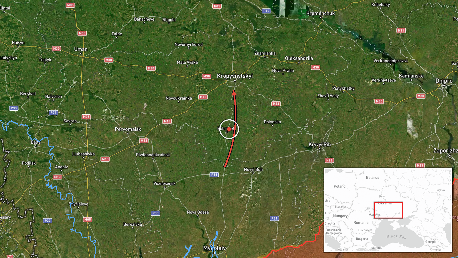
Ukrainian air monitoring reports, relayed through the Telegram channel @kpszsu, state that a single jet-powered drone was moving from Mykolaiv Oblast toward Kirovohrad Oblast on the morning of 17 October 2026. The original Ukrainian post reads, in translation, 'jet-powered UAV from Mykolaiv region on course to Kirovohrad region (Holovanivsk),' naming Holovanivsk, a town in Kirovohrad Oblast, as the apparent destination. The event is logged at 09:59 UTC, while a closely worded entry with the same summary is timed at 07:54, which may indicate a repeated or updated post rather than a second aircraft. The report identifies the drone as a Russian Shahed-type design, described in the summary as the Geran-3 jet variant. No impact, target, or damage is reported in the data, and the post does not describe where the drone ended its track.
Context and assessment
Kirovohrad Oblast sits in central Ukraine, between Mykolaiv to the south and Kropyvnytskyi, its regional centre, at its core. Drones crossing it on a northerly or easterly track often pass over the country's interior rather than its front-line zone. The related entries show this track was part of a wider pattern that day. Late on 16 October a Shahed-type drone was reported heading toward Kropyvnytskyi at 19:44, and earlier that day Russia reportedly launched 315 attack drones, 78 of them jet-powered, together with Gerbera decoys and 15 S-8000 Banderol munitions, against Ukraine between 07:00 and 19:00 without a specific target named. A ballistic missile threat warning was issued at 01:39 on 17 October and cancelled at 02:22, with no launch site or target reported. Taken together, the sequence suggests a campaign that spreads salvos across many oblasts, with individual drones sent through central regions to saturate air defence and stretch warning coverage. Jet-powered airframes are faster than piston-engined Shaheds, which may shorten the time available for interception, although the data does not show whether this drone was engaged. Holovanivsk is a relatively small settlement, so an attack there would more plausibly be a transit or area target than a deliberate strike on critical infrastructure. This reading remains tentative.
Sources and confidence
The item rests on one Telegram channel, @kpszsu, which the data lists as its only source, so the source count is 1 and no independent outlet has been matched. The wording is consistent with surrounding Ukrainian air-monitoring entries from the same period, which lowers the chance of a misreading, but cross-confirmation has not been established. The score of 8.0 is taken as assigned by the scoring system; with a single source it is not reinforced by multiple reports. Confidence would rise with a matching Ukrainian Air Force statement, a regional military administration notice, or reports from independent monitoring groups. It would fall if a correction appeared or if a conflicting track were reported. The record is currently not marked as corrected.
Location
The location is recorded at region level. The coordinates correspond to an approximate point in Kirovohrad Oblast rather than a settlement or facility, and the location confidence is marked low. The destination named in the original post is Holovanivsk, a town in the oblast, but the map point should not be read as its exact position. Kirovohrad Oblast is largely agricultural steppe with river valleys, and the drone's reported route runs from Mykolaiv Oblast to its south. Holovanivsk is not a front-line settlement.
Related events nearby
- Ukrainian air monitoring: 1 Russian jet-powered Shahed (Geran-3) drone from Mykolaiv Oblast toward Kirovohrad 2026-10-17 07:54 UTC · Drone Transit · Kirovohrad Oblast, Ukraine
- Ukrainian air monitoring: 1 Russian Shahed-type drone heading toward Kropyvnytskyi.2026-10-16 19:44 UTC · Drone Transit · Kropyvnytskyi, Ukraine
- Ukrainian Air Force announces all-clear: the threat of Russian ballistic missile use has been cancelled.2026-10-17 02:22 UTC · Siren · Ukraine
- Ukrainian Air Force warns of threat of Russian ballistic missile use; no specific target or launch site report2026-10-17 01:39 UTC · Ballistic Missile · Ukraine
- Russia launched 315 attack drones (78 jet-powered), plus Gerbera decoys and 15 S-8000 Banderol munitions, agai2026-10-16 16:45 UTC · UAS Strike · Ukraine (nationwide, no specific target named)
▶ View this event on the live map

Intel Mapper aggregates open-source reports from monitored Telegram and X channels, geolocates them, cross-checks duplicates across sources and assigns a confidence score. Entries are updated as new confirmations arrive. Read how we verify events.