Russia fires 315 drones and 15 Banderol munitions at Ukraine; 253 drones downed or suppressed
What happened
Ukraine's Air Force and General Staff Telegram channels reported that Russia launched 315 attack drones against Ukraine between 07:00 and 19:00 on 16 October 2026. Of these, 78 were jet-powered. The attack also included Gerbera decoys, drones of other types, and 15 S-8000 Banderol munitions. According to preliminary figures in the reports, air defense downed or suppressed 253 drones, including 49 jet-powered, and 9 Banderol munitions. At 18:00, about 35 attack drones were still reported in the airspace. The reports name no specific target, city, or oblast and describe the attack as directed at Ukraine as a whole. The original Ukrainian post was framed as preliminary and closed with an appeal to residents to heed air-raid alerts.
Context and assessment
Nationwide attacks of this kind are typically aimed at energy, logistics, defense industry and urban infrastructure, but this report names no target, so its significance rests on scale and pattern rather than a specific site. The event sits within a busy day. Earlier that morning, a separate attack of 149 Shahed-type, Gerbera and decoy drones was launched from Oryol, occupied Donetsk and Crimea, with 114 downed or suppressed and 27 hits recorded at 24 locations. Between 01:21 and 15:38, Ukrainian air monitoring logged several single or small groups of jet-powered Geran-3 and Shahed-type drones moving west past Kropyvnytskyi, northern Kirovohrad and southwestern Cherkasy oblasts. Taken together, the sequence suggests repeated waves rather than one isolated salvo, combining decoys with jet-powered airframes. The high share of jet-powered drones is notable because they are faster and harder to intercept. Operationally, the pattern may indicate an effort to stretch air defense across several axes at once, though the reports do not state intent.
Sources and confidence
Two Ukrainian official Telegram channels are listed: the General Staff (@GeneralStaffZSU) and the Air Force (@kpszsu), which is the channel recorded as the primary source. Both are official military sources and report the figures in a consistent format. However, the data shows no independent confirmation from imagery, wreckage, or third-party outlets, and the figures are described as preliminary. The confidence score of 9.1 reflects official origin and two-source agreement, while the preliminary wording and lack of independent verification keep it below the maximum. Confidence would rise with confirmed damage reports or independent tracking data, and would fall if official counts were revised.
Location
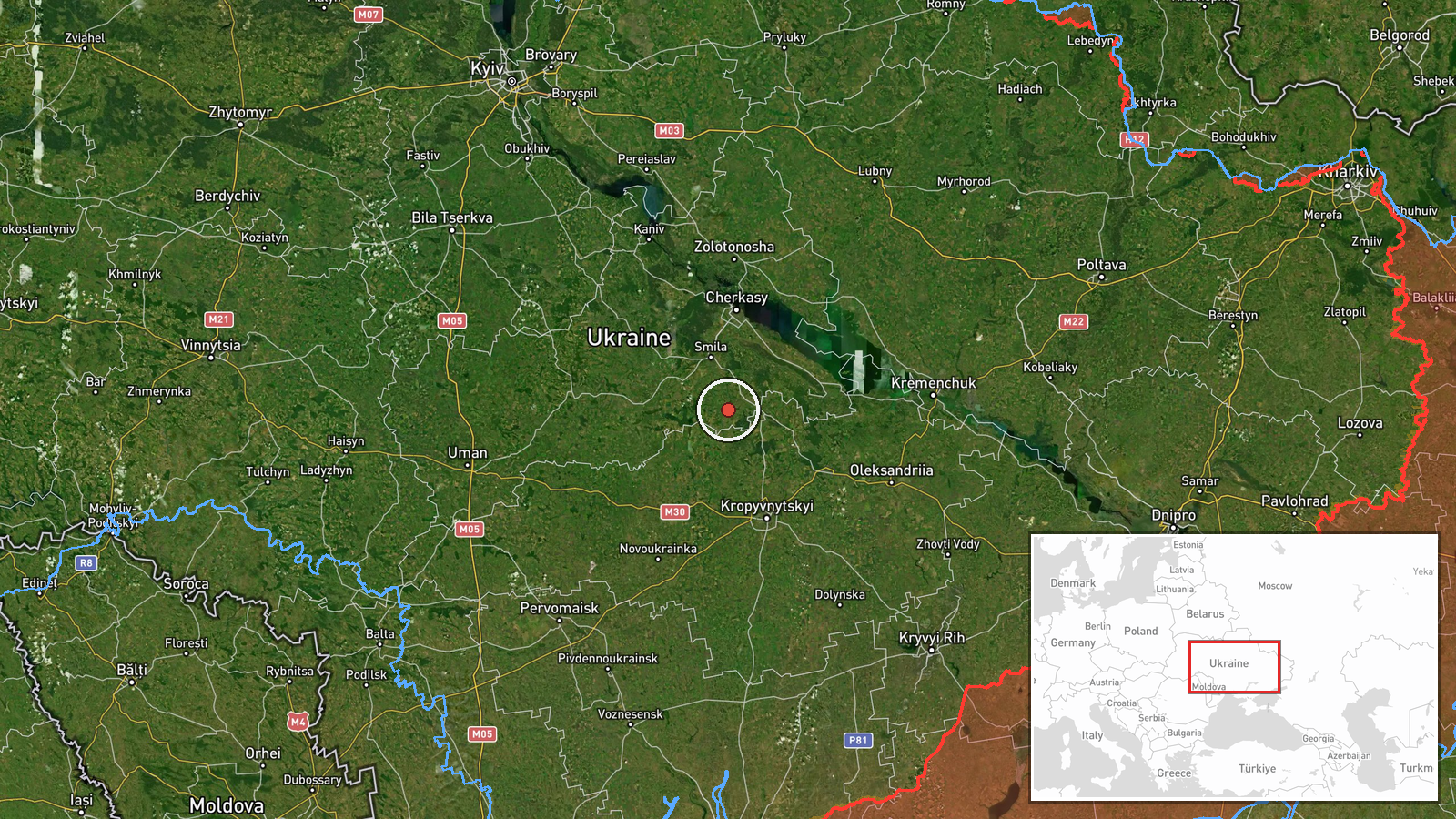
The location is recorded at region precision. The report names no settlement or facility and covers Ukraine nationwide. The coordinates (49.0, 32.0) are a generic central point in Ukraine, near the Kirovohrad and Cherkasy area, and should be read as a placeholder rather than a strike site. Ukraine's terrain varies from steppe in the south and east to farmland and forest in the north, and the Dnipro River runs through the center of the country, which is relevant to the western transit routes described in related events.
Related events nearby
- A woman assaulted a military recruitment officer who had come to take her boyfriend for mobilization.2026-10-16 13:58 UTC · Security · Ukraine (location not reported)
- Russia launched 149 Shahed-type, Gerbera and decoy drones from Oryol, occupied Donetsk and Crimea. 114 downed 2026-10-16 06:42 UTC · UAS Strike · Ukraine
- Ukrainian air monitoring: 2+ Russian jet-powered Shahed (Geran-3) drones passing northern Kirovohrad Oblast, h2026-10-16 04:57 UTC · Drone Transit · northern Kirovohrad Oblast, Ukraine
- Ukrainian air monitoring: 1 Russian jet-powered Shahed (Geran-3) drone passing north of Kropyvnytskyi, heading2026-10-16 01:21 UTC · Drone Transit · north of Kropyvnytskyi, Ukraine
- Ukrainian air monitoring: 1 Russian Shahed-type drone passing southwestern Cherkasy Oblast, heading west.2026-10-16 15:38 UTC · Drone Transit · southwestern Cherkasy Oblast, Ukraine
▶ View this event on the live map

Intel Mapper aggregates open-source reports from monitored Telegram and X channels, geolocates them, cross-checks duplicates across sources and assigns a confidence score. Entries are updated as new confirmations arrive. Read how we verify events.