Single Shahed-type drone reported transiting southwestern Cherkasy Oblast, heading west
What happened
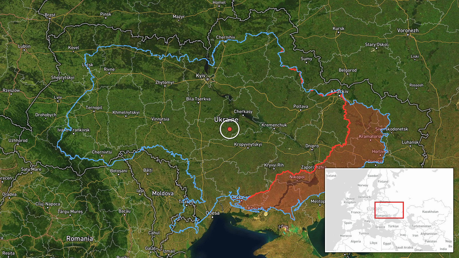
Ukrainian air monitoring reported on 16 October 2026, at about 15:38 UTC, that one Russian Shahed-type drone was passing through southwestern Cherkasy Oblast on a westward heading. The report was posted on Telegram by the channel @kpszsu, which is linked to Ukraine's Air Force monitoring messaging. The original post, written in Ukrainian, describes 'ударні БпЛА' (strike unmanned aerial vehicles) on a westerly course, without giving a precise point, altitude, or any reported impact. The location is described only at regional level, so the exact position of the drone at the time of the report is unknown. No damage, casualties, or interception is mentioned in the source wording.
Context and assessment
Cherkasy Oblast sits in central Ukraine on the Dnipro's right bank, and its southwestern districts lie along the routes that Shahed-type drones have taken westward toward central and western regions. The same day shows a sequence of transits in the area. An earlier report placed a drone over Zvenyhorodka, a town in the same general zone, at about 12:27 UTC, and a jet-powered Geran-3 was reported heading toward Cherkasy city at about 01:49 UTC. Another report noted two or more jet-powered drones over northern Kirovohrad Oblast at 04:57 UTC, a neighbouring region to the southwest. Taken together, these reports suggest a number of drones moving through central Ukraine on a westward path during the day. The broader daily tally included a large launch of 149 drones from Russian-controlled and Russian territory, of which the source reported 114 downed or suppressed. Such transit reports typically indicate routing rather than a specific target, and they may reflect drones flying toward distant objectives in western Ukraine.
Sources and confidence
The report comes from one Telegram channel, @kpszsu, and no second outlet is listed in the event data. The channel's Ukrainian-language wording is consistent with routine air monitoring alerts, which gives it some institutional character, but a single-source report cannot be independently verified here. The confidence score of 8 reflects a single channel, a regional-level location, and no imagery or secondary confirmation. Confidence would rise if regional military administrations, local officials, or additional monitoring channels confirmed the track, or if a precise point were reported. It would fall if the report were corrected or if the track was later attributed to a different object.
Location
The location is recorded as southwestern Cherkasy Oblast, not a settlement or facility, so the coordinates (about 49.05, 31.47) mark an approximate regional centroid rather than a fixed point. The source names no town for this specific report, which is why the location confidence is low. The area is largely agricultural, with farmland, forest belts, and river valleys typical of the Dnipro basin. Nearby features include the Dnipro and its tributaries, and the drone's westward heading would carry it toward the broader central Ukrainian plain.
Related events nearby
- Ukrainian air monitoring: 1 Russian Shahed-type drone passing Zvenyhorodka, heading west.2026-10-16 12:27 UTC · Drone Transit · Zvenyhorodka, Ukraine
- Russia launched 315 attack drones (78 jet-powered), plus Gerbera decoys and 15 S-8000 Banderol munitions, agai2026-10-16 16:45 UTC · UAS Strike · Ukraine (nationwide, no specific target named)
- A woman assaulted a military recruitment officer who had come to take her boyfriend for mobilization.2026-10-16 13:58 UTC · Security · Ukraine (location not reported)
- Russia launched 149 Shahed-type, Gerbera and decoy drones from Oryol, occupied Donetsk and Crimea. 114 downed 2026-10-16 06:42 UTC · UAS Strike · Ukraine
- Ukrainian air monitoring: 2+ Russian jet-powered Shahed (Geran-3) drones passing northern Kirovohrad Oblast, h2026-10-16 04:57 UTC · Drone Transit · northern Kirovohrad Oblast, Ukraine
▶ View this event on the live map

Intel Mapper aggregates open-source reports from monitored Telegram and X channels, geolocates them, cross-checks duplicates across sources and assigns a confidence score. Entries are updated as new confirmations arrive. Read how we verify events.