Ukrainian air monitoring reports Shahed-type drone transit near Zvenyhorodka, Cherkasy Oblast
What happened
On 16 October 2026 at about 12:27 UTC, the Telegram channel @kpszsu reported strike-type unmanned aerial vehicles operating in the area of Kaniv, Zvenyhorodka, Lysianka and Babanka in Cherkasy Oblast, moving on a westward course. The Ukrainian-language post uses the phrase 'ударні БпЛА' (strike UAVs) and gives no count beyond the plural. The Intel Mapper summary narrows this to a single Russian Shahed-type drone passing Zvenyhorodka, a more specific reading than the source wording supports. No impacts, casualties, or damage are reported in the material available. This is a transit report, not a confirmed strike.
Context and assessment
Zvenyhorodka sits in central Ukraine west of Cherkasy city, an area that is not usually a primary target zone but lies along routes that drones take toward western and southwestern Ukraine. The related reports show a sustained pattern through the same region over roughly 24 hours. On 15 October, jet-powered Shahed (Geran-3) drones were logged near Bila Tserkva and Myronivka, then over the Vinnytsia–Cherkasy border area. On the morning of 16 October, another was reported from Kirovohrad Oblast toward Uman. Earlier that morning, a large wave of 149 Shahed-type, Gerbera and decoy drones launched from Oryol, occupied Donetsk and Crimea, with 27 hits at 24 locations reported. Operationally, a series of single or small-group transits across several oblasts may reflect stragglers from that wave, decoys, or drones rerouted around air defence. It may also indicate a deliberate effort to stretch monitoring and interceptor coverage. The original post does not give a type, so any link to the jet-powered variant rests on the surrounding reports rather than this one.
Sources and confidence
The event rests on a single Telegram channel, @kpszsu, which is widely understood to be linked to the Ukrainian Air Force's official air-monitoring reporting. No second channel, official statement, or independent imagery in the dataset confirms the sighting. The score of 8.0 reflects the channel's institutional origin and the clear, time-stamped wording, offset by the single-source basis and the fact that the summary's specific drone count and type go beyond the original text. Confidence would rise with corroboration from regional military administrations or other monitoring feeds, or with reports of impacts or interceptions along the stated path. It would fall if later updates revised the number or direction of the drones.
Location
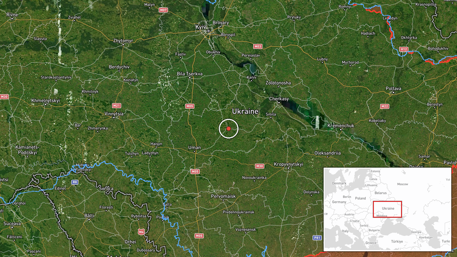
The coordinates correspond to settlement-level precision for Zvenyhorodka, Cherkasy Oblast, the settlement named in the event summary. The original post lists four settlements, so the mapped point is representative of the reported area rather than a precise track position. Zvenyhorodka lies in the forest-steppe zone of central Ukraine, an area of farmland, scattered woodland and river valleys, with the Dnipro lowlands to the east. The nearby settlements named in the report, including Kaniv, Lysianka and Babanka, lie within a few dozen kilometres along the Dnipro-side corridor and are the reference points that define the reported westward path.
Related events nearby
- Ukrainian air monitoring: 1 Russian jet-powered Shahed (Geran-3) drone over Vinnytsia–Cherkasy border area.2026-10-15 17:50 UTC · Drone Transit · Vinnytsia–Cherkasy border area, Ukraine
- Ukrainian air monitoring: 2+ Russian jet-powered Shahed (Geran-3) drones from Cherkasy Oblast toward Myronivka2026-10-15 17:32 UTC · Drone Transit · Myronivka, Ukraine
- Ukrainian air monitoring: 1 Russian jet-powered Shahed (Geran-3) drone passing Bila Tserkva, heading toward My2026-10-15 16:56 UTC · Drone Transit · Myronivka, Ukraine
- Ukrainian air monitoring: 1 Russian jet-powered Shahed (Geran-3) drone from Kirovohrad Oblast toward Uman.2026-10-16 09:00 UTC · Drone Transit · Uman, Ukraine
- Russia launched 149 Shahed-type, Gerbera and decoy drones from Oryol, occupied Donetsk and Crimea. 114 downed 2026-10-16 06:42 UTC · UAS Strike · Ukraine
▶ View this event on the live map

Intel Mapper aggregates open-source reports from monitored Telegram and X channels, geolocates them, cross-checks duplicates across sources and assigns a confidence score. Entries are updated as new confirmations arrive. Read how we verify events.