Jet-powered Russian drone reported over Kropyvnytskyi on 16 October 2026
What happened
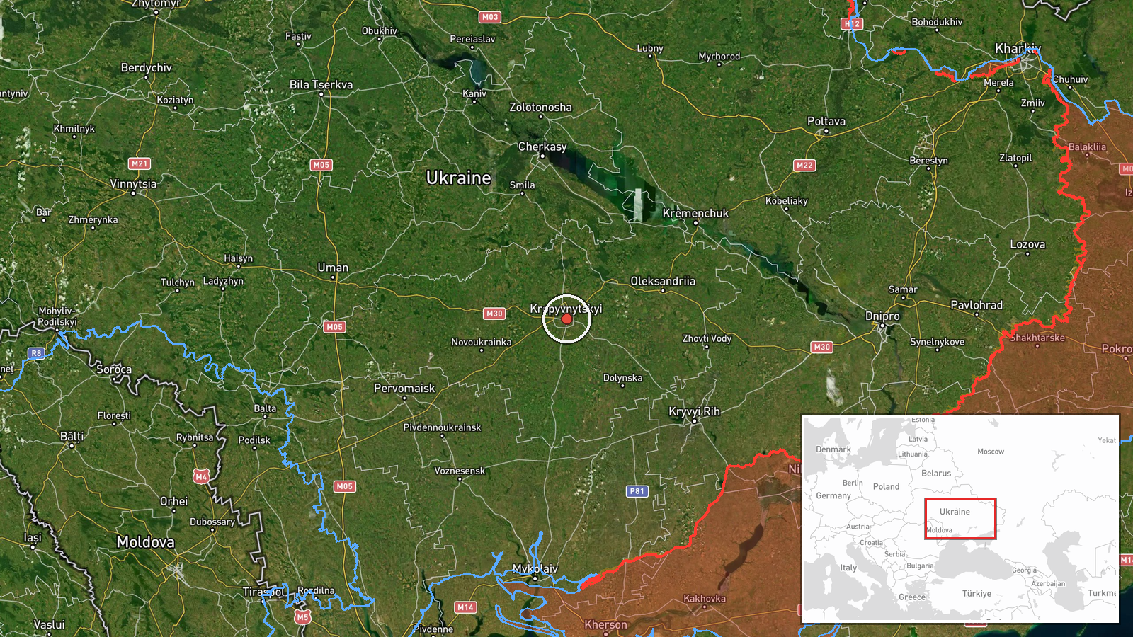
Ukraine's Telegram channel @kpszsu, which relays Ukrainian air monitoring reports, stated at about 01:21 UTC on 16 October 2026 that a single jet-powered unmanned aerial vehicle was located north of Kropyvnytskyi, travelling on a westward course. The original Ukrainian wording reads as a jet-type UAV alert, and the event summary identifies it as a Russian jet-powered Shahed (Geran-3) type. The same post carried a second line reporting jet-powered UAVs in eastern Vinnytsia Oblast heading north. That is a separate location and is not mapped on this event. The report is logged as a drone transit. It does not describe impact, damage, casualties, or an intercept.
Context and assessment
Kropyvnytskyi is the regional centre of Kirovohrad Oblast in central Ukraine, a rail and road hub on the Inhul River, and it lies on a corridor that drones regularly cross between eastern and western Ukraine. This report sits within a cluster of overnight activity. A Shahed-type drone was reported over the city at 01:04 UTC, and a jet-powered drone was reported there again at 01:23, so the later message may refer to the same object on a continuing track or to a second aircraft. On the previous night, 15 October, jet-powered and Shahed-type drones were logged over Kirovohrad Oblast at 01:55 and 10:56. A separate air defense summary for the night of 14 to 15 October reported 536 Shahed-type, Geran and decoy drones downed or suppressed, along with other missiles. Taken together, the pattern suggests a sustained, high-volume campaign in which transit reports across central Ukraine are routine. The westward heading may point toward western oblasts, although a single track cannot establish intent. Jet-powered variants are faster than the older piston-engine Shahed and can be harder for mobile fire groups to engage, which is a plausible reason for their increased reporting.
Sources and confidence
The event rests on one channel, Telegram @kpszsu, with a source count of 1. No independent outlet, official Ukrainian Air Force statement, or second monitoring account in the data confirms the track. The confidence score of 8.0 reflects a credible, specific and recent military-monitoring post with a clear heading and location, tempered by the absence of cross-confirmation. Confidence would rise with corroboration from other monitoring channels, an official air force update, or consistent track data across several sources. It would fall if a correction were issued or if later reports placed the object elsewhere.
Location
The location is settlement-level. The coordinates, 48.51 N and 32.27 E, are assigned to Kropyvnytskyi, and the location confidence is recorded as high. However, the report places the drone north of the city, so the point marks the urban centre rather than the object's actual position, which could differ by several kilometres. The city sits on the Inhul River in the Kirovohrad Oblast steppe, where open farmland surrounds the urban area.
Related events nearby
- Ukrainian air monitoring: 1 Russian jet-powered Shahed (Geran-3) drone over Kropyvnytskyi.2026-10-16 01:23 UTC · Drone Transit · Kropyvnytskyi, Ukraine
- Ukrainian air monitoring: 1 Russian Shahed-type drone over Kropyvnytskyi.2026-10-16 01:04 UTC · Drone Transit · Kropyvnytskyi, Ukraine
- Ukrainian air monitoring: 1 Russian jet-powered Shahed (Geran-3) drone over Kirovohrad Oblast.2026-10-15 10:56 UTC · Drone Transit · Kirovohrad Oblast, Ukraine
- Ukrainian air defenses downed/suppressed 536 Russian Shahed-type drones, Geran drones, and decoy drones from n2026-10-15 05:03 UTC · Air Defense · Ukraine
- Ukrainian air monitoring: 1 Russian jet-powered Shahed (Geran-3) drone heading toward Cherkasy.2026-10-16 01:49 UTC · Drone Transit · Cherkasy, Ukraine
▶ View this event on the live map

Intel Mapper aggregates open-source reports from monitored Telegram and X channels, geolocates them, cross-checks duplicates across sources and assigns a confidence score. Entries are updated as new confirmations arrive. Read how we verify events.