Russian Shahed-type drone reported south of Kropyvnytskyi, tracked toward Mykolaiv Oblast
What happened
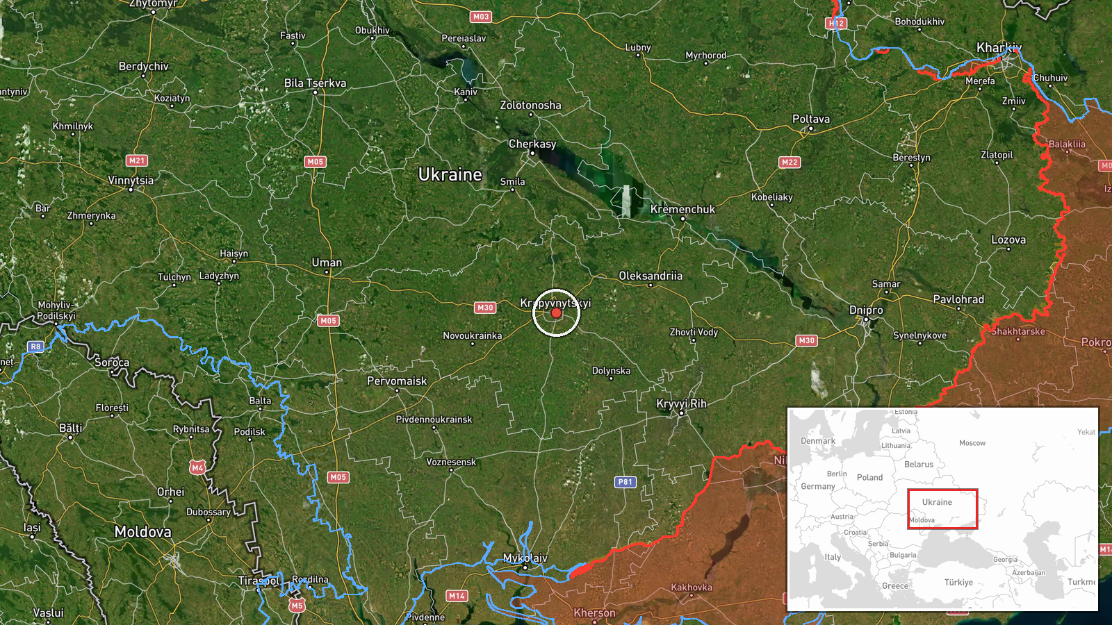
Ukrainian air monitoring reported one Russian Shahed-type drone at about 01:04 UTC on 16 October 2026, located south of Kropyvnytskyi in central Ukraine. The original Ukrainian-language post, published on the Telegram channel @kpszsu, says the drone was on a course toward Mykolaiv Oblast, which lies further south. The report describes no impact, casualties, or damage. It places the drone only in general terms relative to the city, not at a precise point. The event is classified as a drone transit, meaning the report tracks a munition passing through airspace rather than striking a defined target. The confidence score is 8.0, based on a single channel.
Context and assessment
Kropyvnytskyi is a regional centre in Kirovohrad Oblast, on the Inhul River and a major rail and road junction, so drones passing over it can be tracked across several corridors. Mykolaiv Oblast to the south contains port infrastructure on the Black Sea approaches, which has been a recurring focus of long-range strikes, so a southward course fits a pattern of routing toward that region. The related reports show a sequence rather than an isolated sighting. A jet-powered Shahed (Geran-3) was reported over Kirovohrad Oblast at 10:56 on 15 October. A separate air defense report describes 536 Shahed-type, Geran, and decoy drones downed or suppressed on the night of 14 to 15 October, with additional missile launches. Several Geran-3 transit reports followed over Kropyvnytskyi and then toward Cherkasy in the early hours of 16 October. This suggests a series of drones moving through central Ukraine along routes that may be linked to a larger wave. It may also indicate the use of decoys or staggered flights to stretch air defenses, though the data does not confirm either purpose.
Sources and confidence
All of the data rests on one Telegram channel, @kpszsu, and no independent cross-confirmation appears in the dataset. The score of 8.0 reflects the channel's role in routine air monitoring, the specific wording, and the consistency with other reports in the same window. It is held below the top of the scale because the report is unverified by a second source and describes only a transit, not a confirmed impact. Confidence would rise with corroboration from other Ukrainian air monitoring or regional military administration channels, or from independent flight-tracking data. It would fall if later reports contradicted the direction or type, or if the channel issued a correction. The record is not marked as corrected.
Location
The location is recorded at settlement level, with high location confidence, using the coordinates for Kropyvnytskyi (48.51, 32.27). These coordinates mark the city rather than the drone's position, which the original post placed to the south of it. Kropyvnytskyi sits on the Inhul River in the flat, largely agricultural steppe of central Ukraine. Its rail and road links make it a noted transit point in the region.
Related events nearby
- Ukrainian air monitoring: 1 Russian jet-powered Shahed (Geran-3) drone over Kropyvnytskyi.2026-10-16 01:23 UTC · Drone Transit · Kropyvnytskyi, Ukraine
- Ukrainian air monitoring: 1 Russian jet-powered Shahed (Geran-3) drone over Kropyvnytskyi.2026-10-16 01:21 UTC · Drone Transit · Kropyvnytskyi, Ukraine
- Ukrainian air monitoring: 1 Russian jet-powered Shahed (Geran-3) drone over Kirovohrad Oblast.2026-10-15 10:56 UTC · Drone Transit · Kirovohrad Oblast, Ukraine
- Ukrainian air defenses downed/suppressed 536 Russian Shahed-type drones, Geran drones, and decoy drones from n2026-10-15 05:03 UTC · Air Defense · Ukraine
- Ukrainian air monitoring: 1 Russian jet-powered Shahed (Geran-3) drone heading toward Cherkasy.2026-10-16 01:49 UTC · Drone Transit · Cherkasy, Ukraine
▶ View this event on the live map

Intel Mapper aggregates open-source reports from monitored Telegram and X channels, geolocates them, cross-checks duplicates across sources and assigns a confidence score. Entries are updated as new confirmations arrive. Read how we verify events.