Jet-powered Shahed (Geran-3) drone reported heading toward Ichnia in Chernihiv Oblast
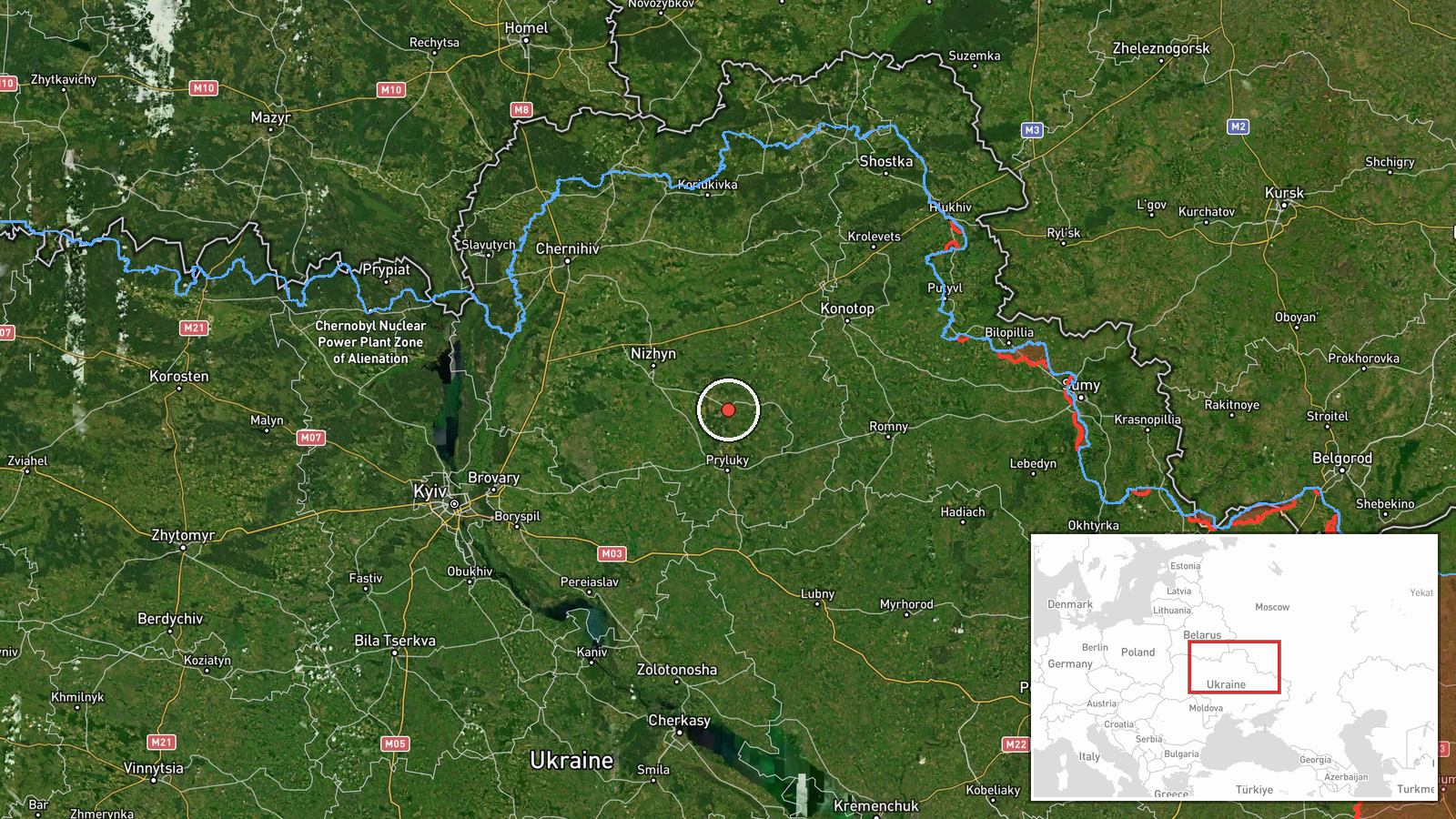
What happened
Ukrainian air monitoring, as relayed through the Telegram channel @kpszsu, reported one Russian jet-powered Shahed, identified as a Geran-3, heading toward Ichnia at about 12:58 UTC on 17 October 2026. The original post, written in Ukrainian, is a short alert naming Ichnia and the nearby settlement of Mala Divytsia, while the English summary refers only to Ichnia. The report does not describe any impact, casualties, or damage, and it does not state the drone's launch point. The alert is a transit notice, meaning it tracks an airborne threat moving through the area rather than confirming a strike. Because it is a single-channel real-time alert, its details reflect what monitors observed at that moment and may be updated as the situation develops.
Context and assessment
Ichnia lies in the north of Ukraine, in the wider corridor that runs between Chernihiv and Poltava oblasts, an area that has seen repeated drone traffic in recent months. The same morning's activity shows this pattern clearly. Earlier alerts tracked drones toward Nizhyn at 01:22, 02:57 and 07:55 UTC, and a second group passed Nova heading west at 08:38. At 11:36 a Banderol mini cruise missile was reported moving from Chernihiv Oblast toward Dihtiari, placing a different weapon class in the same northern airspace within hours. Taken together, the sequence suggests sustained launches or routing through the north rather than a single isolated event. Operationally, this may point to efforts to stretch air defence coverage across several districts at once, to probe approach routes, or to pair drones with cruise missiles against infrastructure. The reports alone do not establish which of these aims applies, or whether Ichnia itself was the intended target.
Sources and confidence
The event rests on one Telegram channel, @kpszsu, which is generally regarded as an official Ukrainian air force monitoring feed. No independent outlet or second channel in the dataset confirms this specific alert, and the related events, though nearby in time, come from the same reporting pattern rather than separate verification. The confidence score of 8.0 reflects a credible official-style source and precise timing, but it is held below the maximum because of single-source status and the absence of any impact or follow-up reporting. Confidence would rise with corroboration from a second independent source, radar-based confirmation, or reports of debris or impact in the area. It would fall if the alert were updated, withdrawn, or found to refer to a different route or target.
Location
The point is placed on Ichnia itself at settlement-level precision, and the location confidence is recorded as high because the town name is explicit in the source. The coordinates correspond to the town centre rather than a specific facility, so any site-level target is not identified. Ichnia sits in Chernihiv Oblast in the lowland terrain of northern Ukraine, a largely flat landscape of farmland, forest belts and river valleys. The nearby settlement of Mala Divytsia, named in the original alert, lies in the same general area and is not separately mapped here.
Related events nearby
- Ukrainian air monitoring: 1 Russian Shahed-type drone passing Nova, heading west.2026-10-17 08:38 UTC · Drone Transit · Nova, Ukraine
- Ukrainian air monitoring: 1 Russian Banderol mini cruise missile from Chernihiv Oblast toward Dihtiari.2026-10-17 11:36 UTC · Cruise Missile · Dihtiari, Ukraine
- Ukrainian air monitoring: 1 Russian jet-powered Shahed (Geran-3) drone heading toward Nizhyn.2026-10-17 07:55 UTC · Drone Transit · Nizhyn, Ukraine
- Ukrainian air monitoring: 1 Russian Shahed-type drone heading toward Nizhyn; 1 Russian Shahed-type drone from 2026-10-17 02:57 UTC · Drone Transit · Nizhyn, Ukraine
- Ukrainian air monitoring: 1 Russian jet-powered Shahed (Geran-3) drone from Chernihiv Oblast toward Nizhyn.2026-10-17 01:22 UTC · Drone Transit · Nizhyn, Ukraine
▶ View this event on the live map

Intel Mapper aggregates open-source reports from monitored Telegram and X channels, geolocates them, cross-checks duplicates across sources and assigns a confidence score. Entries are updated as new confirmations arrive. Read how we verify events.