Single jet-powered Shahed (Geran-3) reported from Chernihiv Oblast heading toward Nizhyn
What happened
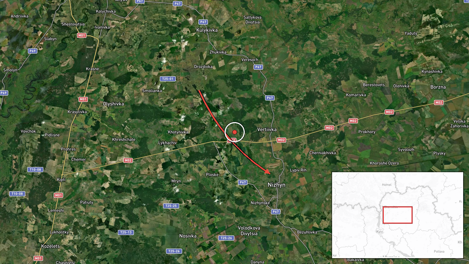
Ukrainian air monitoring reported one Russian jet-powered Shahed-type drone, identified as a Geran-3, in Chernihiv Oblast on a course toward the city of Nizhyn at about 01:22 UTC on 17 October 2026. The information comes from a single Telegram channel, @kpszsu, whose original Ukrainian wording reads roughly as 'jet-powered UAV in Chernihiv region, heading to Nizhyn', with no further detail on altitude, speed, or impact. The report describes a transit warning rather than a confirmed strike, and the source mentions no casualties, damage, or interception. The event is logged as a Drone Transit and attributed to Russia as the origin of the system.
Context and assessment
Chernihiv Oblast lies in northern Ukraine and borders Russia and Belarus, so drones and missiles crossing it toward central and western targets are a recurring feature of the air campaign there. This report sits within a dense sequence in the related events. Early on 16 October, a Banderol mini cruise missile was reported moving from southern Chernihiv Oblast toward Kozelets. Later that day, at 10:21, three or more Shahed-type drones were reported heading toward Chernihiv, and at 00:08 on 17 October two or more were reported on the same axis. Between 00:39 and 01:23, several jet-powered Geran-3 drones were reported near Sedniv, Oster, and Nizhyn, including one from western Chernihiv Oblast that was logged about a minute after the Nizhyn report. Taken together, these entries suggest repeated routing through the same northern corridor over roughly twenty hours. Operationally, this may indicate efforts to probe air defense coverage or to strike infrastructure in the region, though the data alone cannot confirm intent. Jet-powered variants fly faster than piston-engine Shaheds, which may shorten warning times for civilians and air defenders.
Sources and confidence
All information rests on one channel, @kpszsu, a Ukrainian military air-monitoring account that regularly posts real-time alerts. No independent outlet or second official channel in the dataset reports the same track, so cross-confirmation is absent. The confidence score of 8.0 reflects the channel's institutional role, the specific system type, and the precise settlement reference, offset by the single-source basis and the lack of corroborating tracks. Confidence would rise with confirmation from Ukraine's Air Force statements, regional military administration updates, or other monitoring feeds. It would fall if the track were revised, withdrawn, or contradicted by reports from neighboring alert channels.
Location
The coordinates are placed at the settlement level for Nizhyn, the city named in the report, and location confidence is rated high because the reference is explicit and unambiguous. Nizhyn sits in northern Chernihiv Oblast, northeast of Kyiv, in a largely flat landscape of farmland and river valleys. The Oster River, a tributary of the Desna, runs through the area, and the nearby settlements of Oster and Sedniv appear in the same alert sequence.
Related events nearby
- Ukrainian air monitoring: 2+ Russian jet-powered Shahed (Geran-3) drones heading toward Borzna.2026-10-17 01:58 UTC · Drone Transit · Borzna, Ukraine
- Ukrainian air monitoring: 1 Russian Banderol mini cruise missile from southern Chernihiv Oblast toward Kozelet2026-10-16 05:53 UTC · Cruise Missile · Kozelets, Ukraine
- Ukrainian air monitoring: 2+ Russian Shahed-type drones heading toward Chernihiv.2026-10-17 00:08 UTC · Drone Transit · Chernihiv, Ukraine
- Ukrainian air monitoring: 3+ Russian Shahed-type drones heading toward Chernihiv.2026-10-16 10:21 UTC · Drone Transit · Chernihiv, Ukraine
- Ukrainian air monitoring: 1 Russian jet-powered Shahed (Geran-3) drone heading toward Sedniv; 1 Russian jet-po2026-10-17 00:39 UTC · Drone Transit · Sedniv, Ukraine
▶ View this event on the live map

Intel Mapper aggregates open-source reports from monitored Telegram and X channels, geolocates them, cross-checks duplicates across sources and assigns a confidence score. Entries are updated as new confirmations arrive. Read how we verify events.