Ukrainian air monitoring reports 3+ Shahed-type drones heading toward Chernihiv
What happened
On 16 October 2026 at 10:21 UTC, a Telegram channel linked to Ukrainian air monitoring reported groups of unmanned aerial vehicles on a course toward Chernihiv from the north. The summary describes at least three Russian Shahed-type drones. The original Ukrainian-language post, in translation, reads 'Groups of UAVs heading to Chernihiv from the north.' It does not specify the drone model, altitude, or whether any were intercepted or struck a target. The event is classified as a drone transit, meaning a report of aircraft moving through or approaching an area rather than a confirmed impact. Attribution to Russia reflects the reporting channel's framing and the wider pattern of Shahed-type use in the region.
Context and assessment
Chernihiv sits in northern Ukraine, close to the Belarusian border and within reach of the capital region, which makes it a recurring point on routes used by long-range strike drones. The related events show a sustained pattern over roughly 24 hours. On 15 October, at 10:39 UTC, two or more jet-powered Geran-3 drones were reported passing Ripky heading southwest. At 15:38 UTC, two or more were reported over Chernihiv itself, followed at 17:08 UTC by a single jet-powered drone heading toward the city. On 16 October, a single Geran-3 was reported moving from northern Chernihiv Oblast toward Slavutych at 06:54 UTC, and a Banderol mini cruise missile was reported from southern Chernihiv Oblast toward Kozelets at 05:53 UTC. Operationally, repeated tracks toward the same city from several directions may point to probing, saturation attempts, or efforts to stretch air defense across the oblast, but the data cannot establish intent. The jet-powered variant is faster than earlier piston-engine models, which would shorten warning time for residents and defenders. These are inferences from the pattern, not confirmed conclusions.
Sources and confidence
The report comes from a single Telegram channel, @kpszsu, and the event carries a source count of one. The confidence score of 8.0 out of 10 reflects a monitoring feed with a consistent record of similar reporting in the same oblast and a clear, specific description of the track. It falls short of a higher score because no second outlet, official statement, imagery, or geolocated debris confirms the group. Confidence would rise with corroboration from Ukrainian Air Force statements, regional military administration alerts, or verified footage. It would fall if the report were retracted, revised, or shown to describe a different aircraft type or a misidentified track.
Location
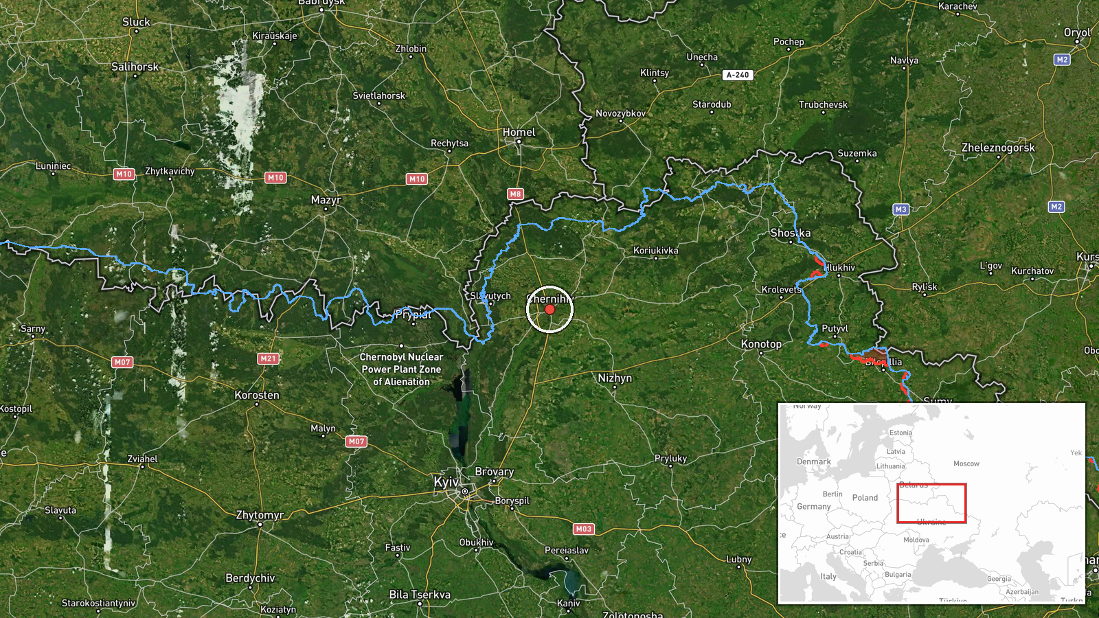
The coordinates, 51.49 N and 31.29 E, correspond to the city of Chernihiv. The point is assigned at settlement precision with high location confidence, meaning it marks the city rather than a specific facility or street. Chernihiv lies on the Desna River in northern Ukraine. The surrounding terrain includes Desna floodplain, wetlands, and forested areas, and the Belarusian border lies to the north, which is consistent with the reported approach direction.
Related events nearby
- Ukrainian air monitoring: 1 Russian jet-powered Shahed (Geran-3) drone heading toward Chernihiv.2026-10-15 17:08 UTC · Drone Transit · Chernihiv, Ukraine
- Ukrainian air monitoring: 2+ Russian jet-powered Shahed (Geran-3) drones over Chernihiv.2026-10-15 15:38 UTC · Drone Transit · Chernihiv, Ukraine
- Ukrainian air monitoring: 3+ Russian Shahed-type drones from northern Chernihiv Oblast toward Slavutych.2026-10-16 10:40 UTC · Drone Transit · Slavutych, Ukraine
- Ukrainian air monitoring: 1 Russian jet-powered Shahed (Geran-3) drone from northern Chernihiv Oblast toward S2026-10-16 06:54 UTC · Drone Transit · Slavutych, Ukraine
- Ukrainian air monitoring: 1 Russian Banderol mini cruise missile from southern Chernihiv Oblast toward Kozelet2026-10-16 05:53 UTC · Cruise Missile · Kozelets, Ukraine
▶ View this event on the live map

Intel Mapper aggregates open-source reports from monitored Telegram and X channels, geolocates them, cross-checks duplicates across sources and assigns a confidence score. Entries are updated as new confirmations arrive. Read how we verify events.